I spent a lot of time on Hadrian’s Wall. I became fascinated by the idea of what was so terrifying up there that the Romans built a 60-mile long, 30ft-high stone wall to keep it out? – Neil Marshall

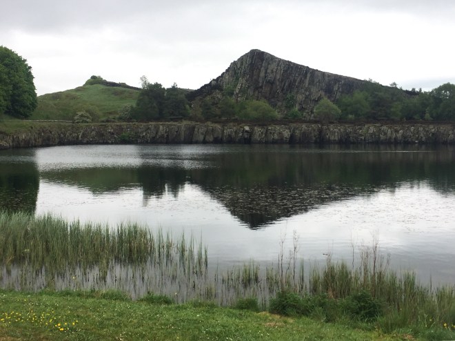
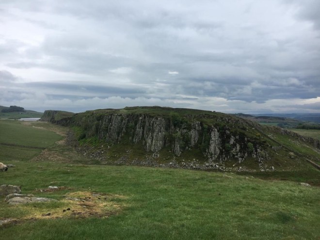
The standout feature of today’s walk was going to be Hadrian’s Wall. Our route took us along a well-preserved 8km stretch of it, starting at Cawfield Quarry and leaving it where it crossed with the Pennine Way to the east near Housesteads. The section knitted together the defensive needs of the Romans with the naturally defensive geological structure of the Whin Sill, an igneous intrusion of dolorite which is the bedrock of much of Northumberland but which here breaks through to the surface.
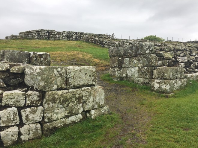
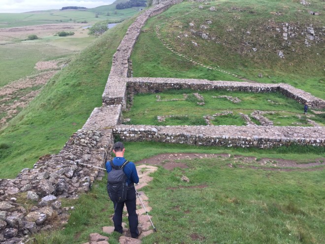
The quarry has destroyed a section of the wall, which otherwise rises and falls with the landscape today as perfectly as it did 2000 years ago when it was constructed, by 15,000 men over the course of six years. In some places it has been replaced with dry-stone walls for farming, built using much of the original stone, but where the Roman structure is extant, which is most of it, it it rises as a double-faced wall with rubble infill held together with rough lime mortar – the composition of this Roman cement was exceptional: there was no sign of any modern repointing, except for one small section which had fallen down and which is presumably going to need to be rebuilt.
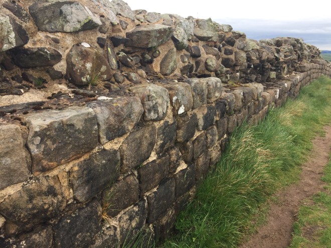
Our section of the wall started with a milecastle in which between 10 to 30 soldiers would have been stationed. It had a relatively small footprint, but would have risen several stories high. The wall itself stood up to 6 foot high in the section we walked today, but would originally have been a lot higher.
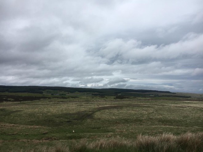
The Whin Sill here is a series of high craggy outcrops facing towards the barbarian north, providing a natural barrier to incursion.
Gaps between the Sill were potential weaknesses in the defences and watchtowers had been added at these points in addition to the two which were sited in between each milecastle.
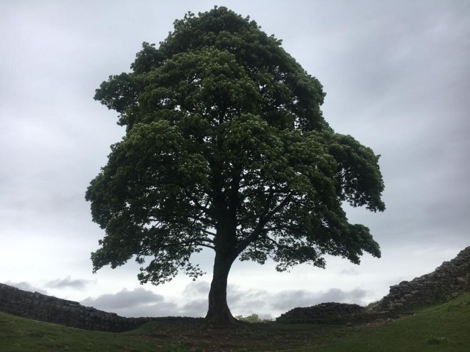
One of these, Sycamore Gap, was an iconic view: an ancient tree framed by the Roman wall sweeping down on either side.
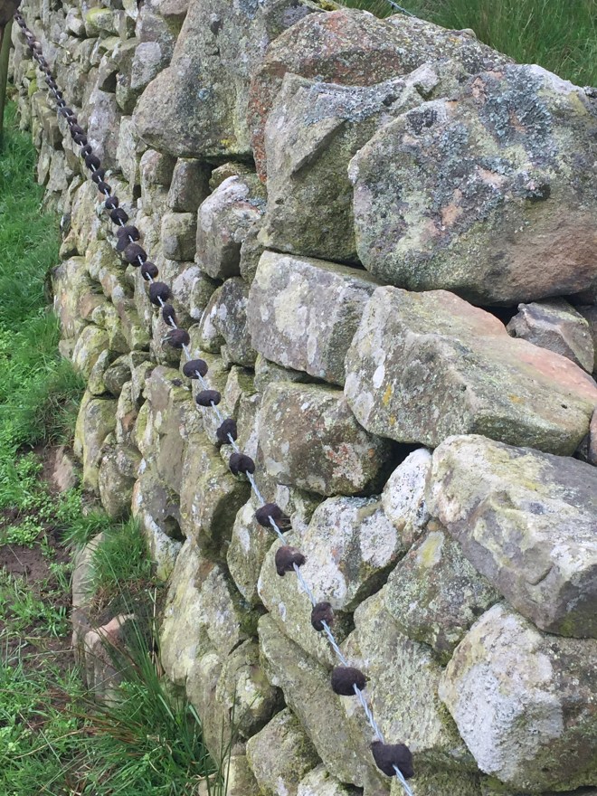
The final stile before we turned off on the Pennine Way seemed decorated with a string of beads made out of matted cow hair, felted as they rubbed themselves up against the barbed wire. They looked so perfectly made I couldn’t decide whether they were formed by accident or by human hand.
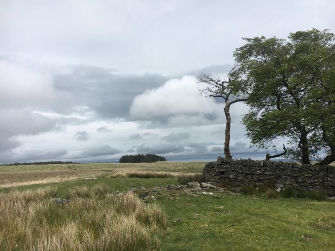
The atmosphere felt very much as though one was at the edge of empire, civilisation, the known world. The bleak Northumberland moorland, the lowering clouds, the dull light, all combined to create a sense of being in a liminal space, an edge-land. What must the soldiers stationed here have felt, guarding the edge of civilisation in the Northumbrian mists?
And so we crossed over onto the other side, beyond the ancient boundary of the Roman Empire.
What we immediately discovered, once we had crossed the initial boggy, rushy sheep fields and were at the eaves of the forest, was a pair of hiker friends, Kevin and Les, walking the Pennine Way. Their days being shorter than ours, they were generally tending to walk slower than us, so after introducing ourselves we moved on. We were looking forward to having more of a chat when we got to Bellingham.
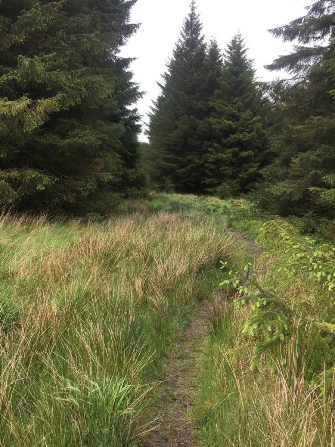
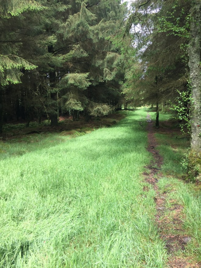
The forest path was a narrow sliver of super-saturated ground bordered by long wet grass which soaked our boots within minutes as we wound through the trees. The entire passage of this part of the forest was a focused attempt to avoid the worst of the bog, but I’m not sure it was worth the bother.
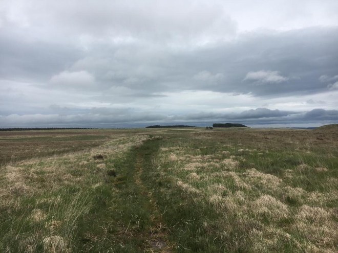
We were both relieved when we exited the treeline, but rather disheartened when we surveyed the expanse of moorland we needed to cross to reach the next section of forest.
Stephen’s theory was that you simply need to be moving faster than you are sinking. My theory was that you need to place the feet carefully on the rushy tussocks. I think I was awarded the laurel for path-finder persuivant in the end but it was an empty victory because our feet were soaked, and we were both exhausted by the time we reached a stock enclosure functioning as a kind of island slightly above the high water mark, on the collapsed dry-stone wall of which we stopped to eat our lunch. It started to rain. I kept looking back to see whether the men had made it out of the forest and was worried that I saw they hadn’t.
Energy levels somewhat raised we tackled the rest of the bog and then dived into the second forest section by a beautiful patch of cowslips.
Two walkers came through the trees towards us and we hoped to hear about the condition of the path ahead. It was Kevin and Les. What? How?
They had missed the footpath out of the forest and got on a forestry track which motorwayed them west around the wide boggy moor and into the second forest section. They knew they were lost but then met the Pennine Way path crossing their track. So they needed to decide which way to turn on it: right or left? They decided right (wrongly) and so were going back on themselves heading south! It was an unbelievable piece of luck that we were coming through at the same time and could turn them around.
Again we left them to come on more slowly behind us, and headed off into the never-ending rain. We were now into high farmland and the temporary uptick in our energy levels and spirits had taken a decisive turn for the worse. It was a total mind-numbing metronomic soul-destroying trudge. I was quite sad.
Then down at the bottom of a valley we saw a sign marker-penned onto the lid of a feed bucket.

Up the valley on the other side we sweated, fuelled by curiosity– and another sign on a gate directed us into a farmyard and a shed.

I might have shed a little tear.
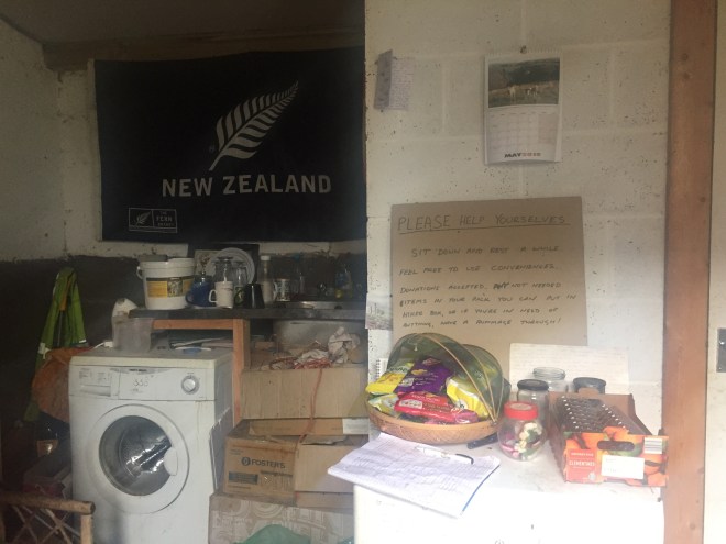
Our spirits were completely restored by being able to sit in the dry, and rest, and help ourselves to a packet of crisps and a waggon wheel. We could have made a hot drink if we’d wanted. We signed the visitors’ book and echoed the sentiments of an earlier walker through the rain: bless you for your kindness.
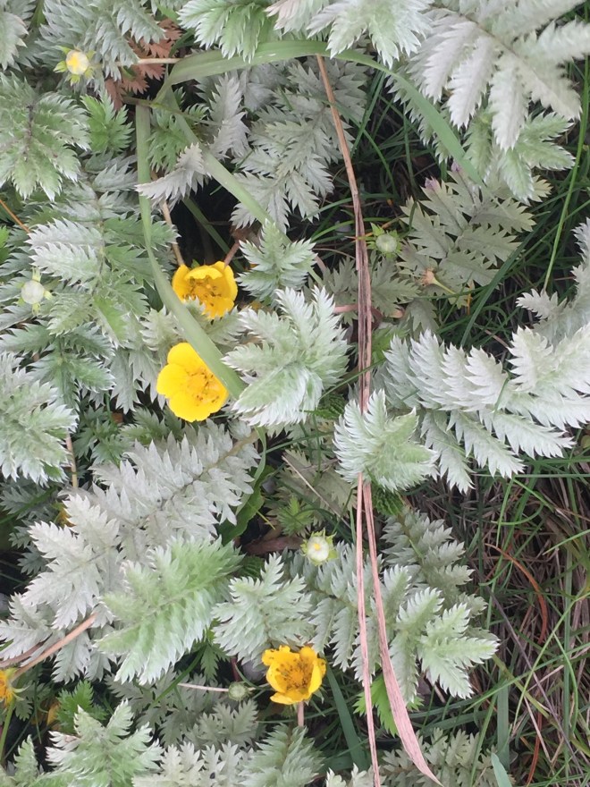
Lighter of step, we felt that the rest of the day really did not seem that bad. It was quite a bitty path, with patches of bog and cow fields and road-walking into the town of Bellingham, but the Pit Stop had made it bearable. I even felt cheerful enough to notice that the silverweed is now in flower.
Supper was in the Cheviot Arms where we knew Les and Kevin would be staying. Apparently the rooms were good but our meal was awful: how can you mess up apple crumble and custard? We had to send the dish back.
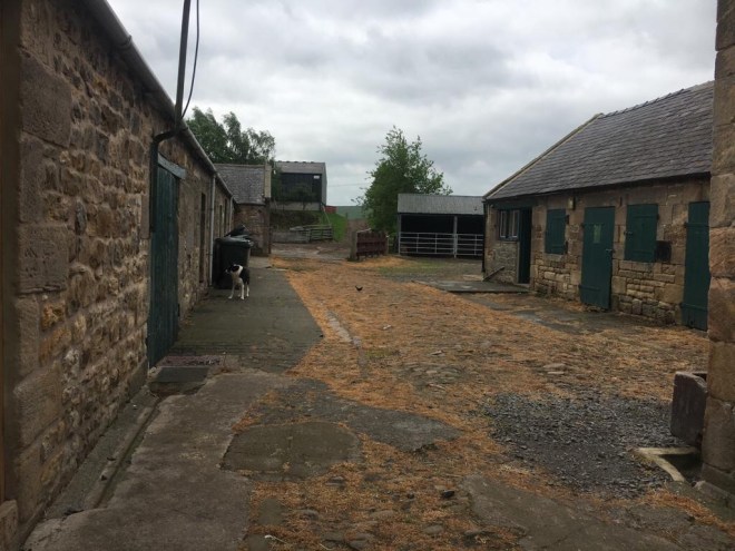
Our campsite was in a farm in the centre of town, and it would have been fine had it not been for the (quite happily) drunken Geordies in a caravan singing until well past midnight and having loudly deep and earnest conversations: ‘I am just mesself, me’. Well who else would you be AT TWO IN THE MORNING?

Today’s blog made me chuckle, nothing worse than under cooked crumble, the description of drunken geordies …classic! Soldier on you amazing pair x
LikeLiked by 1 person
Today we were legionaries marching along Dere Street!
LikeLike
Your mention of Sycamore Gap reminded me of this excellent book by LJ Ross… Sycamore Gap: A DCI Ryan Mystery (The DCI Ryan Mysteries Book 2) https://www.amazon.co.uk/dp/B0157EGENU/ref=cm_sw_r_cp_apa_i_Qo-8CbX0QTGB5
Highly recommend!
LikeLiked by 1 person
Oooooo!!
LikeLike