A stone is ingrained with geological and historical memories. – Andy Goldsworthy
Stone, both literal and figurative, featured heavily in today’s walk, and the day saw two significant milestones of this journey.
We re-joined the Pennine Way almost immediately out of Dufton and started climbing through rough pasture and out onto open moorland.
It was about 600m climb all the way up to Knock Fell, the highest point of the entire End-to-End Trail. The views to the west of the northern Lakeland hills were spectacular as we climbed (although hard to photograph).
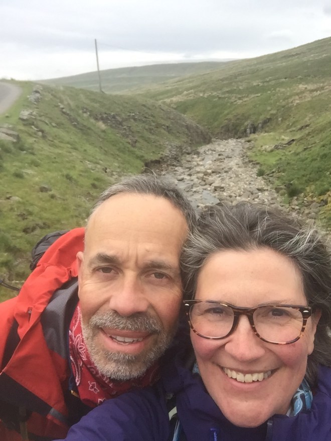
By the time we reached the top the clouds had lowered and the wind had picked up, but it was exhilarating, and we had the place to ourselves. In fact, we had the whole day to ourselves, not meeting another walker once. We passed Knock Old Man, a cairn from the 1860s just shy of the summit itself, to commemorate our own milestone with a photo at the summit cairn.

We couldn’t linger. Conditions underfoot on the top were classically Pennine, wet as we had not seen on the Yorkshire moors, and made chilly both by height and by the wind.
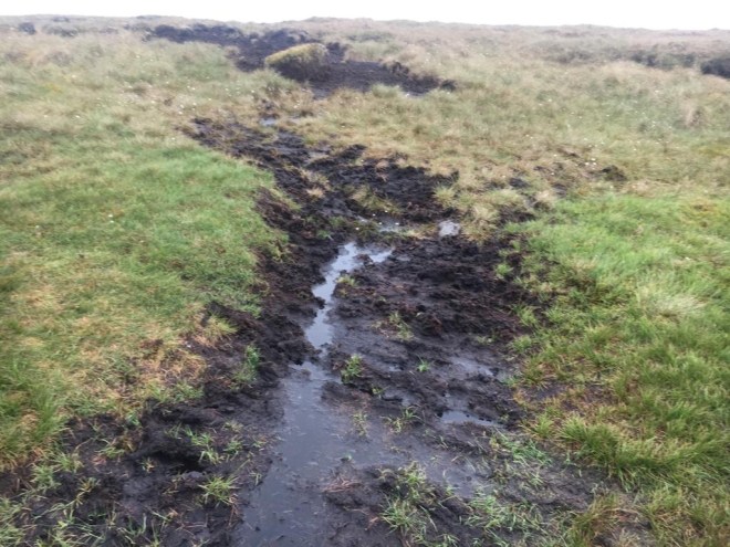
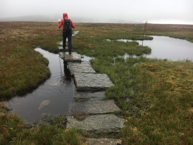
For the first time I was grateful for the slabs which gave us safe and clear passage over the sections of waterlogged peat, or over permanent pools of water.
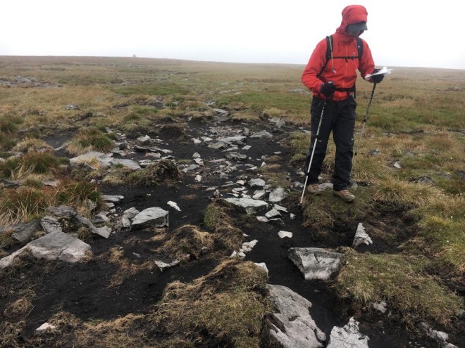
The guidebook did say that this section should not be attempted if you are not confident with a map and compass – and there was a fair amount of micro-navigation and compass work to check that we were getting correctly across what was something of a featureless peat bog. Whilst the signage on most of the Pennine Way is very helpful, it is slightly odd that up here where safely is a consideration that it dwindles to nothing. We discussed the pros and cons of signposting well-known routes in mountainous areas.
We left the Pennine Way before its two highest points (Great Dun Fell, at 848m, and Cross Fell a little further west at 893m) as we dropped down into the col before the final rise up to the radar station. Considering the physical effort that we had put into our climb and the remoteness of the spot it felt out of place to see a car descending from the radar station.
Our route took us instead into the next distinct phase of today’s journey, the long river valley through the Moor House Upper Teesdale Nature Reserve. Golden Plover are a conservation priority in this area and we saw and heard a calling pair as we descended, although didn’t see the gentians and marsh saxifrage I was hoping to spot, which are two of the 70 nationally scarce species contained within this landscape of blanket bog and montane heath which colonised this area after the last ice age.

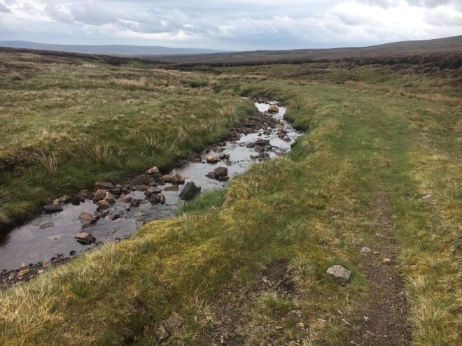
The valley began with old mine workings and then the stream picked up, flowing over a mixture of limestone, sandstone, siltstone and mudstone, swelling gradually as it collected more and more water flowing out of the bogs and flushes.
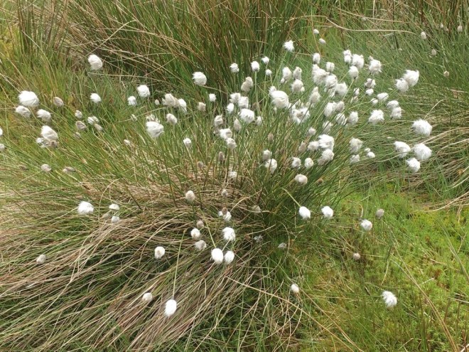
Cottongrass was a constant feature, creating useful tussocks on the path to help us dance over the wetter sections.
For the first time on this walk I could smell wild thyme being crushed underfoot.
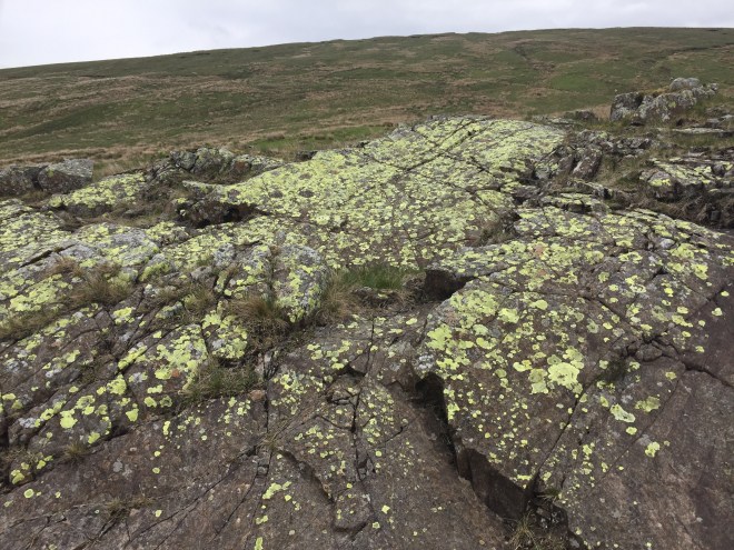
The Trout Beck established a particular character for itself but then we came across a surprising section of pure limestone. Recording and monitoring equipment was set up permanently in this area and it would have been fascinating to know what the CCTV camera was set up to monitor here.

The river widened and reached a bridge at the meeting of three valleys and the point where the Trout Beck joins the River Tees, but we turned down into the valley slightly north of the Tees in which the South Tyne rises.

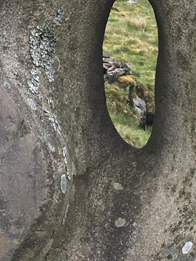
The source of the South Tyne is marked by a stone sculpture pierced with a hole which (if you are tall enough) frames the spring itself.
From its source the South Tyne descends, a track beside it, collecting water from tiny tributary after tiny tributary and very quickly becomes a sizeable stream flowing over bedrock which has fractured along rectangular planes.
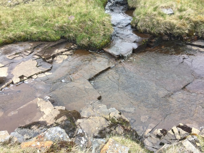
The braided patterns created by this fracturing were an interesting contrast over a couple of kilometres from the rounded erosion of the limestone rocks in the Trout Beck valley higher up.

Speaking of kilometres, we were keeping a close eye on the GPS watch, and a short way down the track from the Tyne Head, we registered another milestone for ourselves: our thousandth kilometre of walking.
From that point onwards the quality of the path deteriorated as we lost elevation. There were a couple of marked trails, including one called ‘Daft as a Brush’ which tracks the South Tyne 135 miles in aid of Cancer research and care. It was a daft path indeed: not really a path at all, just a faint track over steeply-angled fields, bogs, and stiles, and by the time we got to the point we were to turn off it in the direction of Nenthead we were thoroughly sick of it and wished we had taken the less picturesque road instead. But before we left the South Tyne we appreciated how it had grown quite a considerable size already.
The walk out to Nenthead took us through grouse moor and the inevitably rocky track with verges full of rocks kicked up by four-wheel-drive vehicles. Down we came into mine workings where it got even worse – but only for a short time. We were soon installed in the Miner’s Arms in front of the woodburner with comforting pints of Doom Bar.

My dear friend Mary came to pick us up – a friend I have seen once in 36 years – and was putting us up for two nights. I say ‘put us up’ but we were treated royally, with showers and a wash of our clothes and the tent out airing, a delicious supper, packed lunches for the next day and masses and masses of chatting. Bliss.

Fantastic milestones! Really enjoying the posts still. A big contrast to my experience in London and the week I just spent in New York!
LikeLiked by 1 person
♥️
LikeLike