There is no news
script of the 8.45pm BBC news bulletin, 18 April 1930 (before piano music was played for the rest of the 15-minute segment)
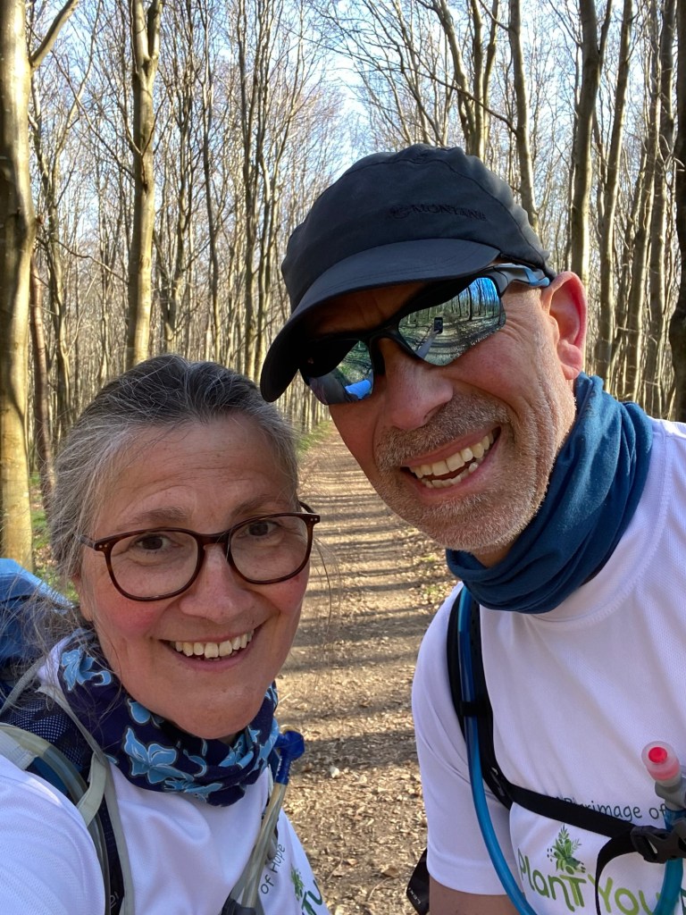
We left Guînes de bonne heure, since today we were combining two of the suggested stages of the Via Francigena. Guînes to Licques was only 16.3km, and Licques to Tournehem was even shorter, 15km. We decided that by cutting out one hilly section and taking a straighter route we could probably do it in about 28km: a long day, but more satisfying than two really short ones.
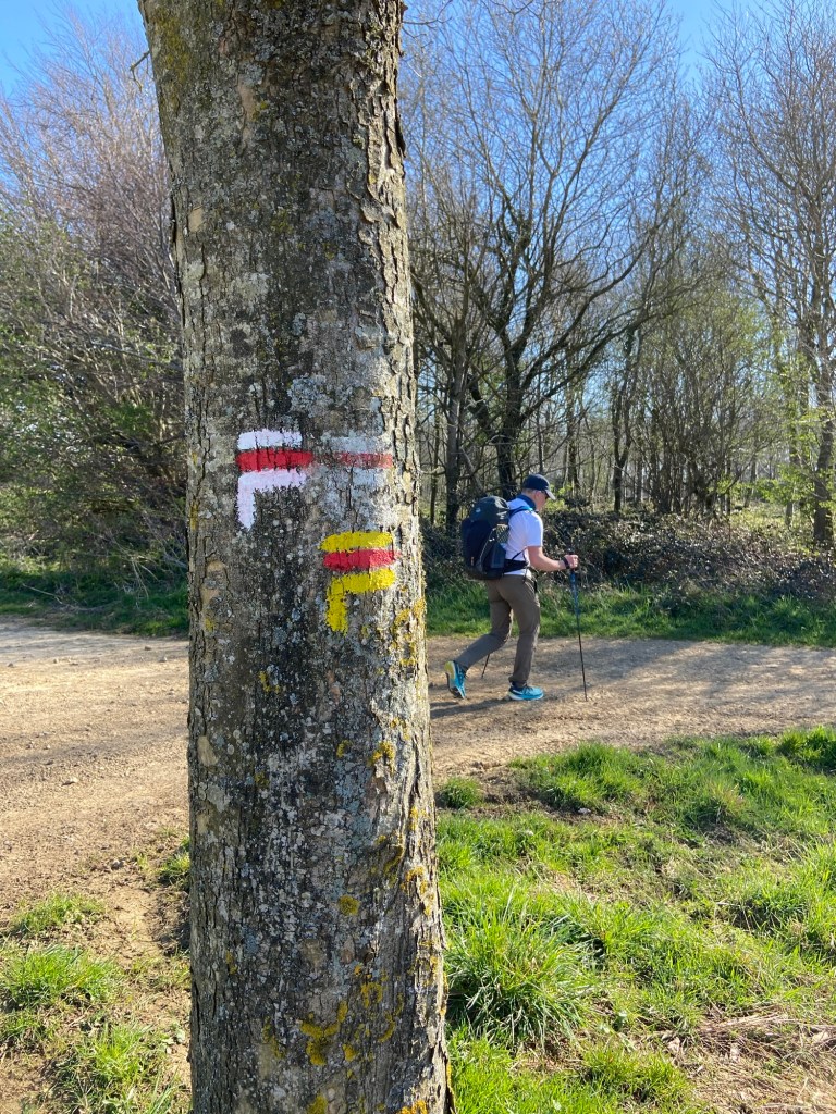
We threaded a path out of Guînes between a blackthorn hedge and a sloping railway line. I remarked how odd it was that trains could go uphill, and reminisced about the time that I had been on a train on its way into Birmingham, very much higher than Worcester, and we almost got stuck on the hillside because the diesel engine was so ancient. “Well, it is one of the steepest rail inclines in the UK,“ said my rail infrastructure expert. “There are other inclines which are longer, but this is one of the steepest.“ I just don’t get how he knows all this stuff that he comes out with. Oh well, as our daughter would say, acidly, every day is a school day.
Later on, after a long period in which we had been walking in silence, Stephen said he’d been thinking about his father’s favourite record, the one he used to listen to about once every six months — recordings of different steam locomotives. For example, the flying Scotsman pulling out of Waverley Station in Edinburgh, or a goods engine shunting in Crewe. One of the trains that certainly wasn’t on the ancient 33 RPM was the TGV to Sangatte. “Low hum,” said Stephen, as it flew north in the distance.
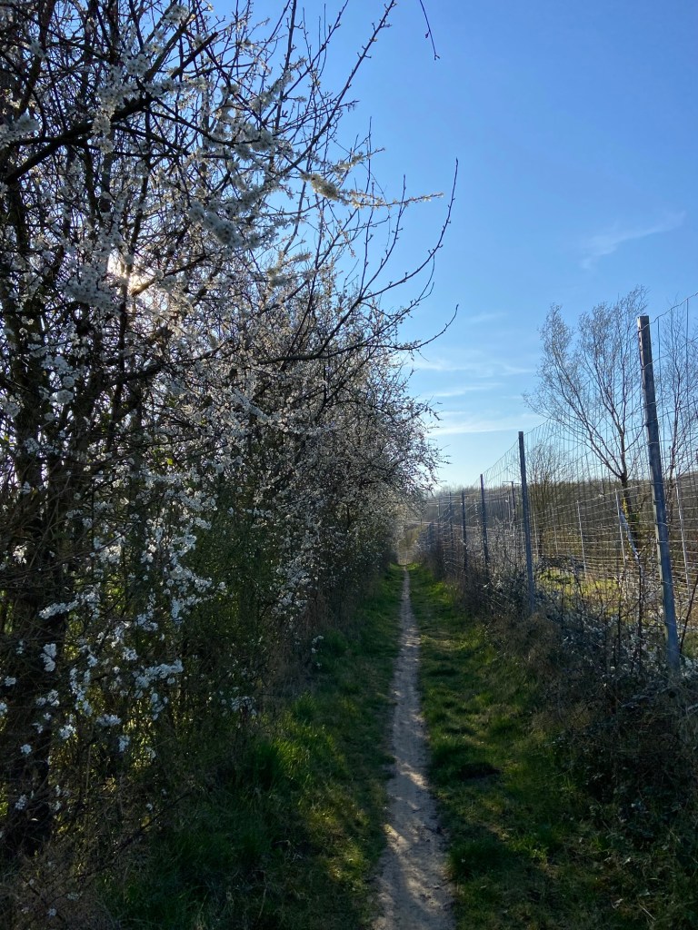
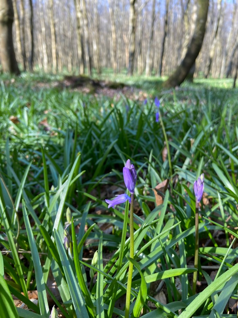
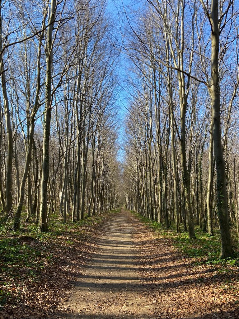
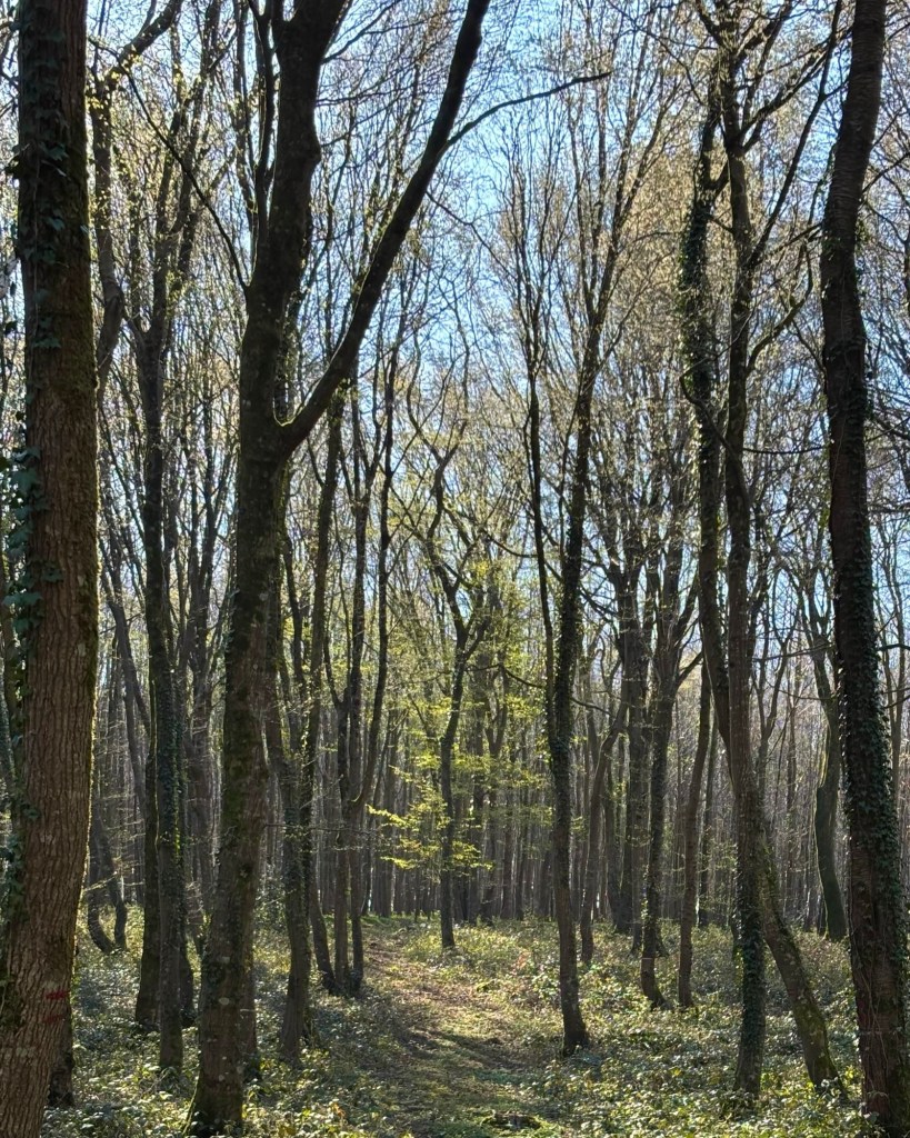
But then the Via plunged us back into the forest, where for the first few hours, a crabbing path took us through different kinds of plantations. The forest extends in various guises all the way down towards Tournehem, but most of our route was sadly out in the open farmland. There were several circular walking routes waymarked through the forest, including one which takes in the site of the flamboyant meeting between François I of France and Henry VIII of England, the Field of the Cloth of Gold, or Camp du Drap d’Or (think 10,000 m² luxurious glamping tent and two monkeys covered in gold leaf). The Field itself was to the north of us, and of it there remains no trace. Here in the forest there was only peace and silence: the early spring carpet of windflowers and violets, soon to be overtaken by a spectacular show of bluebells, the very first of which were showing here.
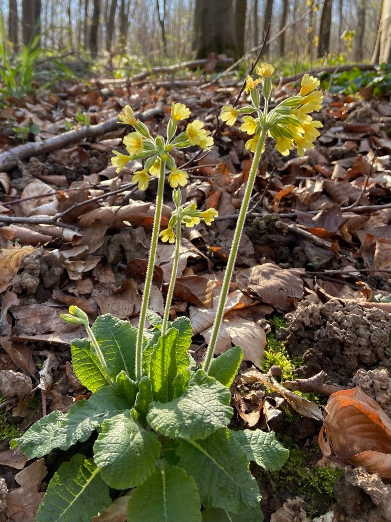
Honeysuckle leaves had begun to reach out to the sun on their twining stems, and by the side of the path, miniature Solomon’s seal were unfurling. In homage to the Field of the Cloth of Gold there was one single golden cowslip glowing amongst all the green and brown.
When we had walked Land’s End to John O’Groats we had set out on 19th April and walked north at the pace that spring was advancing. We had our first orchid on May 1 in Devon, and were still seeing orchids and bluebells in the very far north of Scotland, seventy days later. Here in France it will be the opposite: we will walk south as spring rushes headlong up to meet us. We started out from Canterbury three weeks earlier than when we left Land’s End, yet already the season seems more advanced.

I remember when we’d got to Somerset on the End to End walk being struck by the fact that suddenly the light in woodlands had become dappled as the trees came into full leaf. This will happen here soon, I think, as there is a haze around some of the treetops where the buds are cracking, but for now the shadows still fell across the paths in soft grey bars.
Even this early in spring, though, the forest is a place of wonders. Mighty oaks almost overcome with strangling trunks of ivy

and single saplings earlier to come into leaf shining in a little clearing.
Apart from a couple of peacock butterflies and one lone runner, we had the forest all to ourselves.
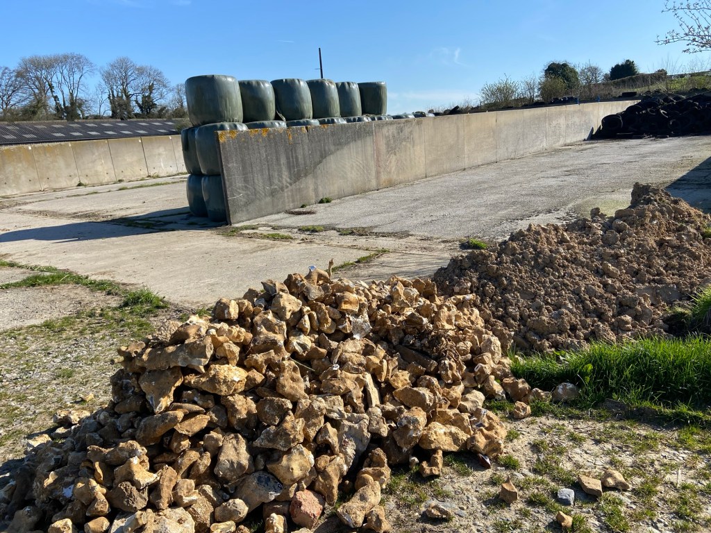
Out in the open air again we found ourselves in farmland — and encountered our first dog. It was a working cocker, a hunting dog, who took himself off behind a fence in a very well-behaved manner to watch us go by. The whole farm was very well-behaved, in fact, with tidy piles of all the things: field-stone flints, tyres for the silage clamp, silage bales and clay soil for Unknown Purposes.
We walked on the by-now familiar clay and flint tracks past scattered woods and copses (I heard a redstart for the first time in years and years).
After nearly three hours of quiet walking we came to a little hamlet, and somebody had put a little bench by the side of the road for the use of walkers, with a handwritten sign to that effect.

So we sat down and almost immediately heard a small voice in the garden behind us, marvelling, ‘C’est un randonneur!’ ‘There are two walkers’ I called back (in French, bien entendu). It was a tiny girl of three or four on a little scooter, and she brought her grandmother to the gate to witness the miraculous event. It was like being in an episode of the Strangers on a Bench podcast only with a minuscule interested French person instead of Tom Rosenthal. Or being a bird, watched through a window as it is attracted by the nuts in a feeder.
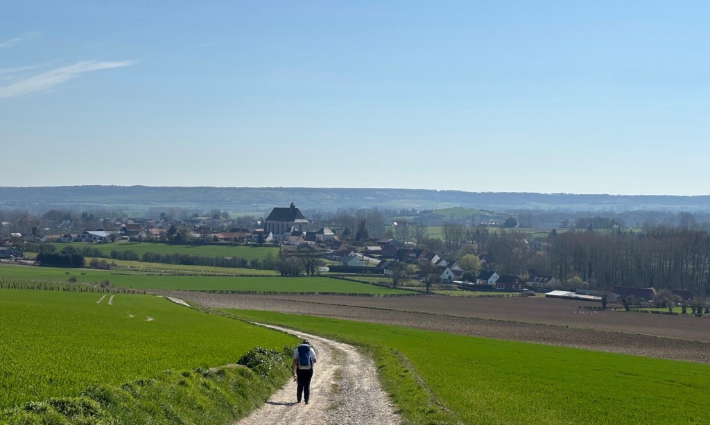
The handwritten sign had welcomed to ‘La Ventus’ and I later saw it is actually a place on the map rather than the name of the house. Something to do with a windy place? It certainly was that. We were walking out on a long limestone ridge with the Licques river valley below us, and the wind was in our faces the whole way. Wind and sun — it’s been the hallmark of the walk so far. Perfect walking weather, and the views were tremendous.

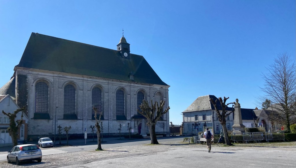
We were to do the first stage before lunch, have a decent break, and then set out again for the second. We came down off the ridge just after midday and made for the huge abbey church of Licques, a commanding presence before us.
While Stephen got our lunch out of his bag I went in search of a stamp.
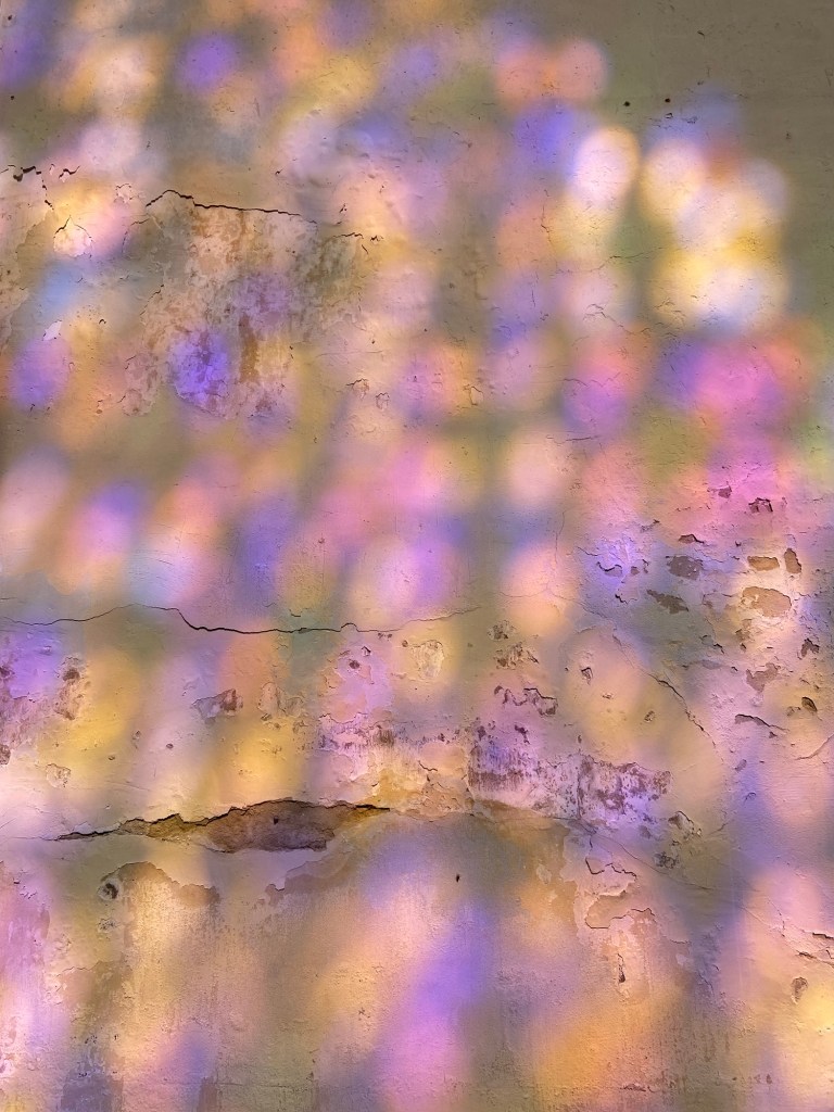
Inside, the church had none — but the stained glass light flooded the opposite wall with colour, fleetingly, like watery ink.
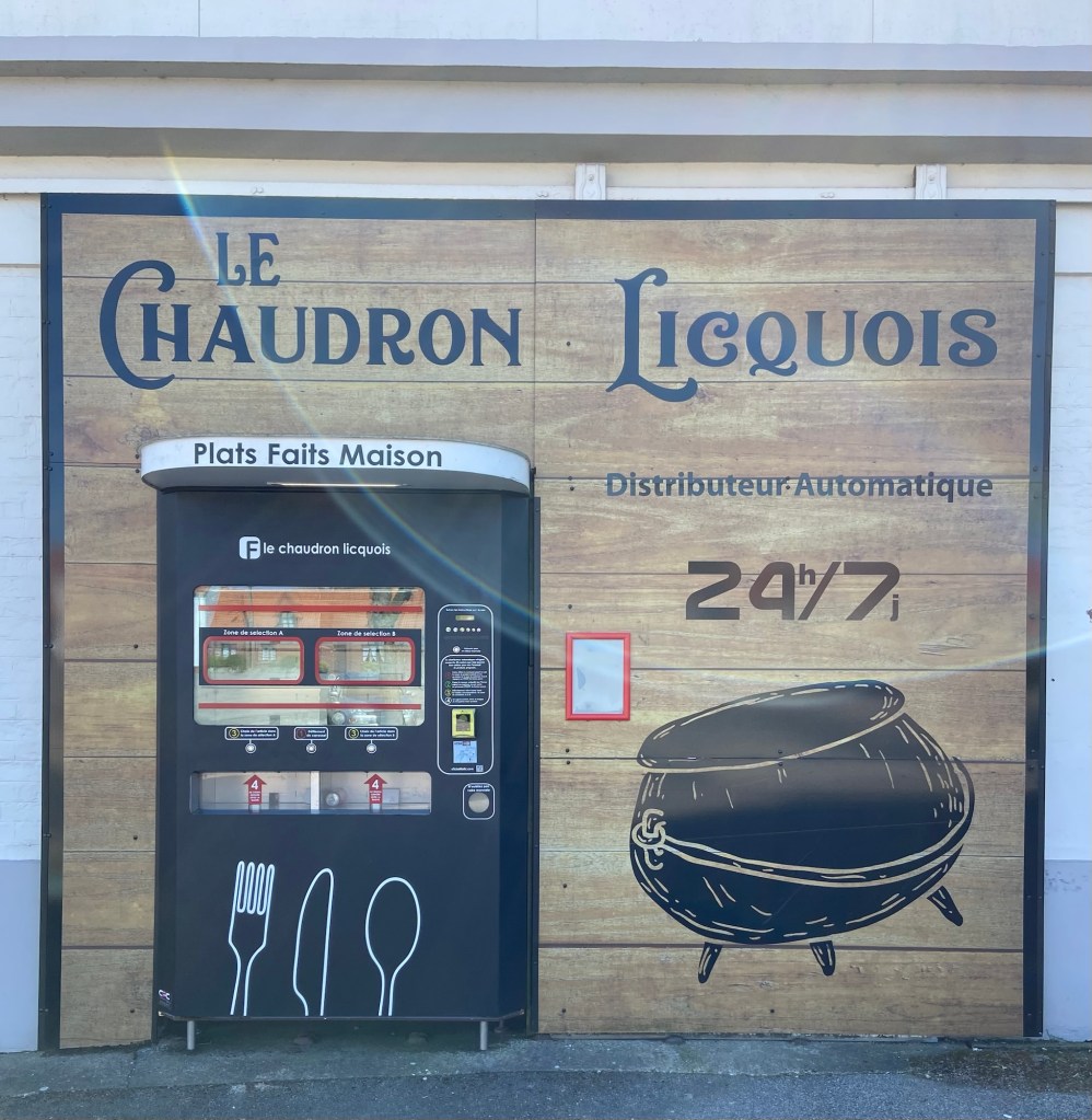
The other place I might find a stamp was the Mairie, but it had closed for the day at 12.00. I repaired back to the bench in the square and we sat companionably eating the leftovers of last night‘s lentil and sausage stew. Licques seemed to be completely closed. Every single shop and café. We had imagined that there would be a village or town café in the places we passed through, where old men spend two hours over the lunch break drinking pastis and smoking Gitaines or Gaulois, but no… it is absolutely the case that you need to plan your lunch the day before when the shops are open. What the town did have, though, was two food vending machines. We encountered the second on our way back out into the countryside, a pizza machine (‘I put my credit card in,’ said the woman standing in front of it, ‘in three minutes it serves me delicious pizza without me having to do anything!’), but we sat looking at the first while we ate our lunch, snorting lentils over the fact that the dispenser was effectively called ‘The Leaky Cauldron’
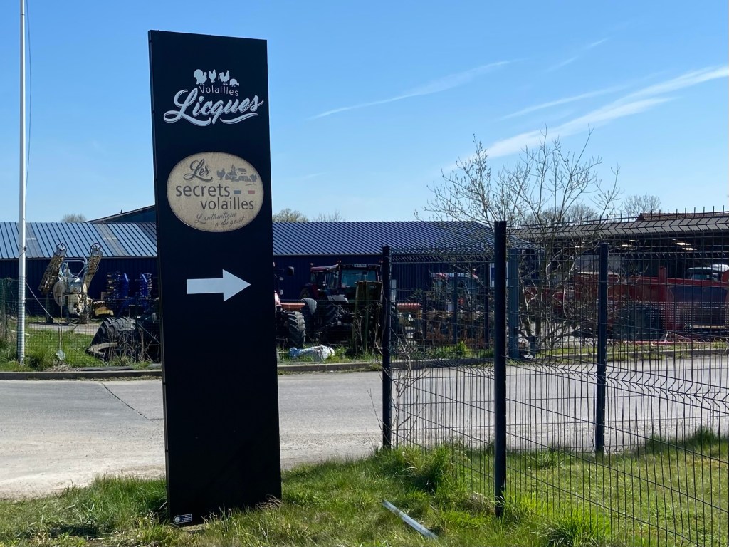
Licques is famous for its turkeys. It has a turkey festival in which the birds are paraded around the town, and there’s a small statue to one of the gobblers on a kind of roundabout.

The town is mad for them. Coming into town we had passed a sign on a mini industrial estate ro a premises tantalisingly promising ‘secret poultry’ or maybe ‘poultry secrets’. Either would have been thrilling, and I am now kicking myself that we didn’t go in and ask them to whisper the secret in our ears.
The second half of the day was tiring, not just because the whole day racked up 28km, but also because it was almost entirely on roads. In view of the fact that we were merging two stages, we had decided to miss out the last hill climb, a detour up another limestone ridge to see a reconstructed stone chapel, and just march along the valley road.
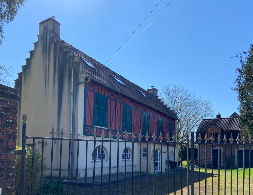
Small villages were dotted about the valley with Flemish names, each with more Flemish architectural detail than the last. Dutch gable ends, for example,
next to über-French, expertly pollarded trees,

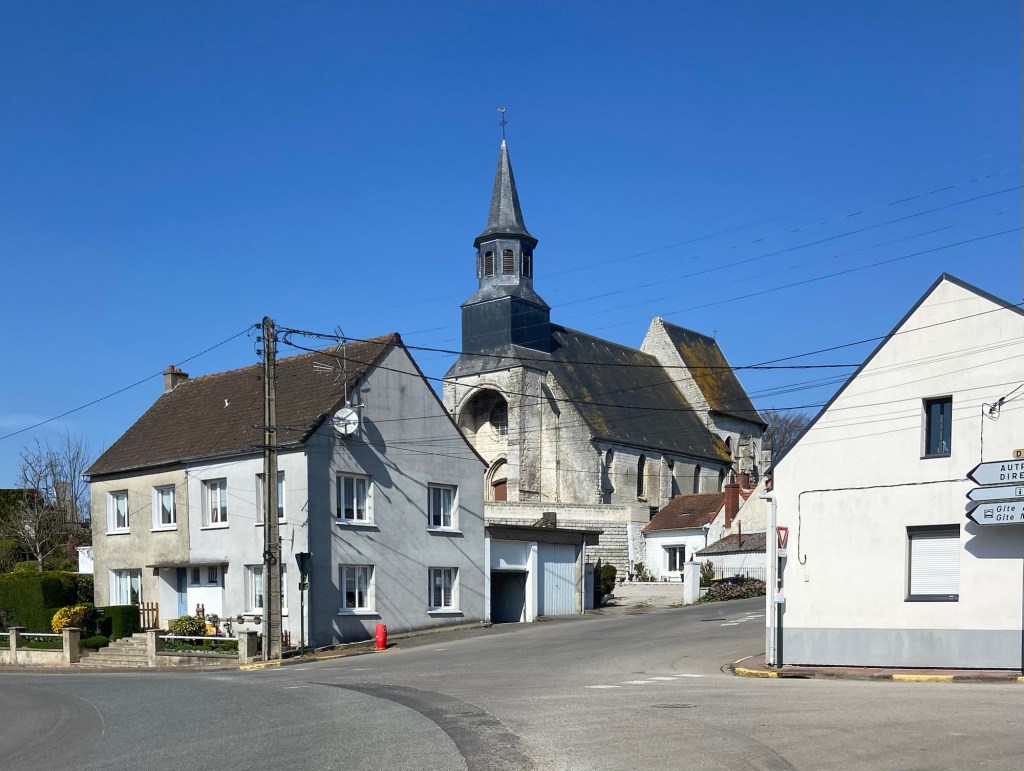
Norman chapels

and quintessentially French houses, set well back from the road.
We battled on against the headwind (‘you can’t say we are wind-assisted, said Stephen as a bicyclist flashed past us going in the other direction); in one field of winter wheat the tops of the leafblades were blown horizontally.

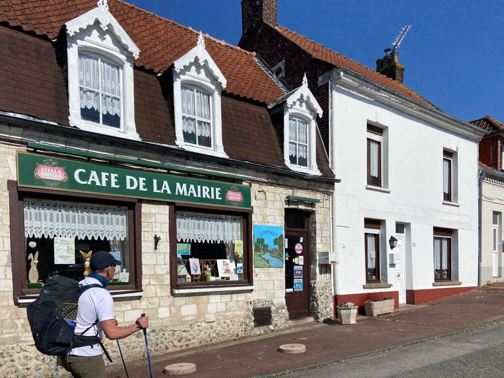
Tournehem, when we reached it, was also closed. No stamp in the locked church
Or Mairie — or even the Café Mairie.
But we were so nearly at our destination that it didn’t really matter. We passed through the town gateway where a plaque informed us that this historical gate was a visible trace of the Leulène Road, an ancient route along which Julius Caesar passed along twice, in 56 and 54 BC, to take ship north from Wissant in his efforts to subdue the Britons.
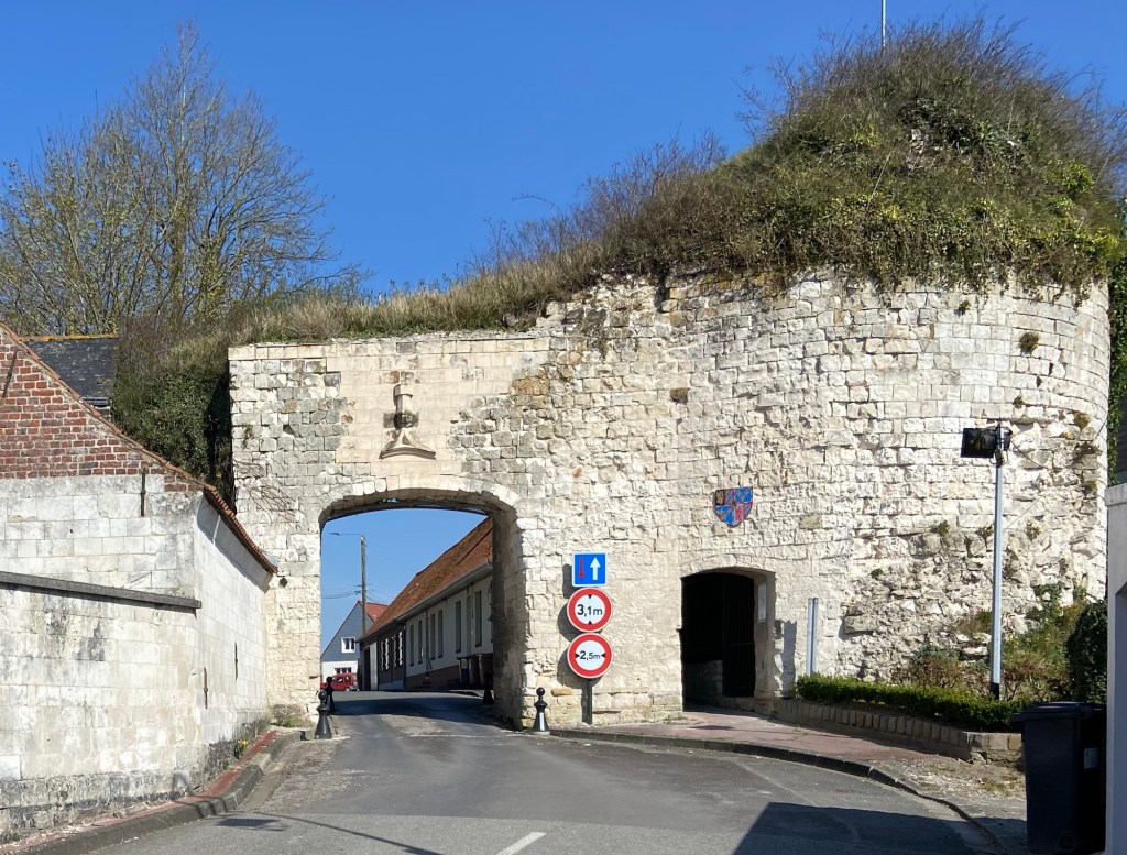
Excitingly, our route tomorrow takes one of the very few extant sections of this road, I am looking forward to retreading the steps of Caesar — and to have a day with generally more to talk about!
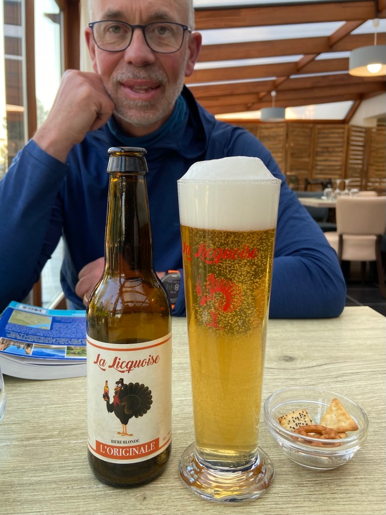
For now we simply appreciated the food in the restaurant at the Hotel Bal, and wondered anew what the secret of the turkeys of Licques might be.
Stats for the Day:
Distance: 28.33km
Climb: 474m
Blisters: 1
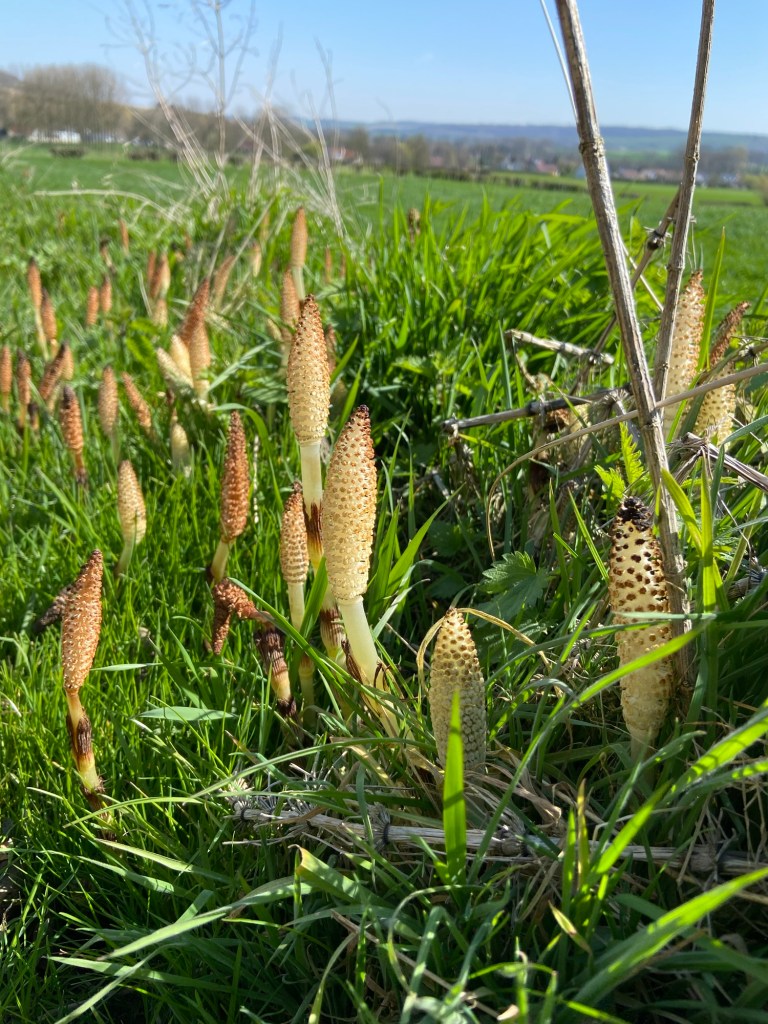
Bonus mystery plant to identify

I am so happy to have your blog to read in the mornings, allowing me to muse on the secrets of turkeys, and to worry about everything being closed! Thank goodness for Stephen’s lentils. Maybe not much happened today, but it was good to read about nonetheless. Xx
LikeLiked by 1 person
🥖 🧀 🌳 ☀️ just read this comment sitting under a tree on some
Excellent mown grass positively FEASTING on baguette and local cheese and salami. Photos later in the blog! ♥️
LikeLike
good morning! I am from South Africa but in UK for 2 months looking after a lovely lady before I start my walk from Canterbury on 4 June. I too am following Jennifer’s list of places she stayed at as I think you may be too? I LOVE exploring and knowing about the places I’m in. Tell me..how do you find all the history and information about the statues, arches, bridges, buildings while you walk or after or before? And on what platform do you find this info?
so many questions, I’m sorry , which apps, maps, should I use? I will be walking solo
have a great day. Love your writing ❤️
LikeLiked by 1 person
Hi Jan, nice to hear from you. I just Google it all! Also read up on the information boards, and sometimes ask people. I don’t read up about it beforehand— it’s all on the day.
Re route finding, Sandy Brown’s guidebook is really excellent and has good descriptions and detailed maps. The path is exceptionally well way-marked. I also use the French mapping app IGNRando, with a GPX file imported. This comes with Sandys Book (which is also available digitally I believe).
What DOES need planning carefully is food. We haven’t figured this out yet, but read on to find out!
LikeLiked by 1 person
Thank you. I have his Stage 1 book and awaiting the Cicerone Accomodation book to be delivered. I’m walking solo so just need to get best app for backup, also which sim card, translater (google?) Have got both Jennifer Andrewes and Col Ette’s detailed lists of accomodation they used (don’t know if you followed them last year?) Glad to know the pathnis well marked, and yes! I need to plan rest food. Been told to go to cemeteries if I need water
LikeLiked by 1 person
It sounds as if you are all set!
LikeLike
…and another fab blog! Isn’t the mystery plant a wretched horsetail? Lovely but very invasive.
LikeLiked by 1 person
I thought so but I have never seen them in flower. I guess edible but maybe only for a brontosaurus
LikeLike