Ah’m awa for a daunder
I’m off for a stroll
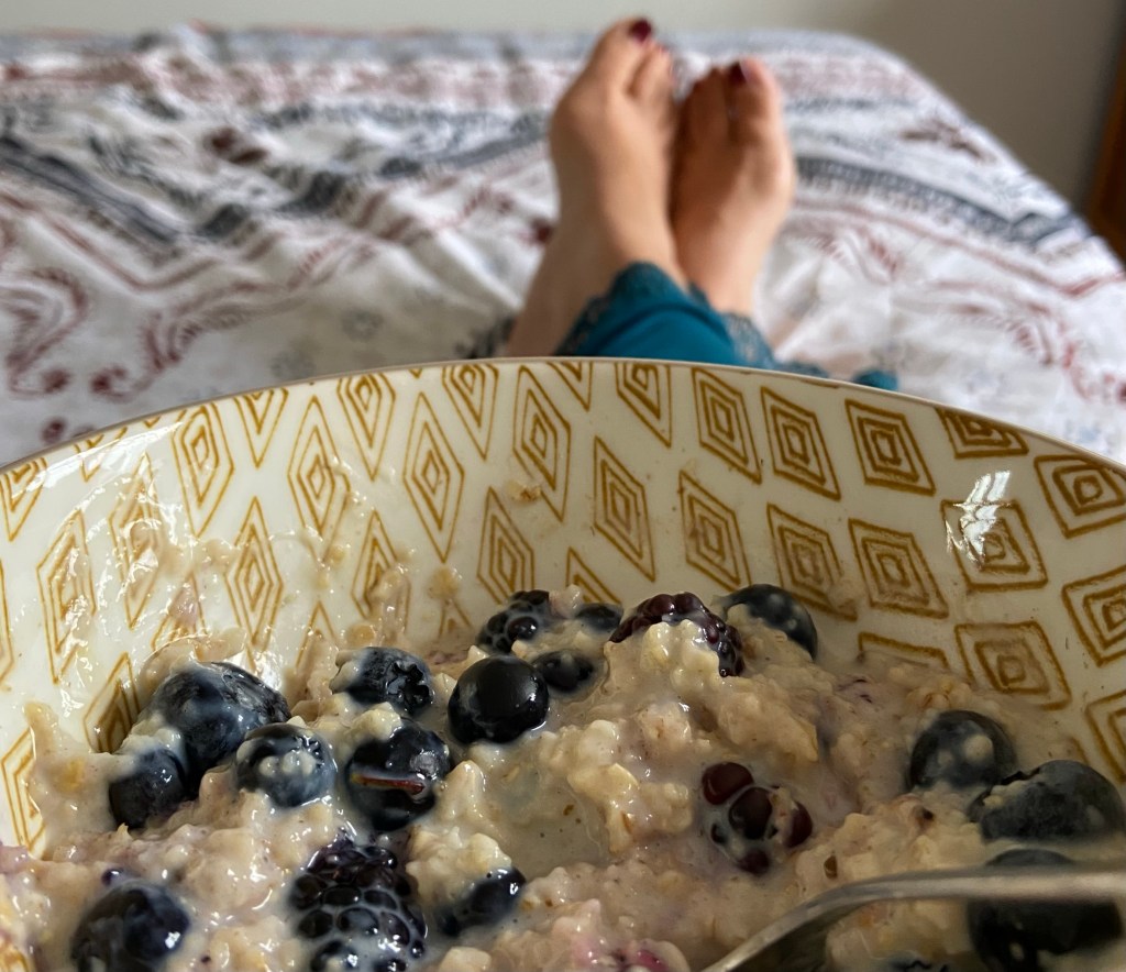
As I was looking at the problem of the afternoon return bus times in the early hours of this morning, I hit upon the wizard wheeze of getting the morning bus out to Cockburnspath instead, and walking back into Dunbar. So I enjoyed what felt like a guilty pleasure of a lie-in, a very leisurely breakfast of coffee and porridge, before catching the 10.20 bus down the coast.
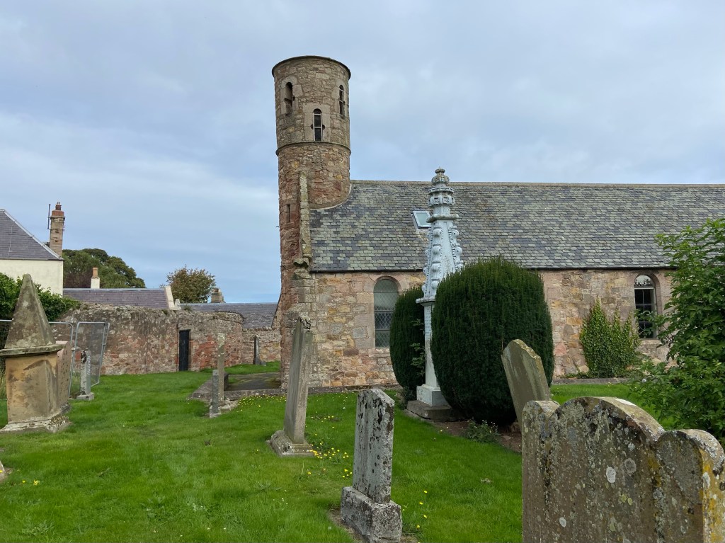
Cockburnspath had a church with an interesting cylindrical dovecote tower, and an actual whited sepulchre in the churchyard — a phrase I have used for years, but which I have never seen. I was thrilled.
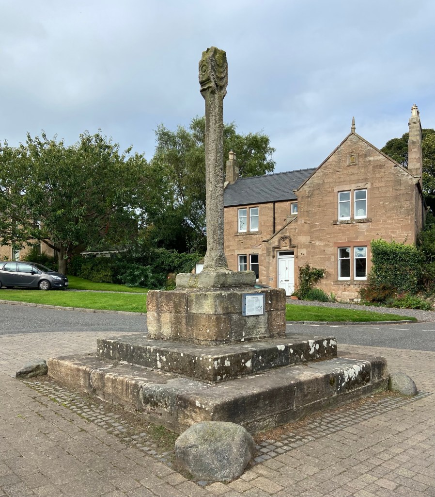
Next came a 500 year-old stone cross, commemorating the gift by King James IV of Scotland of Cockburnspath and its lands to Princess Margaret Tudor (sister of Henry VIII). This dynastic marriage, uniting the Scottish thistle and the English rose, held peace between the countries until the battle of Flodden, ten years later in 1513.
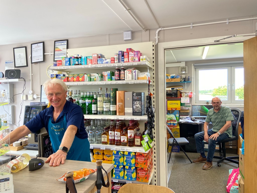
It was all happening in Cockburnspath. I couldn’t not stop at the Co-Path Community Shop — the wildflowers in the planters looked so promising…

Paul and Johnny, the self-styled Morecambe and Wise of Co-Path, rolled their eyes when I said that I, as a professional in the field, was buying a packet of Walkers crisps. “Everyone knows that Walkers are the real McCoy,”said Paul. It was the perfect lighthearted way to start what I hoped would be a shorter, smoother day’s walking, along a named path constructed to link together the JMW with the North Berwick coastal path.
It certainly started off well, as I set out along a field edge munching my chicken flavour crisps and looking out to sea.

I met Scotsman Paul, walking to Berwick-upon-Tweed in the other direction for no other reason than the country was finally experiencing a period of decent weather. He’d come from Dunbar today. I said I was doing the same thing and he said with horror, ‘but you’re walking in the wrong direction!’ We compared routes from yesterday: he had not attempted the coastal route but gone inland via East Linton. Paul is much harder than me. Some of his days are as much as 40km, and he’s reaching Berwick tomorrow, doing in one day what I will do in two.
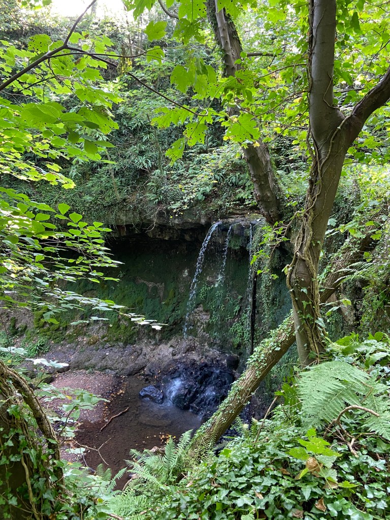
The link route coincides with the Forth to Farne Way, a pilgrimage route, but I chose not to detour off it to the ruined collegiate church on the hill, instead turning down to descend through a wood which gave quite as much peace as Muir would ever have wished.

The little dingle turned into a deep gorge, spanned by road and rail bridges.
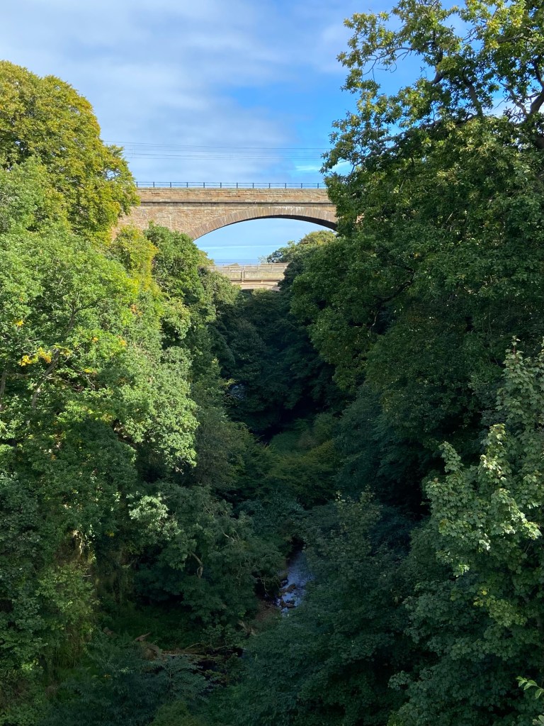
The graceful arches provided a strong contrast but also a connection with the arched branches of the trees.

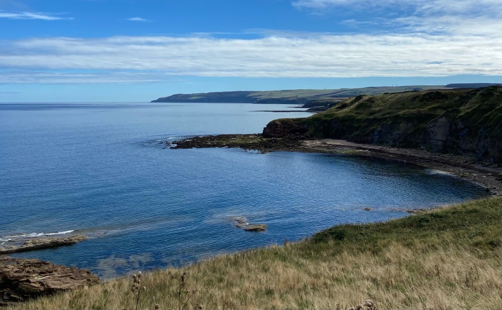
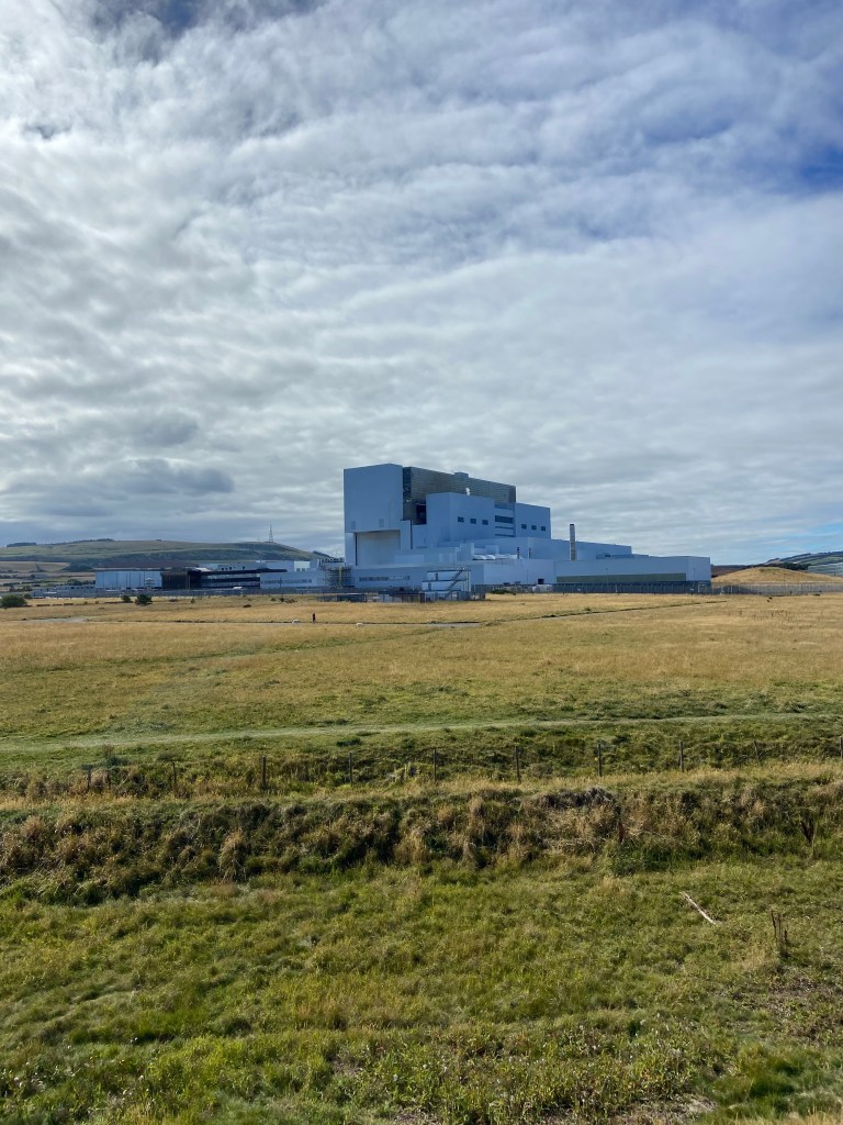
My route wound me down on the high side of the gorge until I got within sight and sound again of the sea. On the beach a huge shallow tidal pool reflected each rock and boulder, with the massive white bulk of the Torness Nuclear Power Station behind it, a man-made echo of Bass Rock up the coast.

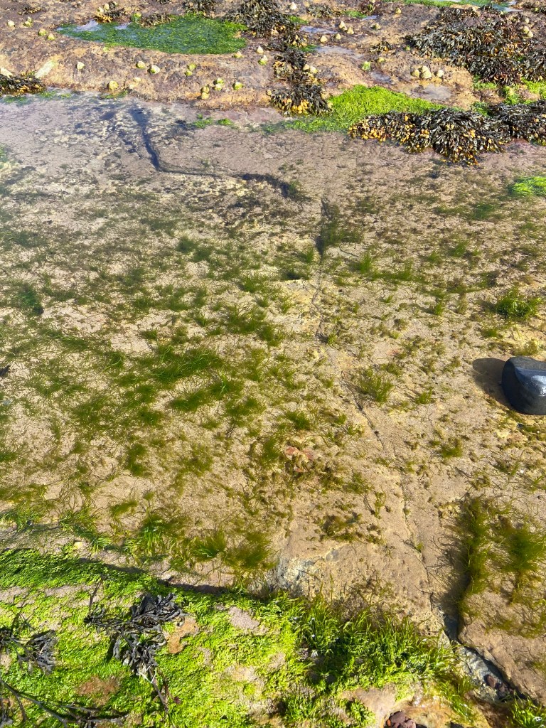
I picked my way across a lunar landscape of sand and gravel, shingle and rocks, with the beach to myself except for the crying curlews and a heron who flew away down the coast. It would have been a shame not to have looked in the rock pools. Today is a short day, after all. The shallow pools on the ancient rocky fossilised beach were perfectly limpid, just deep enough to hold a miniature grassland of seaweed.
Another little dingle took me up onto the cliffs above the beach, past a burn whose water cascaded over moss-covered rocks in the other direction, heading away from me towards the sea.
Now I was walking along the pale stone walls which edge the cliff top, across fields I had seen from the bus. I looked back along the coast the way I had come; the lagoon-like tidepool had already disappeared.

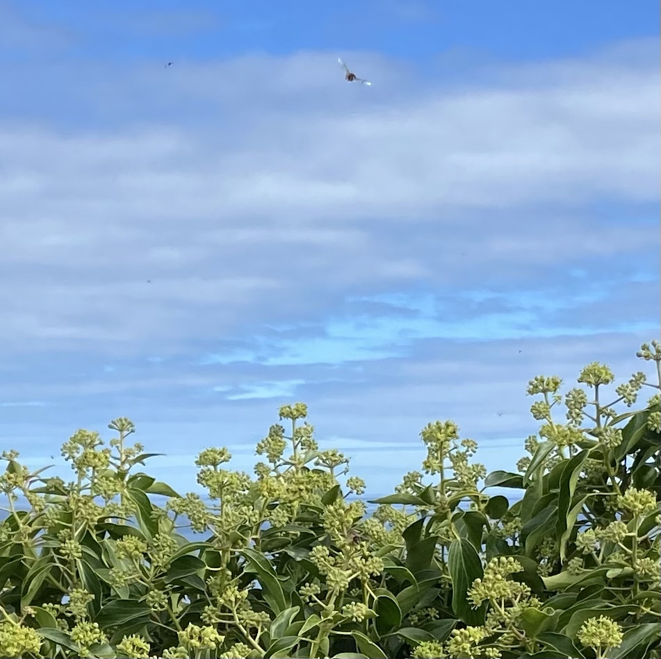
Up here a solitary ivy bush provided a late feast for industrious bees, the nectar from its tiny green clumps of flowers their own version of the Drift clifftop coffee bar.
I hadn’t particularly wanted to look out of the window of the bus this morning, because I didn’t want to spoil the surprises of the walk. But I had noticed a couple of men in high-viz jackets putting up a drone in a field. They were still there hours later when I passed them, And so I came off the path to see if they would tell me what they were doing. I had my theories.

Deaglan and colleagues work for a firm called Geo4D, subcontracted by Sands Geophysical, subcontracted by HDI, working for SP Energies (the Scottish grid). At the very end of this long chain of parties are three men with a van, a drone, and a table full of computer equipment to record the readings from the drone’s magnetometer. Ultimately, the National Grid is going to lay an underground interconnecting high voltage electric cable from here down to England, to siphon off any unused wind energy (I think I remember that it was wind generated in England being used by Scotland, but from where I am sitting writing this I am looking out to see at a beautiful white offshore windfarm, and it’s possible that it’s the other way round). The project is to lay four Eastern Green Link interconnectors, and this is the first. EGL1.
So what was Deaglan looking for with his drone? I had imagined historic buildings that needed to be surveyed archaeologically, but no. They are looking for unexploded ordinance. German bombs? Yes, but also English bombs apparently dropped by British fighters on the way home from bombing raids who weren’t supposed to come back not having dropped their explosives. I asked whether I should add UXBs to the list of walking hazards, to go with yesterday’s quicksand advisory, but apparently they’re all about 3 metres underground, and pose no danger unless you are laying international high voltage cables.
I stopped for my Co-Path sausage roll lunch with a view of the power station to the north, the coast all the way down to Saint Abbs head to the south, and uninterrupted views of the sea in front of me. I was going so slowly today. Perhaps this was the result of tiredness building up, perhaps the result of yesterday’s long slog. It was also getting hot — I applied sun cream and wondered whether I had enough water to last me to the end of the walk.

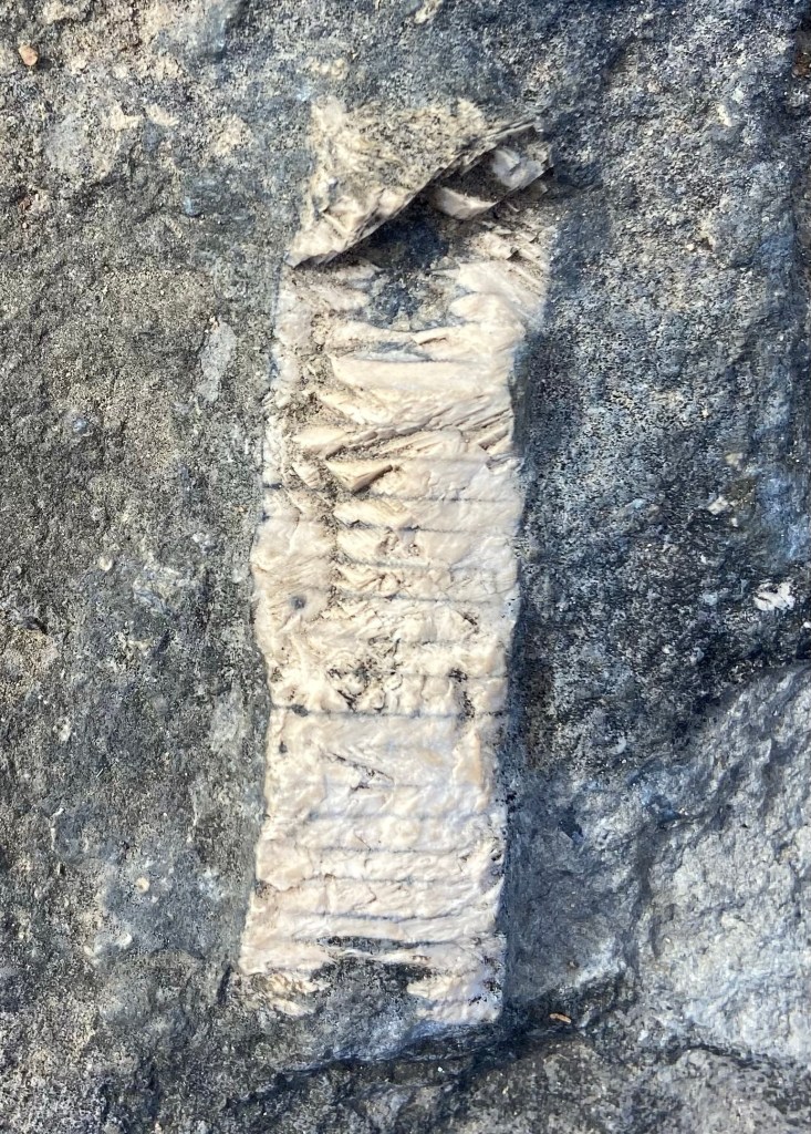
Down on the beach once more I hunted for the stones with the best fossils, finding a couple jam packed with the shell remains of tiny creatures, unimaginably old.

The sand I walked over was made of the same stuff: rock and shells of more recent creatures, but crushed and ground down into fine grains by the ceaseless action of the waves

Torness power station are eager to interact with the public. There is a visitor centre there, and two walkways skirting the station on the coastal side. I took the higher of these, which gave magnificent views inland to the power station, across fields which they plant up every couple of years with crops such as quinoa and maize, to provide habitats for linnets and other birds.
Then I walked in the shade of the lower walkway for a while, and briefly chatted to one of the bass fisherman who heaved himself up off the concrete blocks and headed round to the surf. It was a wee bit calm he said. ‘Are you going to Saint Abbs? It’s as good as it gets’. The sea bulwarks were massive concrete shapes, heaped up as if they were no more than jacks.

The signed path climbed up above the beach, but I could see a carpark ahead and was fairly sure the path was going to descend again and I wanted to walk across the giant slab of ancient beach that curved round this little bay.

There were fossils in it that I have never seen before, seemingly annelid precursors, types of seaworm perhaps.
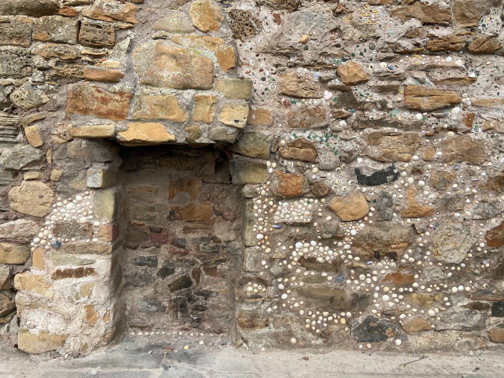
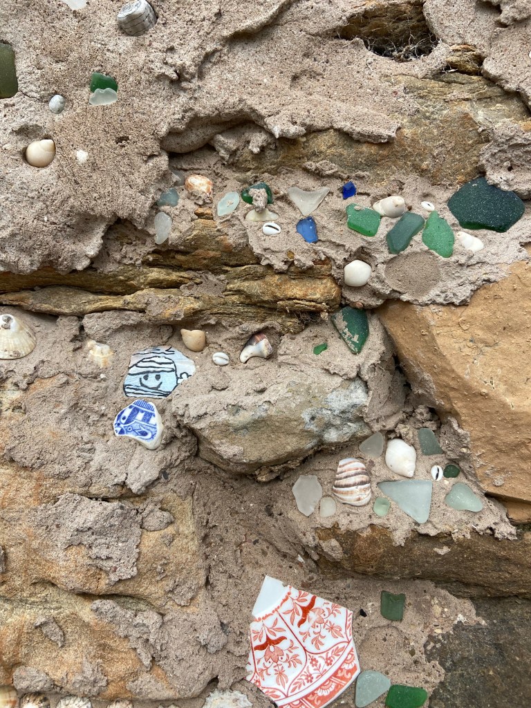
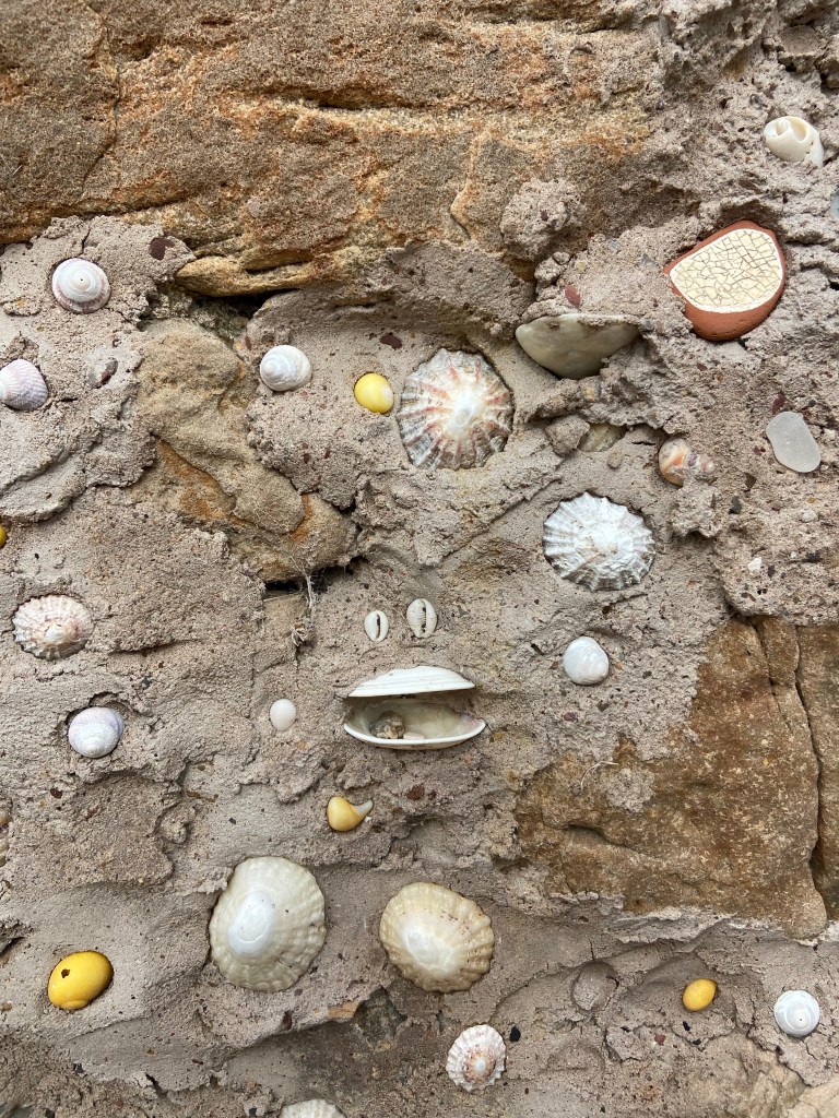
Just along from the beach was a tiny ruined cottage, slightly off the path. It looked like someone had been sticking limpets in plaster round the old fireplace, so I went to have a closer look. There were all kinds of shells and seaglass artfully pressed into wet, plaster, and the more I looked, the more I saw to make one joyful.
You need some stalking skills around here. A flock of birds, tiny ones, landed on the fence ahead of me. I could see through the binoculars that they were goldfinches, many of them stripping a large patch of ragwort of its seeds. I tried to creep up behind the dune grass and almost made it. But what I really need is a long lens; not the sort of thing I would want to be carrying on these walks. Although it has been absolutely wonderful leaving most of the contents of my pack back in Dunbar each day. I had better luck creeping up on some seagulls and oystercatchers.

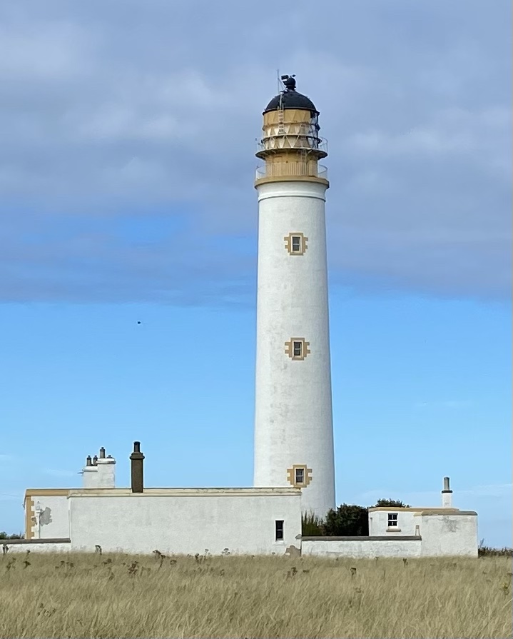
The shingle bank was more like a shingle cliff in the walk up to the Barns Ness lighthouse. The top of it was thick with tree trunks, branches and other detritus. The lighthouse is oddly the first one I have passed on land; most of them have been out to sea in the islands. A flock of starlings had made it their roost and flew in and out of the niches in the lamp, screaming and chattering.
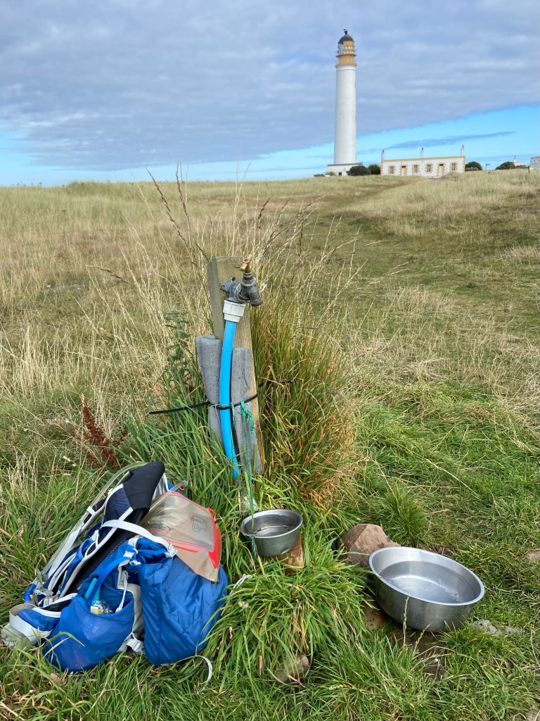
Someone had installed one of those camping water stations with bowls for dogs. It came just at the right moment for me: I’d been sipping at my water to try to come serve it, but what I really needed was some really long gulps.
White Sands was the last beach before I turned off the coastal path and made for the B&B. I thought rather than sit at home back at the ranch writing the blog, I would take off my shoes and boots, sit on the handy bench which presented itself, and just drink it in the late afternoon. It seemed a choice entirely consistent with the generally indolent atmosphere: a stand-up paddleboarder who had kept pace with me (or I with him) since the power station had given in to the temptation of the totally flat sea, and stopped in the middle of White Sands Bay, lying flat on his back with his arms behind his head, fast asleep.
My feet felt 100% better for having been able to stretch out my toes for a bit. I got talking to Roy, camping on the other side of the bay and we discussed different methods of strapping up and supporting failing knees. At 75 he says he’s slowing down a bit on his walks, but he’s still planning on travelling round New Zealand for a couple of months, leaving soon. We chatted as we walked, and I inattentively missed the path and had to backtrack to be able to head round the (you’ve guessed it) golf course.

My cunning cut through to get to south Dunbar without having to go through town didn’t quite work, because they were building a new housing estate on the hill behind the links, and the land was all fenced off and bristling with heavy machinery. I don’t think Right to Roam means using wire cutters to break into building sites. So I put on my headphones and slogged through town after all.
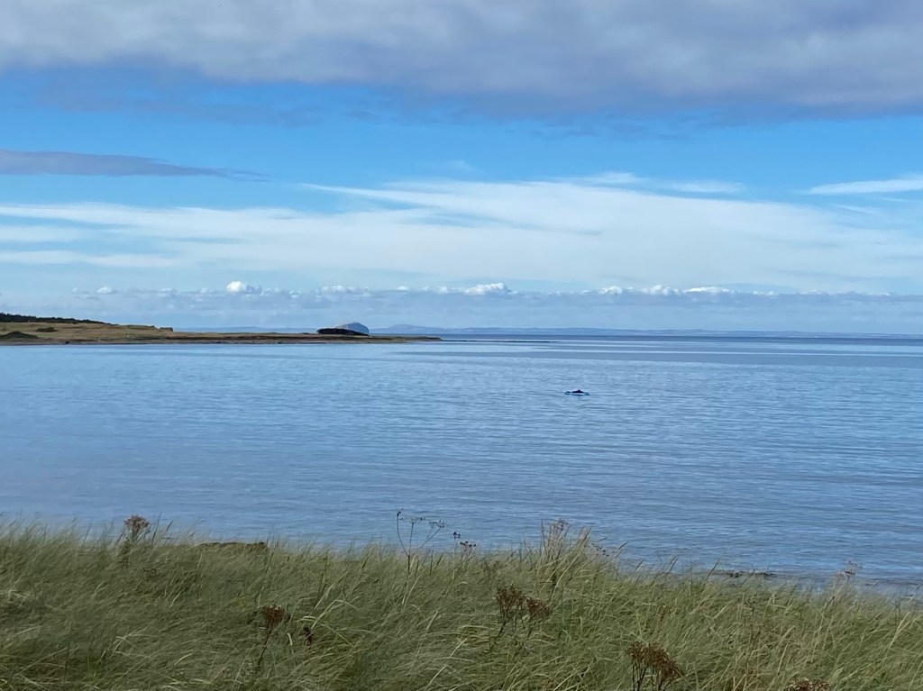
But I enjoyed the enforced longer walk around the coast, and the changing patterns of light and shades of blue on the quiet sea.


Beautiful photo ^^;
LikeLiked by 1 person
Thank you, Yolanda … there were so many!
LikeLike
What an absolutely beautiful day ☺️ x
LikeLike
I think I would have managed this day!
LikeLike