
Hiding in plain sight
Leo the tree surgeon
Today was a monster — 30km, with 500m of climb at the start of the day. I’m so glad I didn’t try to push on in the rain on Thursday and do the hill section, partly because I was wet and chilled and tired and that would have taken all the pleasure out of it, and partly because the climb up high above Cardigan Bay gave me terrific views, which I wouldn’t have had through the rain. And finally because I knew there were many little gems up there on the hill (mostly thanks to the two couples I met in the café bar last night) that I would have missed completely had I slogged past with my head down.
I set off at 9am, having woken early and gone outside to look at the early-morning light flooding into what I could see of the estuary at Barmouth.
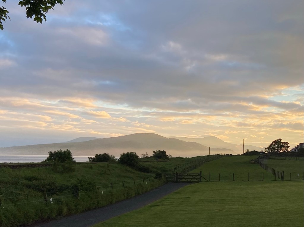
The views from all the camping pods at Hendre Hall were all terrific — mine looked out over Cardigan Bay and I am sure if I’d stayed long enough I would have seen some of the dolphin pods for which the Bay is famous, from my front door.
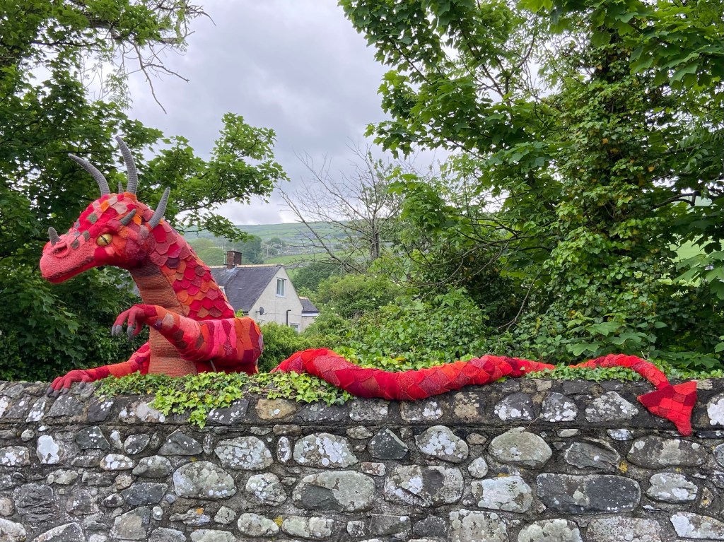
I left Hendre Hall looking handsome in the full sun,
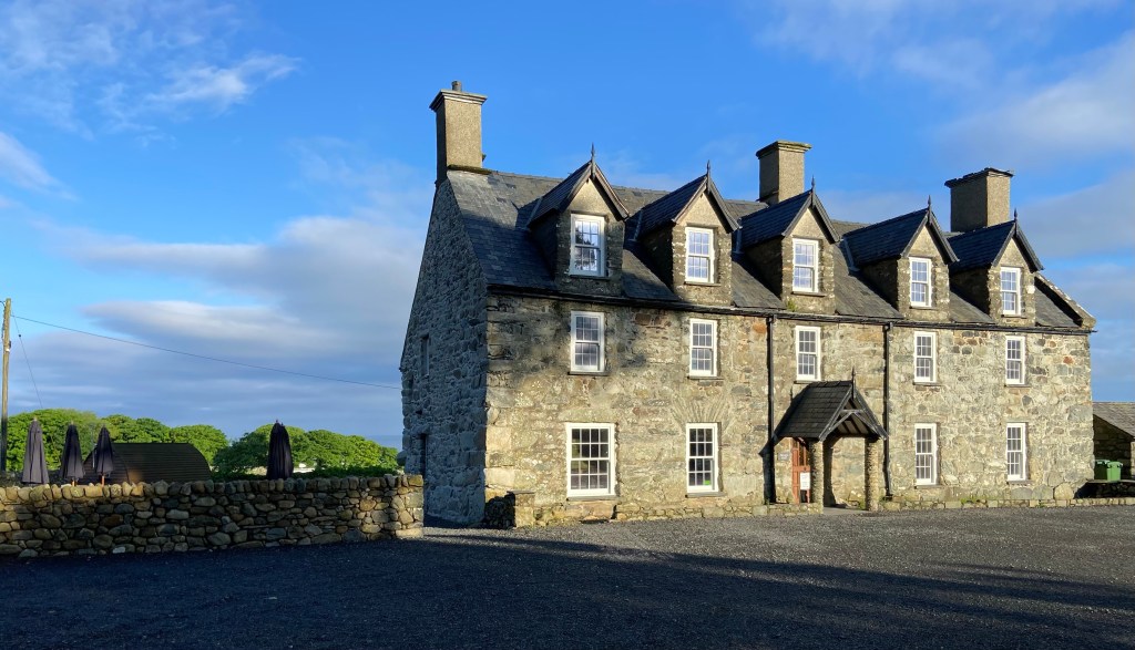
and was waved off not by Mei or Spot the dog, but by Y Ddraig Goch saluting me from behind a wall.
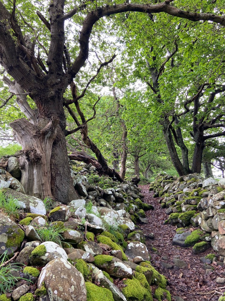
I climbed up through a wood on a very steep ancient track lined with oaks and mossy stones, the path a soft bed of leaf litter,
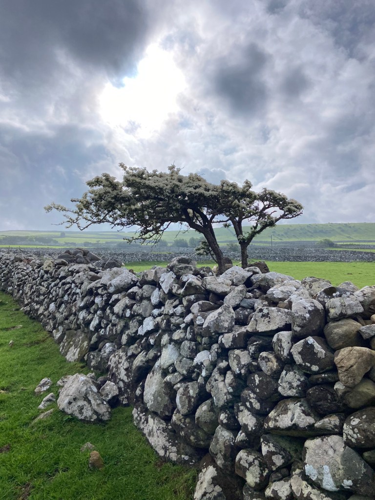
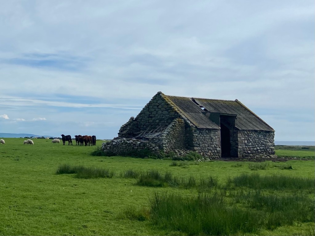
to emerge into a sheep-farming landscape that could have come straight from the Dales: sturdy dry stone walls and wind-blown hawthorns, sheep grazing in fields studded with what looked like collapsed chamber cairns.
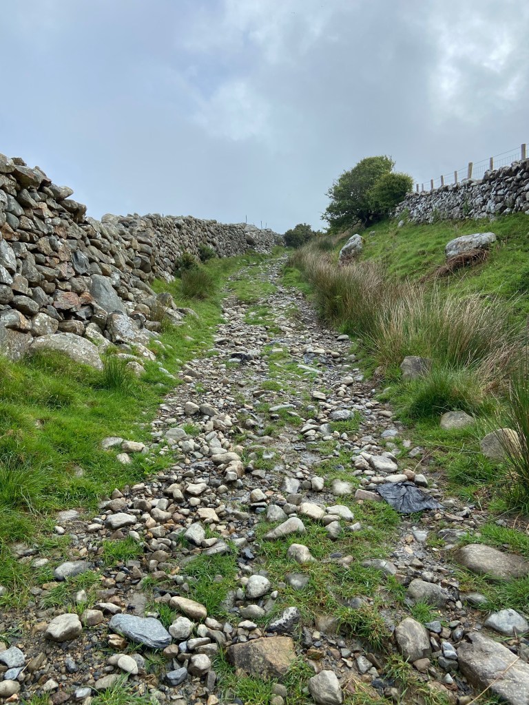
The Wales Coast Path here follows an ancient track over the hills which must have been trodden for centuries, and walking through the the thin mist up here, there was nothing except a half-buried piece of black plastic perhaps ripped from a silage bale to suggest that I hadn’t been transported back in time to a harder, harsher age.
Looking back, however, all was different. It would be worth climbing back here again just for the revelatory view: Cardigan Bay far below, curving outwards on either side in soft, misty pastels. The first of today’s hidden gems.

Bleak farms, exposed to the elements, followed one on the other, and I was more than glad I hadn’t attempted this in the rain yesterday.

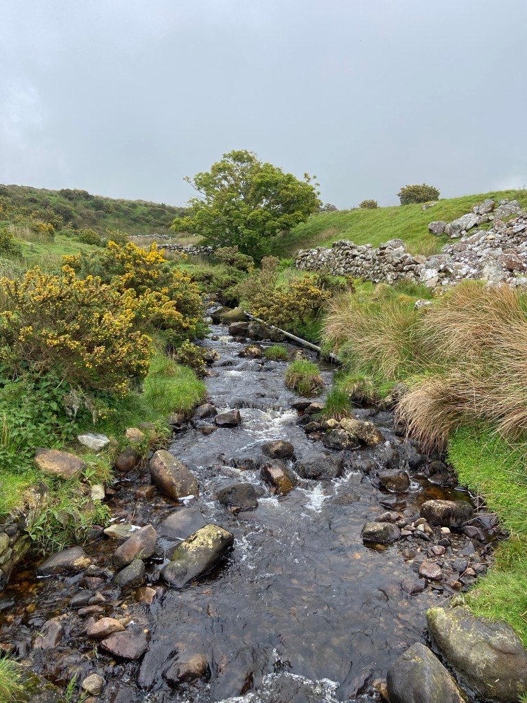
Today I was fresh and interested in my surroundings, the mountain streams,
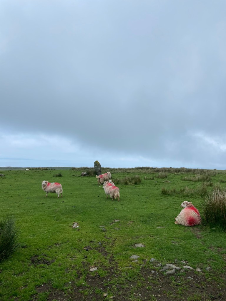
the sheep over-enthusiastically painted with the farmer’s red mark,
and the gleams of sun illuminating the sands all the way up the river estuary from Fairbourne and Barmouth to the road bridge at Penmaenpool. From up here is is easy to see how low-lying Fairbourne is doomed to sink beneath the waves, and the 700 inhabitants being forced to move over the next decades and become the country’s first climate refugees.

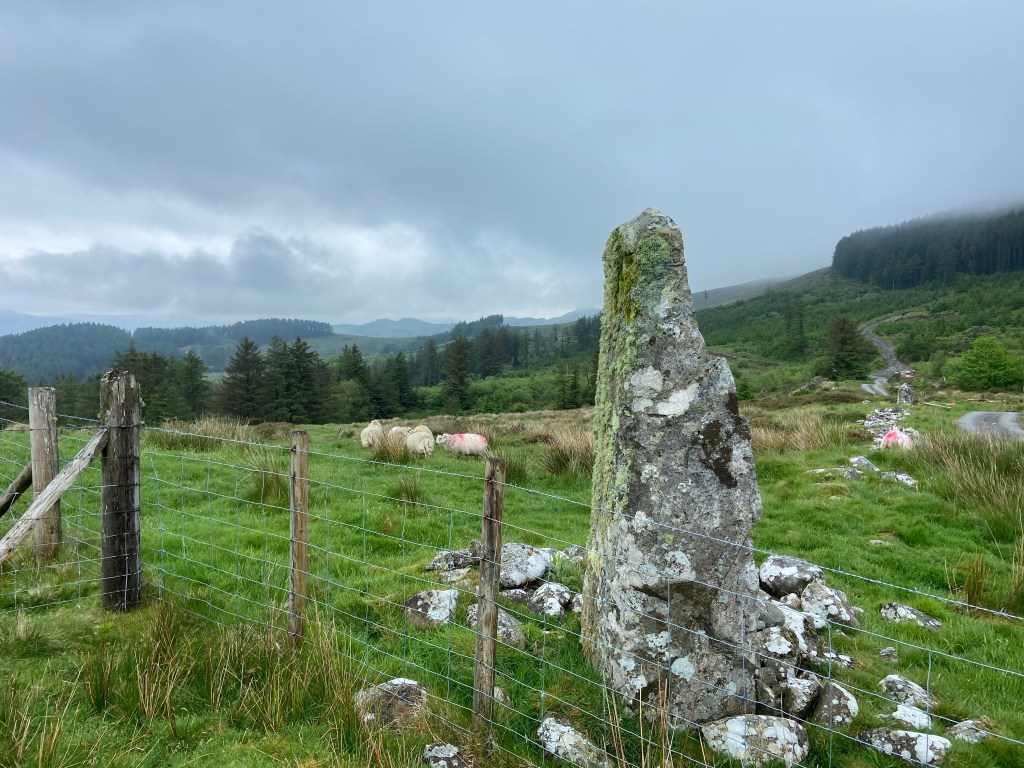
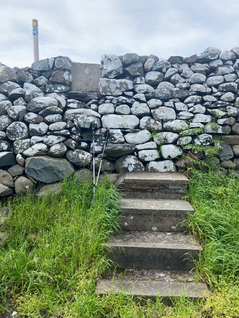
Jane recommended that I go and see the standing stones and Bob-Ian that I take a shortcut leaving down to the blue lake; I certainly had enough energy to take the detour to the stones: rough-hewn rocky monuments connecting us to our ancestors in the far past with whom we shared this landscape.
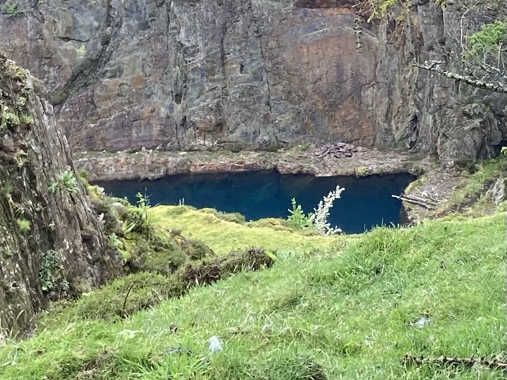
The Blue Lake fills the bottom of flooded Golwern quarry. It isn’t visible from the path; you have to climb up a steep grassy path to view it from above. I had expected the lake to reflect the grey sky (I was only going there out of dogged determination — I hardly knew why), but I was astonished to see that the water really was blue: a farmer I met much later in the day said it was copper leached into the water which turned it that colour. I haven’t been able to verify that. But it was a gem! And definitely a hidden one.
I had a shortcut planned which might save me some time, since I wanted to get off the hill as head as possible to the rail and foot bridge over the estuary to Barmouth. When I got to it, though, it was a steep slope totally overgrown with brambles, fence and finger post down. This is the trouble with shortcuts — or indeed with planning one’s own routes. They are unverified.

I found another way round, and negotiated a semi-collapsed tree hanging over the path (not easy to duck with a massive pack on your back). I became aware that I was hearing a totally unfamiliar bird call, insistent and high pitched. Merlin told me it was a kestrel, and when I managed to pinpoint the direction it was coming from, I realised it was coming from a nestling hidden away in a hole in a telegraph pole.

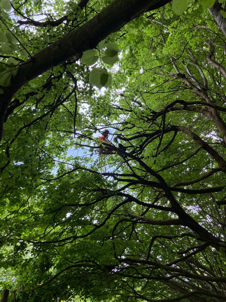
The track took me up the field edge of a high valley running parallel to the estuary. At the top end I met a team of tree surgeons pollarding a line of lime trees over the track. I couldn’t see the one up in the tree. ‘Here I am — hiding in plain sight’, he called down.
My plain sight came from the edge of the wood just further on: a stunning view of the estuary with a bench to sit on and rest, and have a snack and top up with some water.
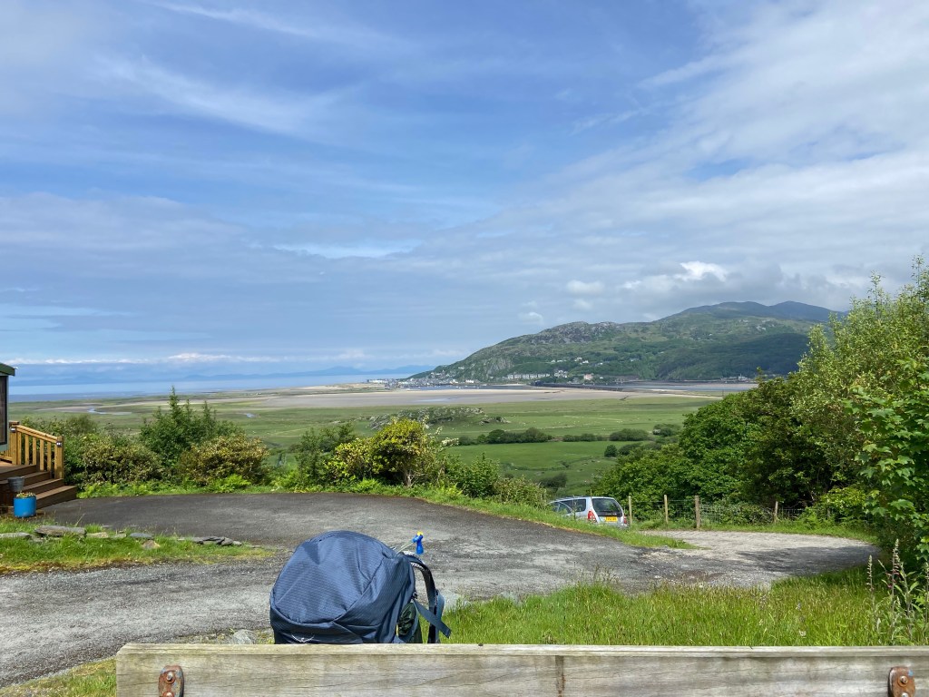
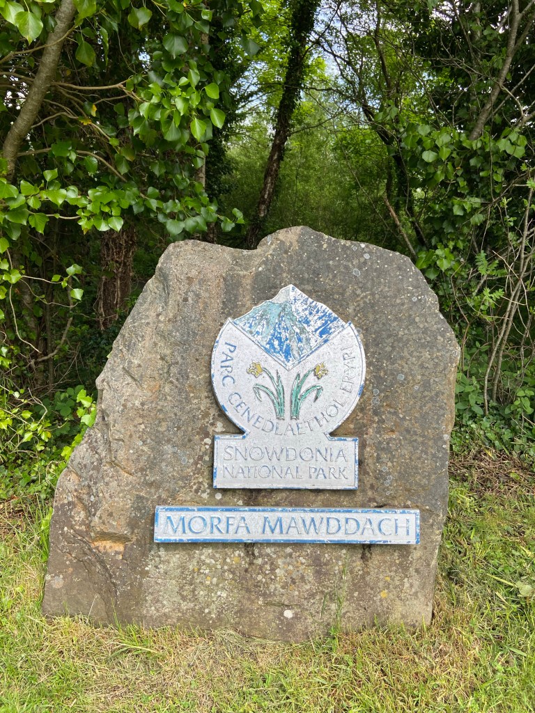
I was terrifically glad I hadn’t tried to do all this last night — it had taken me nearly three hours to get to this point, and that was when I was fresh at the start of the day. Now the sun came out and before long I was looking at a faded sign announcing I was entering the Eryri Snowdonia National Park. I could hardly believe it — that I have walked all this way.
The panoramic bridge over the Mawddach river was another milestone: 1.68km long with inland views over the sandbars so glorious they quite made me forget my tired feet and heavy pack.

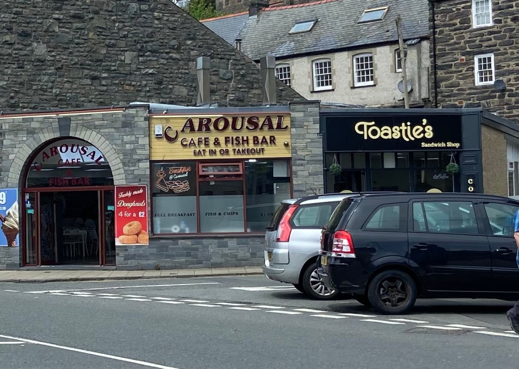
Barmouth was something of a honeypot, once an elegant resort, now fallen on harder times.
I stopped for a brief lunch but then pressed on; I was barely half way because of having front-ended today with that chunk of yesterday’s walk, and sent a couple of waily texts over my desiccated fish pie. ‘Another 15 is well within your capabilities’, said Jane. Yes. Yes! Jane, you are right. I reject all notions of taxis, e-bikes for hire, hitch-hiking, pony-rustling, kite-surfing or any other method of getting to Shell Island.
The Coastal Path goes along the road for miles here. I tried the beach for a bit, but the tide was coming in and it was clear I couldn’t clamber over the groynes.

From the concrete esplanade I watched isolated groups in between the seaweed-draped wooden barriers busy enjoying their beach day down at the shoreline,

until the path climbed high above sea level and I contemplated the poignancy and inevitability of being eventually forgotten, in the face of the overgrown churchyard.

The sleepers were oblivious of their view, which cannot be said for the living; prime seafront real estate was being constructed all the way up the coast from Barmouth.
To get back to the beach now the path slanted back across farmland. There were the usual tiresome obstacles: colossal step-stiles, way too high for tired legs and heavy packs,


Interspersed with beautiful grassy paths.

Cows suspiciously guarding their own real estate,
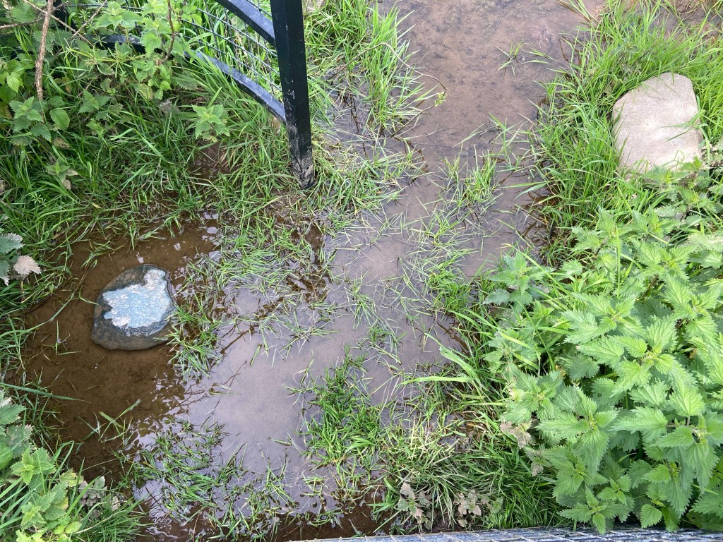
and simply impossible kissing gates. This one had the holy trinity: nettles, water and stones to whack one’s head on hard as one swings on the gate trying to avoid getting legs stung and feet soaked.
But I just ploughed on, repeating to myself the mantra ‘well within my capabilities’. I didn’t realise the female urination device (indispensable) had dropped from my pack whilst negotiating one or other of the aforementioned obstacles. It was such a shame! Peeing standing up confers a terrific sense of power and status. You can almost feel your invisible superhero cape fluttering behind you.
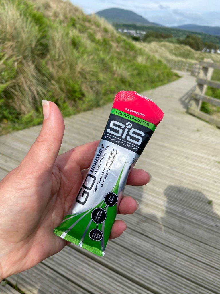
It was now 5pm and I’d been going for eight hours. If it wasn’t for the energy gel I broke out of my emergency food stash,
I might have mugged the old lady for her mobility scooter.

It was another 4-5 km to the campsite, nearly 2.5 miles still to go, but I was now back on the beach, and a beach in the setting sun is an unfailing lifter of spirits. Especially one as beautiful as this, with the hills of the Lleyn rising behind it.

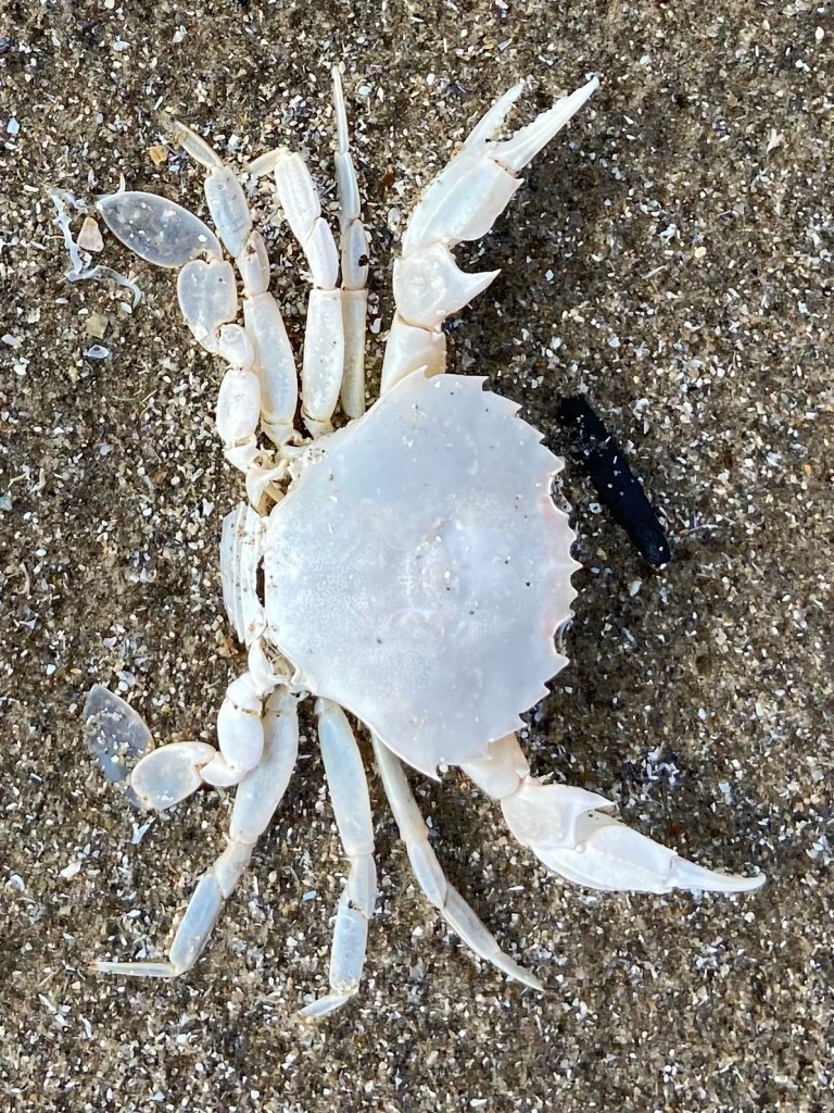
I identified this little white creature as a velvet swimming crab, and, reading up about it later was amazed to realise that crabs have ten pereiopods or legs. I think I would have bet money they had eight. Anyway, the interesting thing about the velvet crab is that the last pair of legs are flattened to help them swim instead of just scuttle like other crabs, which you can clearly see in this photo:
There was other beach stuff too: the internal shell of a cuttlefish mollusc, which I haven’t seen since my brother briefly had a budgerigar in the late ‘70s; more fascinating sand patterns.

Shell Island campsite is mindbogglingly enormous. I believe it’s the biggest site in Europe, and fills the entirety of the area behind the dunes in the lump of land which forms the opening to Harlech Bay. It took me about fifteen minutes to walk from the beach entrance to the reception area.
On this Friday evening the site was filling up with groups aiming to revel their way through the weekend. But the site was so extensive that one hardly noticed; more of an intrusion was the young man living in the campervan next door to my pitch. After offering me help with putting up my tent (I dispatched the task myself with determinedly studied professionalism), he insistently wanted to share details of all his health problems. But I am afraid I had nothing left in the tank to offer him. I made some non-committally semi-sympathetic noises and went heartlessly off to shower and eat a tuna jacket potato. After 30km with 528m of climb I just needed to recharge my own batteries.

And the incredible view was without question, just the thing to do that. Underneath the tiredness I felt physically fine, but I was much too tired even to consider blogging. I was dropping off to sleep almost before I had got into my sleeping bag.

What a view! Well done for today, a monster indeed. X
LikeLiked by 1 person
It’s logged me in wrong! J x
LikeLike
Hope you got it sorted!
LikeLike