
In the morning when thou risest unwillingly, let this thought be present- I am rising to the work of a human being.
Marcus Aurelius, To Himself, Book 5
Starting a walk early means having the world all to oneself and getting some miles under one’s belt before the day gets really going, but starting later as I did this morning means that you get to interact with the people of a place. Kate in The Perfect Blend café just round the corner from my Airbnb made me a quite astonishingly delicious (home roasted) chicken and avocado sandwich for my breakfast, and was also warm and friendly.
When I said I wanted to visit the house of pioneering scientist Dr Jenner before I left, she checked with a lady having her breakfast in a corner of the café, who works there. It was open today, she confirmed, but not until 11 o’clock. Much as I like starting late, that’s a little bit too late for me!

Rather sadly, I thought that I would leave Berkeley without having seen anything of its culture — the museum or the castle.
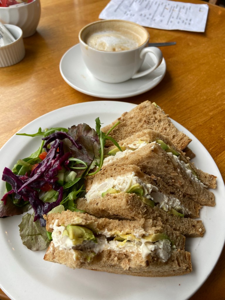
Almost on the edge of the town, I stopped to chat with Fred, mowing the grass in a local community orchard and nature reserve called Sarah’s Field. It has been gifted to the community and restored as a wildlife habitat and watermeadow.
Fred works for the environmental charity Stroud Valleys Project which creates and maintains community green spaces in south Gloucestershire. The “yokel”, as he called himself, posed for his photograph in front of Henry’s Pear, a local variety. We talked geology (Fred is a much more knowledgeable than me, having studied the subject as part of his environmental science degree … it’s the degree that I always wish I had done, and might have got there if I haven’t failed my chemistry O-level. Perhaps it isn’t too late?) Aust cliff, Fred explained, where I am heading by the end of the day, was a desert in the Permian era, which is why the rock is so red. The desert gradually became covered with a shallow sea in the Jurassic, and beds of marle were laid down, a clayey limestone, which explains the shell fossil I found upriver.

Someone else had been out very early too, having harvested some crops for the table: an older couple holding hands. She was carrying a garden trug full of what I judged to be prize-winning radishes, a pair of gardening gloves, and a thermos. I called out a compliment on the wooden trug, and she replied, “Thank you! Alan made it.“
I admired the allotment over the hedge as I went past, and although I failed to visit the museum or the castle, these are the memories I will take with me of Berkeley: the extraordinary yellow rose tended by my lovely Airbnb host Michael on the warm brick wall outside their home, in full flower in late April, the welcome from Kate in the café, the apple blossom in Sarah‘s field, and the happy conversation there with Fred, and the unknown woman’s evident delight in a lovingly-handcrafted useful object and my appreciation of it, and her pleasure in working outdoors with her partner.
I rejoined the Severn Way through a long series of green tunnels which would take me back down to the river.

They spat me out at the other end, and the contrast was immediately impactful: the wide, wide river (stretching 2.2km at this point over Lydney Sands), tidal saltmarsh at its edges, and the waterline high at this time of day. The clouds were lifting, and the whole atmosphere was as different as possible to the river yesterday. The slow grey water moved purposefully southwards, in a great liquid mass. I took off my thin fleece and waterproof and simply enjoyed the feeling of the air on my arms, feeling myself expanding out into the space and the sunlight that was breaking now through the cloudcover.
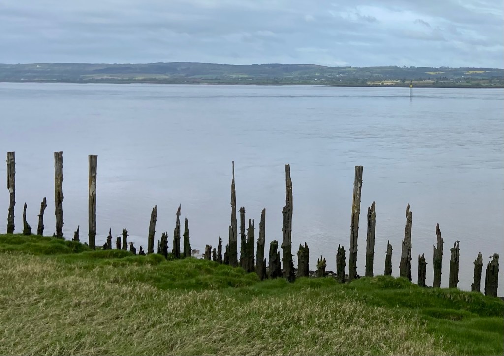
Larks rose and fell in the field to my left, and swallows darted over the water to my right. Where the clouds were thinning, the river reflected duck-egg blue back to the sky with linear smudges of pale ochre, where the sandbanks lie under the water.
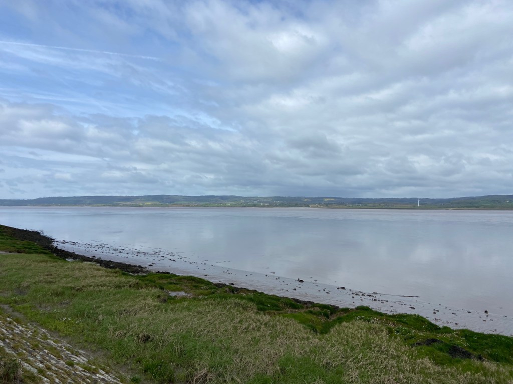
The Severn Way follows the top of an earth embankment a few metres high above the river. A tideline of bladderwrack and driftwood, including some quite large tree trunks was beached near the top of this sea wall, and there was even some bladderwrack on the path. But generally it would appear that the embankment has done a pretty good job of protecting the farmland behind it. As the embankment curved closer to the river the rivuletted mud- and sandflats were revealed, as the tide went further and further out.

I lunched by the decommissioned Oldbury power station looking out over the water and the mudflats gradually being uncovered by the receding tide, eating the tuna mozzarella and spring onion panini that Kate had bagged up for me in the café, and admiring the thick silty mud piled up at the base of the power station jetty.
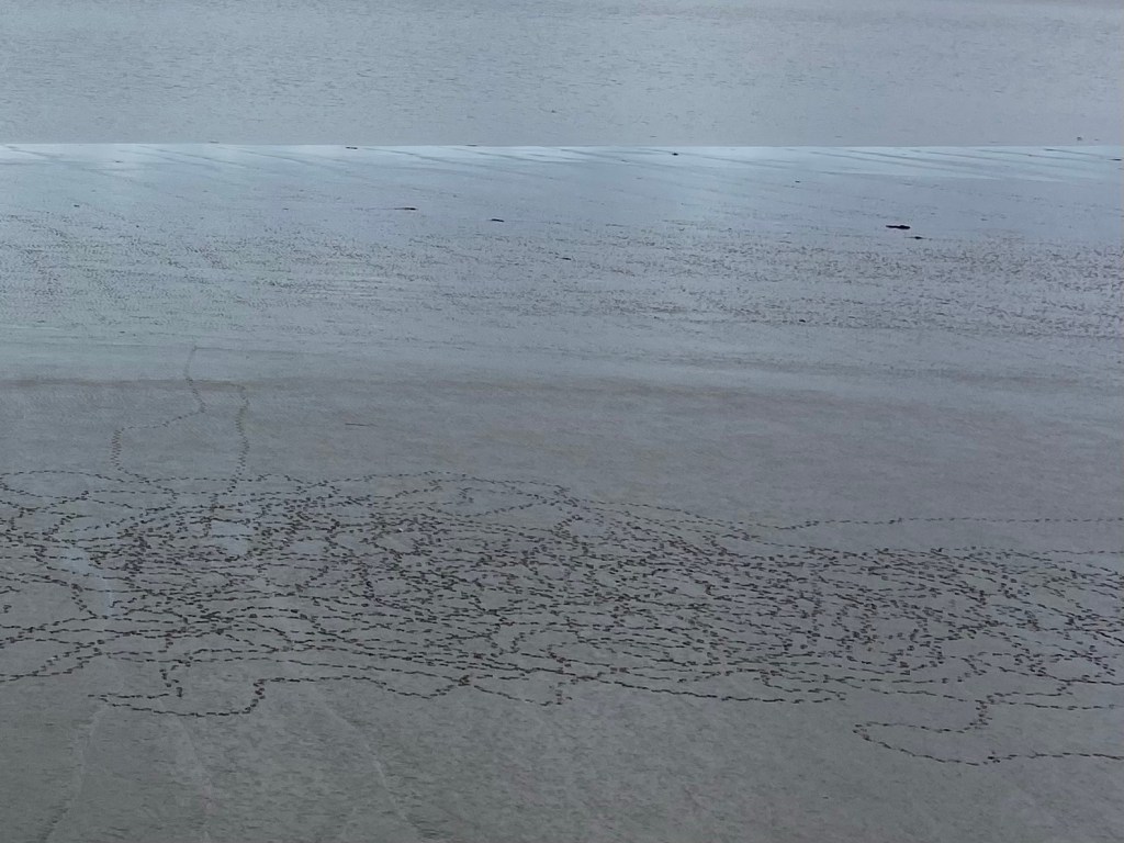
Benches are few and far between on the Severn Way, and a little further on I considered it my duty to sit on the only one between Sharpness and Aust. The binoculars revealed a snowy white egret stalking about below me, stabbing at creatures in the sandy mudflats, and more of the shelduck which are by far and away the most common bird on the river today. Water was sloshed by the wind over the low, seaweed-covered wall of the tidal reservoir that provided water for the power station.
Each tide must present a pristine surface for the shelduck to scribble on, ‘always the beach is oghamed and cunieformed’, as Scottish poet Norman MacCaig observed. They had been hard at it today, for sure, writing ‘a volume beyond the wit of scholars’.
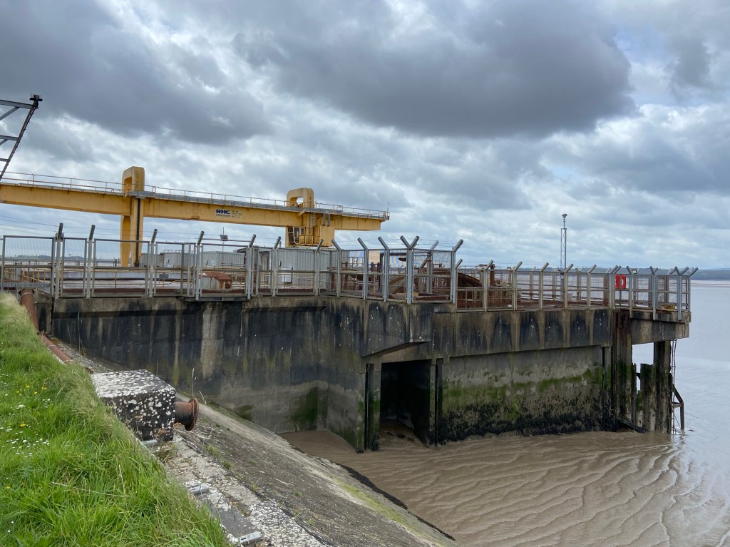
At Oldbury Pill, the Severn Way dinks inland and back again in one of those aggravating lengthenings of a coastal footpath. ‘Some way inland’, as it is described in a detailed ‘South Gloucestershire Landscape Assessment’ available online. This was doubly frustrating because there was a perfectly decent embankment that curved round much nearer to the river, with a bridging structure over the pill (which I learn is a meandering tidal channel). There were two environment agency vans parked up by the gates to the bridge, so I walked over to ask whether I could have permission to take the shortcut. When Simon heard what I was doing, he told me that he’s just back from three weeks walking up to EVEREST BASE CAMP and back again. (He didn’t say ‘Everest’, he just said ‘base camp’ … but everyone knows there is only one Base Camp.) That puts my piddling undertaking to shame!
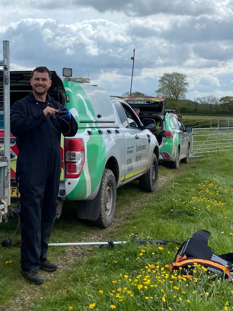
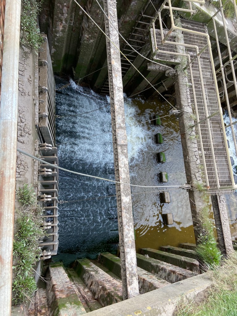
He told me to ask Andy whether it was okay for me to cross, and Andy said he didn’t understand why there was no right of way here anyway. And of course I could cross. He explained that the bridge was a sluice gate, part of the flood defences for Oldbury,

and showed me the enormous flap valves under the bridge, which are pushed shut by the incoming tide to stop in the river rising up the creek and flooding upstream.
I found the landscape assessment by googling ‘Pill and Warth’, two distinctive names on the map, and at first the search returned pages of results about pills and warts (one foot problem from which I do not suffer). A warth, though, is a salt marsh, and these are grazed by cows, some of which had abandoned their salty fare and wandered over to MY embankment to loiter on the rich grass behind it.

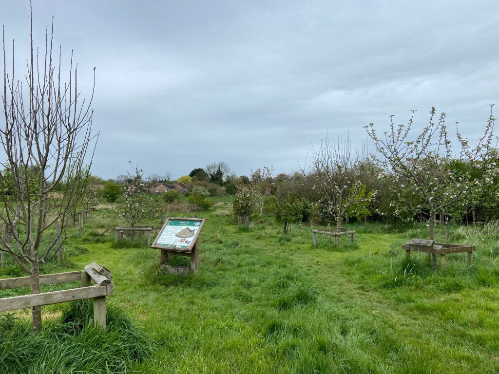
If I had read the document before walking the embankment I would have taken note of the old Putcher ranks in the water as I neared the cliff and the bridge. I can see them very small in the background of one of the photos I took. They are the solid wooden frames on which conical willow baskets were set to catch salmon and were, historically, a particular feature on the Severn, although the practice had fallen into disuse.
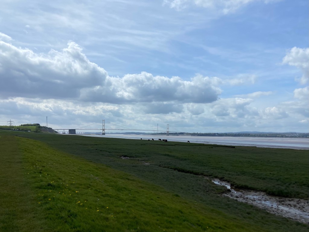
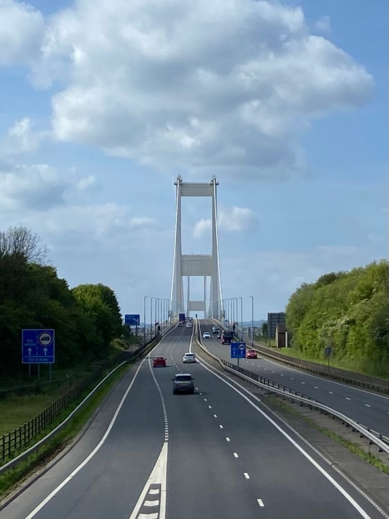
I climbed the cliff to the viewpoint looking out west over the Severn Bridge, a real icon on the journey that for some reason I hadn’t been focusing on at all when I planned the route.
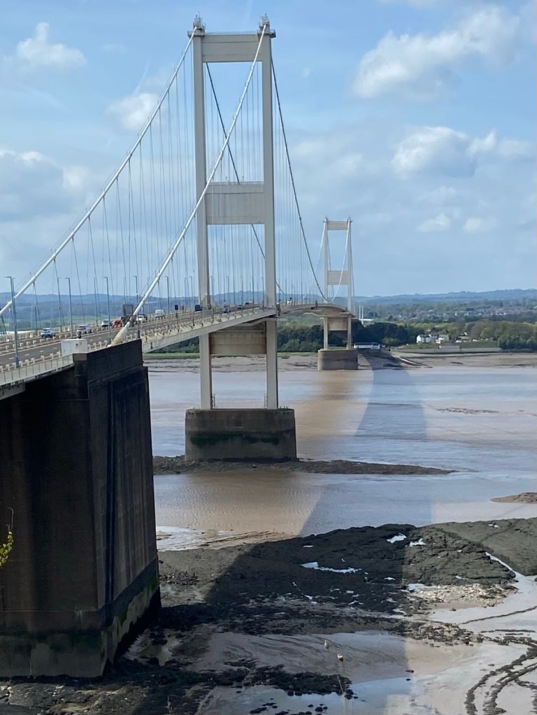
I was so glad I did. I uttered an involuntary ‘Woo-hoo’ as I crossed the footbridge over the M48.
The views didn’t end there, though. My lovely Airbnb host has given me a room with a stunning view downriver to the Prince of Wales bridge, which I will pass by tomorrow on my final approach to the outskirts of Bristol.

Stats for the Day
Distance: 19.82km. Respectable.
Tidal range of the river Severn: 12m (second highest in the world — a good Top Trumps card to have in your hand )
Total ascent today: 54m (versus 6,015m climb up to Everest Base Camp)
A final note on anglers:
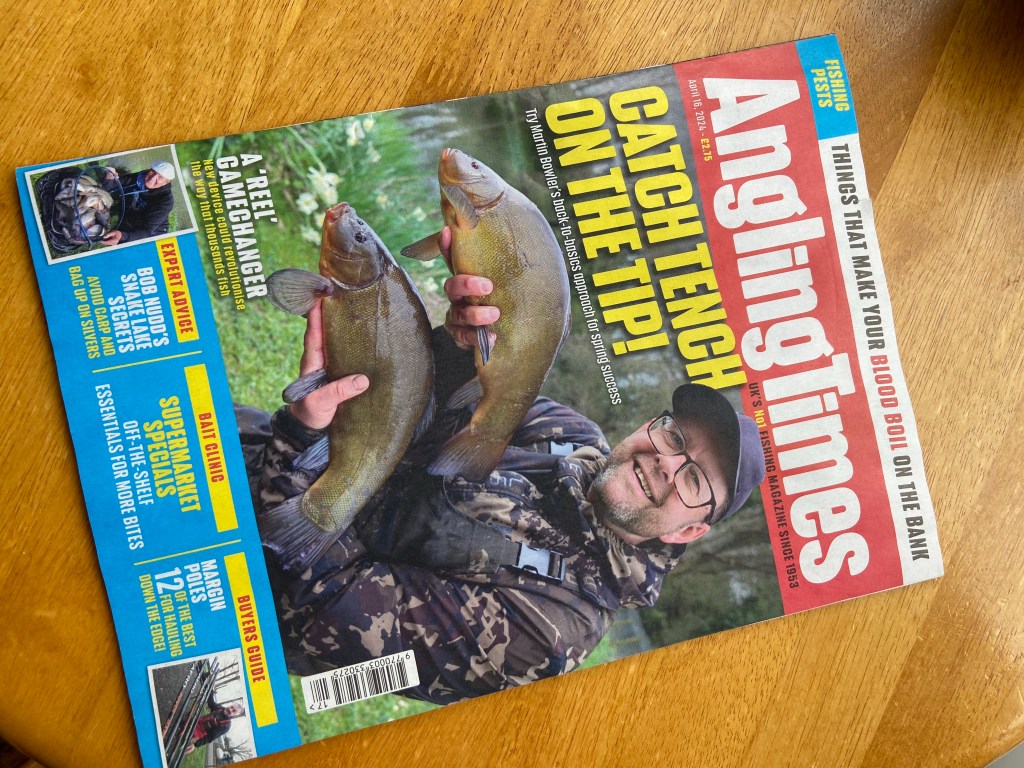
In the café this morning, just as I was leaving, I noticed a copy of The Angler along with the newspapers and magazines thoughtfully provided for customers to read as they sipped their coffee. What a shame I hadn’t seen it earlier, I thought, as I might’ve learnt something about this sport that I had been so interested in the day before yesterday. I flicked through. ANGLERS’ ULTIMATE PESTS, I read. Double page spread. Alongside children, swans, rowers, rain and wasps, apparently ‘Joe and Joanne public’ are loathed by all right-thinking fishermen:
What is it with walkers and general passers-by and fishing? Despite possessing zero knowledge of our sport, every other person seems to be desperately intrigued by what we are doing. First come the inevitable questions, from have you caught anything? to have you caught your tea?” Then comes the advice, whether it’s to do with a massive fish they saw round the corner, or what so and so caught here 20 years ago. Thanks for that, we really wanted to know. Now, is there any chance you could go home and stay there?’
Charming. Misanthropes.

Another great read, which had me smiling most of the time and downright chuckling at the very end!!🐟🤭
LikeLike
Hahahahhaa!!!!
LikeLike