
Rivers are texts by which are expressed the land’s folklore, its mythology, the culture of the people, the character of each region, even the harm done to our landscapes.
Jim Perrin, The Rivers of Wales
In early December I did a four-day walk along the South Downs Way from Eastbourne to Lancing, the last day of which coincided with the polar vortex. It showed me that it is possible to undertake a multi-day walk at this time of year, as long as it isn’t raining too much, the day’s walking is finished before it gets dark, and I am not camping. So I thought I could ease my post-Christmas-stiffened body into walking again by tracing the 160km course of the river Teifi in Ceredigion, from its source in Llyn Teifi down to its egress into the Cardigan Bay at Poppit Sands. It’s a part of Wales I know not at all, but from what I have read seems amply worth exploring.
Train and bus strikes meant that I could not get myself out to the start of the walk last week, but it turned out to be a good thing, because it meant that Stephen could bookend the walk with me, driving me out after work on Saturday, walking the first day with me on Sunday, and meeting me again down at the coast when he breaks up for half term. We drove in the dark over the Cambrian hills, then down narrow, twisty, vertiginous single track roads (that my cycling expert assures me are legendary rides), through the last of the rain before what I hope is going to be a cold but dry week.
We awoke to the forecasted glorious sun. We had B&Bd at the finishing point for the first day’s walk: Tregaron is a market-town famed for trotting races, but we took a taxi out to the Teifi Pools in the hills rising above it. The taxi driver, who doubles up as the proprietor of the town’s fish and chip shop, is Turkish. He has been here for years and speaks English with an adorable Welsh accent, but this was the first time he’d been up into these hills. The roads spiralled and twisted out of the last village and he set us down eventually about a kilometre away from the lakes, in a place he could turn the car round in – providentially, as it turned out, just before a bend in the steep road, still shadowed from the sun by the lumpy rocky hillside, covered from verge to verge with sheet ice.
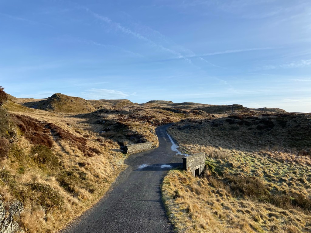
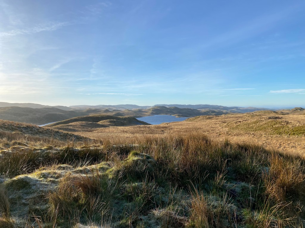
The views were tremendous. The road to the Teifi Pools wound through the outcrops, giving glimpses of Llyn Teifi to our right. We bundled up in hats, gloves and our warm layers, energised equally by the stiff wind, and by the thrill of being out in the wild again.
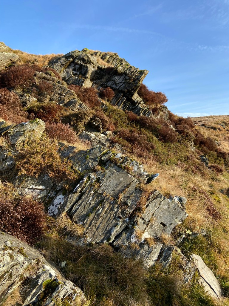
The rocks hereabouts are bluestone — quarried by the Neolithic peoples and transported south to raise Stonehenge. They glittered with frost on the west-facing exposures, but where the sun had warmed them up they were sharp and bright, covered with bilberry and heather.
This early in the day we were fuelled sufficiently to stride quickly down to the shores of the lake. It was a beautiful setting, expansive and incredibly blue, though the wind fairly whipped up the surface in places.

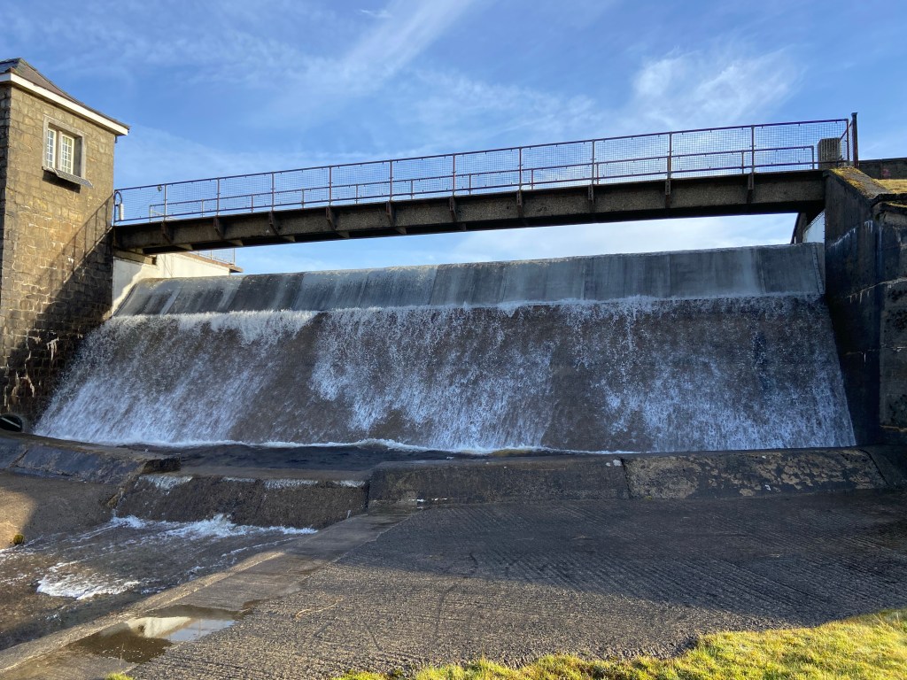
The river’s source is the cascade of water sheeting in pulses over the top of a dam — Llyn Teifi is a reservoir which provides drinking water for North Ceredigion — and we paused a while both to admire the endless movement of the water, and also to take stock of exactly where we were on the map.
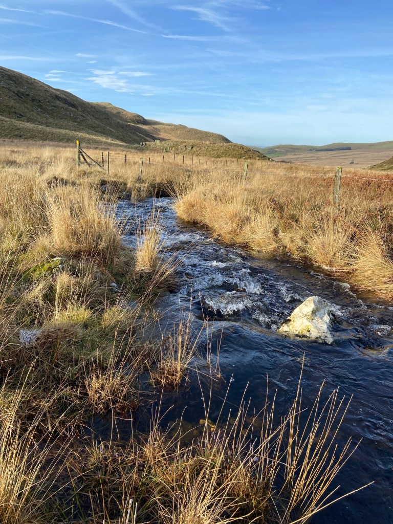
The river is only a stream here, but immediately powerful. By the time we were a kilometre or so down the valley it had already grown to a sizeable flow. Fortuitously we’d strayed off the supposed route, a visible double track, to view the source and then pick our way independently downhill through boggy tussocks on the ‘wrong’ side of the stream (‘it’s every man for himself’, said my boggy hillside expert), because by the time we came to the first ford where the track joined us on our side of the river, the Teifi was decisively too wide and fast-flowing for us to have crossed.
We shouldn’t have congratulated ourselves, though: after a short hour a gate took us out of of the wild hillside and into dirty farmland, fields divided up a by mess of fences thrown up in some places and torn down in others, bearing little resemblance to boundaries on the map.

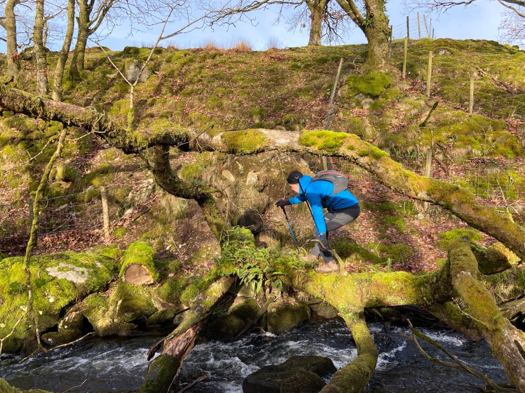
The second marked crossing point of the river was as impassable as the first, in a mini gorge roughly blocked off by dilapidated fencing tied up with bailer twine, and with no bridge. But cross we must.
We reprised a successful strategy from our end to end walk, using a fallen tree to cross by, throwing poles across and climbing from branch to moss- and fern-covered branch.

This one involved a teetering length of trunk across which we had to walk, if not quite like the tightrope walkers over the Niagara Falls, then at least like a gymnast on a balance beam. An Olympic gymnast, I like to think.
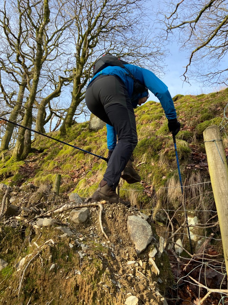
On the other side we used a heap of spoil, thoughtfully flung out of sight and out of mind over the edge of the gorge, to climb over the wire fence erected across the footpath.
From here, deserted farm tracks took us alongside the Teifi as it splashed its noisy way under pressure between rocks through characteristic oak woods, remnants of the great temperate rainforests of oak cleared centuries ago by human inhabitants and, later by their grazing sheep.

As the river valley flattened out, the Teifi becoming wider and shallower, slow-moving and almost silent, we reached the enticingly-named ruined Cistercian abbey of Strata Florida. I had discovered the Teifi route on the British Pilgrimage webpage: this abbey is the first Christian site the route takes in, and the last is the church of St Dogmaels, way down at the mouth of the river. The origins of worship on this site, though, stretch back beyond the founding of the Abbey in 1164 into the dark ages, when there was a Celtic holy well here, and even further back, three thousand years before Abbey’s Norman beginnings, to when the area was a sacred landscape for Neolithic peoples who worshipped the spirits of water.
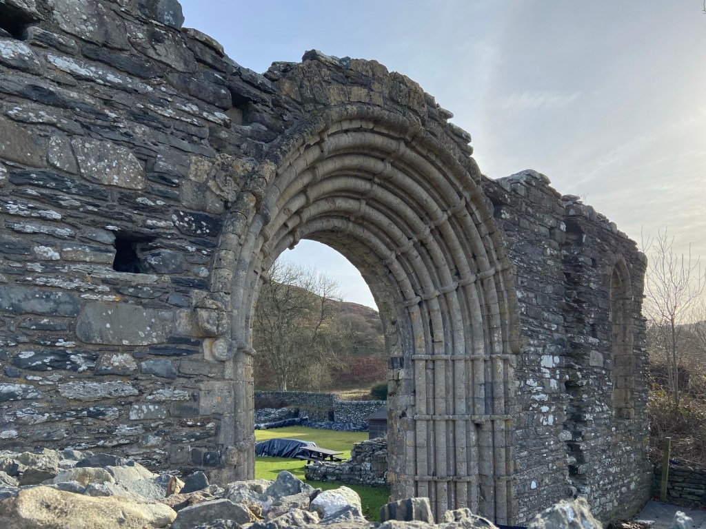
The Abbey is closed until Easter, so to admire the surviving stonework we had to look over the wall from the graveyard of Saint Mary’s church. There’s not a lot left because the stones of the original abbey were plundered during the Dissolution of the Monasteries to build a mansion (now a farmhouse) on the site of the Refectory. There are only traces of the walls on the ground, a few pillars, and a handsome arch through which can be seen on top of the hills from which we had descended a 15-foot steel and oak statue of a pilgrim, erected last October with to replace an earlier wooden one which had collapsed.
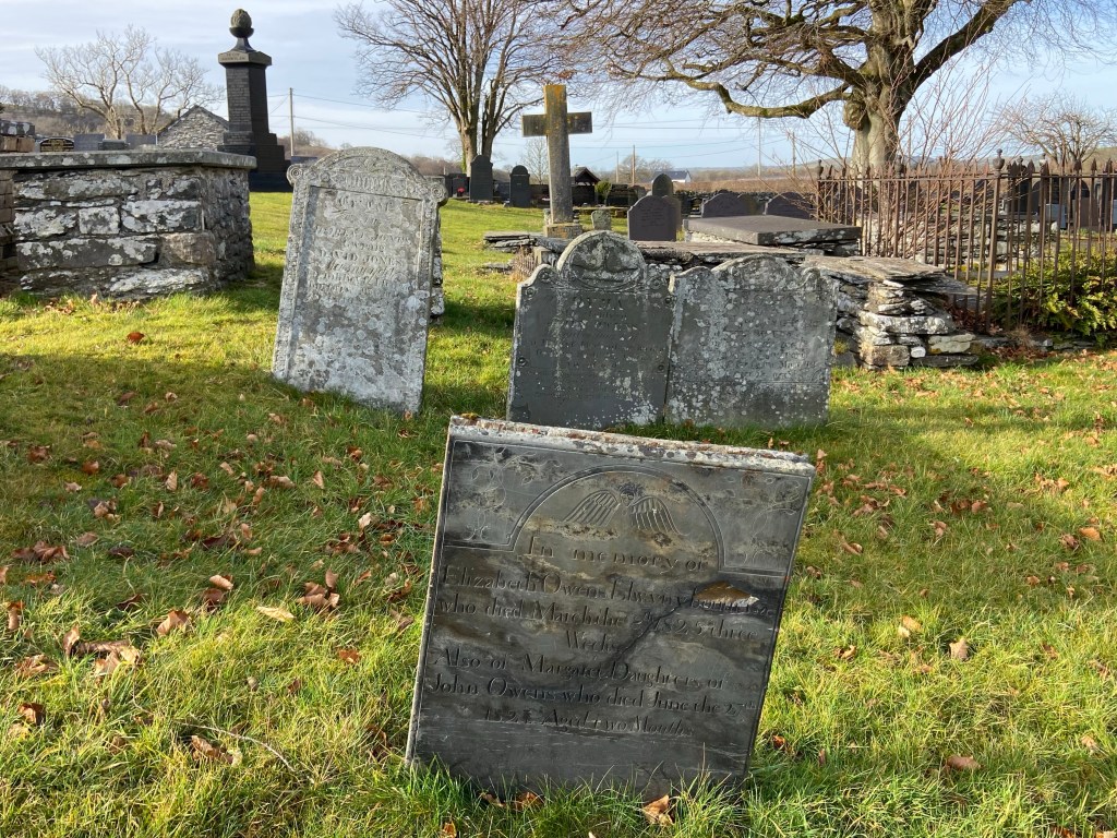
The present church of St Mary adjacent to the ruins is 19th century, although a cross on the back wall dates from the 10th century. I wandered for a while amongst the gravestones, admiring in particular the beautifully-preserved monuments from the 1700s with their curly script, including one with an unusual curved stone lintel protecting it, and a touching headstone to two newborns.
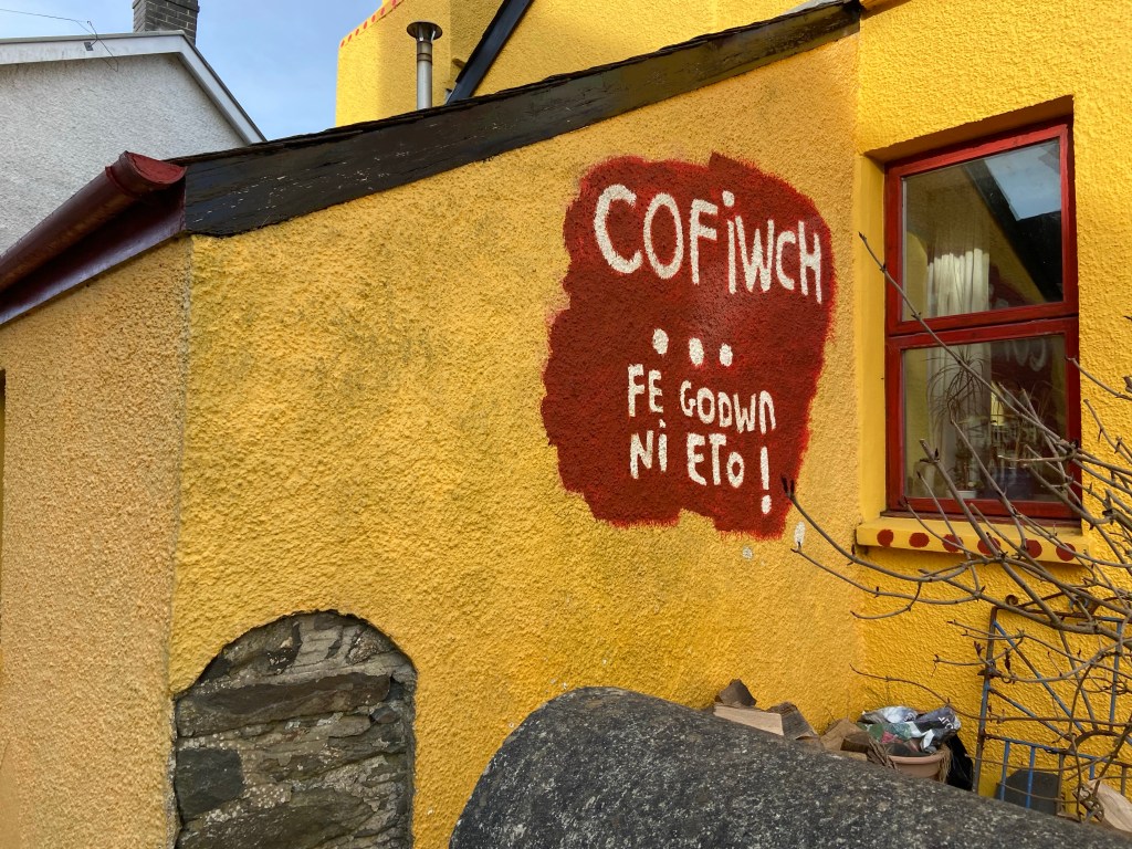
At its height in the Middle Ages under the Welsh princes, the Abbey had been a powerful cultural and political centre — and a century later the monks supported Owain Glendwyr’s uprising against the English overlords at the turn of the 15th century. That this sentiment is still felt in this predominantly Welsh-speaking part of the country was evident at the next village, Pontrhydfendigaid — known locally as ‘Bont’. The red dragon, Y Ddreig Coch, was everywhere, from the energetic one painted onto garage doors to the more contemplative bespectacled metal beast curling round the side of a house.

On the far side of the ancient stone pont were a series of brightly-painted buildings, and I sent my Welsh nephew a picture of one cheerful hand-painted wall asking for a translation. It came back almost immediately: ‘REMEMBER … we will rise again’.
The village stands on the edge of the vast hanging bog of Cors Caron, into which expanse the River Teifi meanders, temporarily losing itself from view. Our track crossed a fairly tame section by the standards of the waterland wilderness, but it was still a tricky job crossing the kilometre or so to the safety of a laid cycle path, keeping our eyes on the ground rather than on the occasional snipe we inadvertently scared out of the purple reed grass.

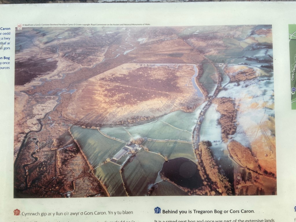
This was the final boggy section of today’s walk. The cycle track now took the direct route of an old railway line, and we motored along it on the lookout for wildlife. Once part of the Abbey’s demesne, the black peat of Cors Caron, growing over 12,000 years at the imperceptible rate of a millimetre a year, was exploited by the monks for fuel. Its remaining precious 349 hectares make it the most important example of this endangered special habitat in the UK — a bog where the sphagnum has formed peat so thick (in places ten metres deep) that the bog has become isolated from the groundwater, and is fed by rainwater alone, causing it to ‘hang’.

The bog is one of the most important habitats for otters in the area, and Stephen saw one large grey form slipping sinuously through the tussocks of reed grass by the side of a channel. A great spot. It made up for the fact that the 3km-boardwalk through the reserve, which I had been really looking forward to, was permanently closed.

As the path climbed away from the visitor centre, following a wide curve round the side of a hill instead of taking the quickest route along the busy road into Tregaron, we could look back and see the bog as it opened up. Various sections of open water were visible – but the area is best seen from the air, as in this aerial photograph of one section, taken from an interpretation board:
This last section of the route was easy-going pastureland, but it was a stiff uphill section near the end of the day’s walk, and I slogged up the ancient track as though I had lost all power. Flagging and lagging.

Finally, we descended into Tregaron by way of a quiet back road looking out over a green river valley studded with white farms on one side, and a steep oakwood on the other.

Tregaron itself is named after Caron, third century, saint and king of Britain, and traces its origins at least back to 1292. Not every son of the town can be said to have followed his saintly example though: norious locals include the children of 18th century innkeeper Matthew Evans. These horrible siblings, two boys and a girl, gave their name to ‘Devil’s Bridge’, living in a defensible cave nearby and freely robbing the neighbourhood for years. If that wasn’t enough, LSD-inventing chemist Richard Kemp had a cottage locally where he carried out his infamous breaking bad operations at scale; police surveillance of the cottage was a key part of successful drug-busting Operation Julie in the 1970s.

Not all the locals are robbers and drug barons, though. Andrea and Roy of the Tom’s of Tregaron café and B&B are exceptionally nice, dispensing hot showers and a comfortable bed in a room with fascinating carved graffiti,

and delicious coffee and breakfast. They sent Stephen away with a bag of coffee beans and me with sachets of porridge – how generous can you get?

I was very sad to say goodbye to Stephen, my best walking partner, although much heartened that he will be joining me again down at the coast on Friday evening, where the Teifi reaches the end of its journey.
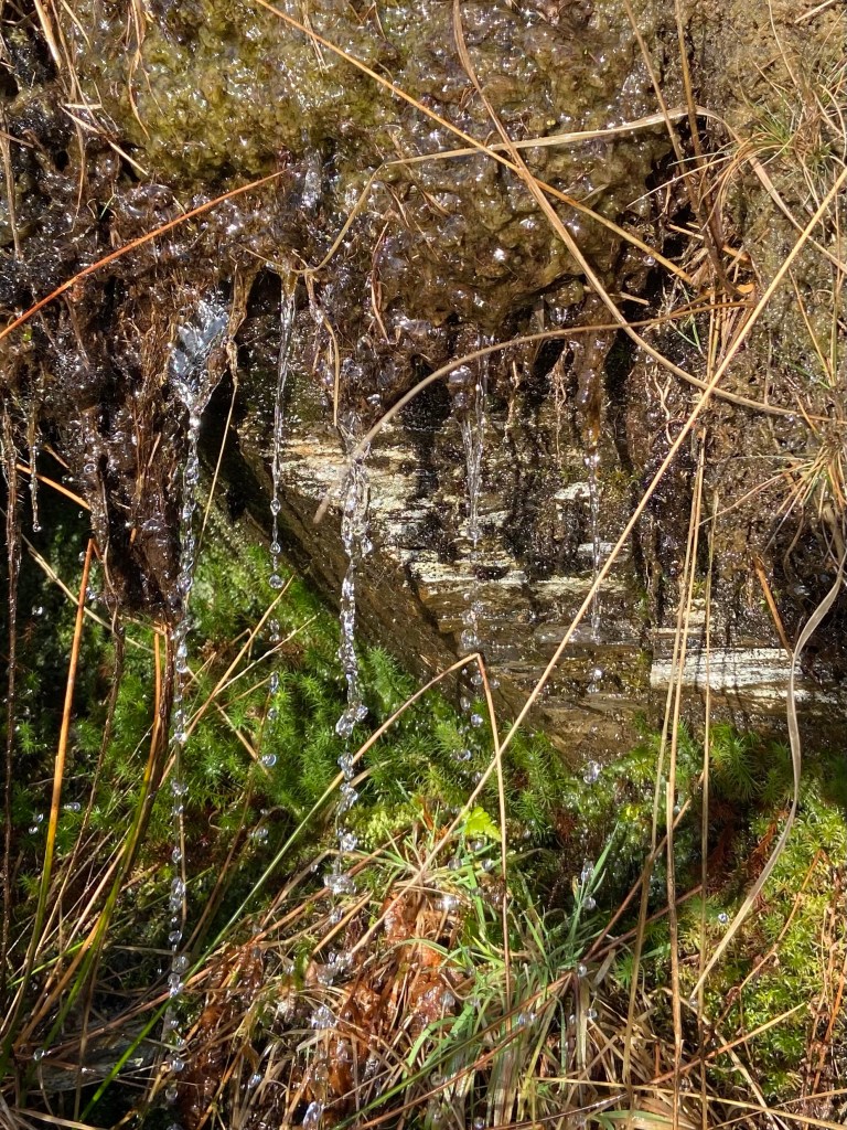
Water of all kinds had been a feature of the day, from the ice sheeting over the steep track as our taxi driver drove us up to the Teifi Pools, the frosts on the sphagnum peat moss, the pools themselves, the newborn river cascading over the Llyn Teifi dam, the saturated boggy ground we hopped across in on the hill-slopes of the Desert of Wales and again on the edges of the Cors Caron raised bog, the rushes of water on the fields, full of water crowfoot. So many different water spirits still resident in this landscape. They have set the tone for the week’s walk.

So glad that you’re out walking again! How is your knee?
Have a wonderful week. X
LikeLiked by 1 person
Knee is being coaxed along. Have I done my exercises? I have not. So far so good. More importantly, how is YOUR knee???
LikeLike
Excited to follow along again!
LikeLiked by 1 person
Thank you 🙂
LikeLike
So lovely to wake up in the mornings and read your beautifully descriptive narratives of your current walk!!
LikeLiked by 1 person
Thank you Gill
LikeLike
Bit late to the walking party, but so pleased you’re sharing your adventures again! Do your exercises 😘
LikeLiked by 1 person
Religiously, Niki!!
LikeLike
Ha ha! Xx
LikeLike