
For those in peril on the sea
from the hymn ‘Eternal Father strong to save’, William Whiting, 1860
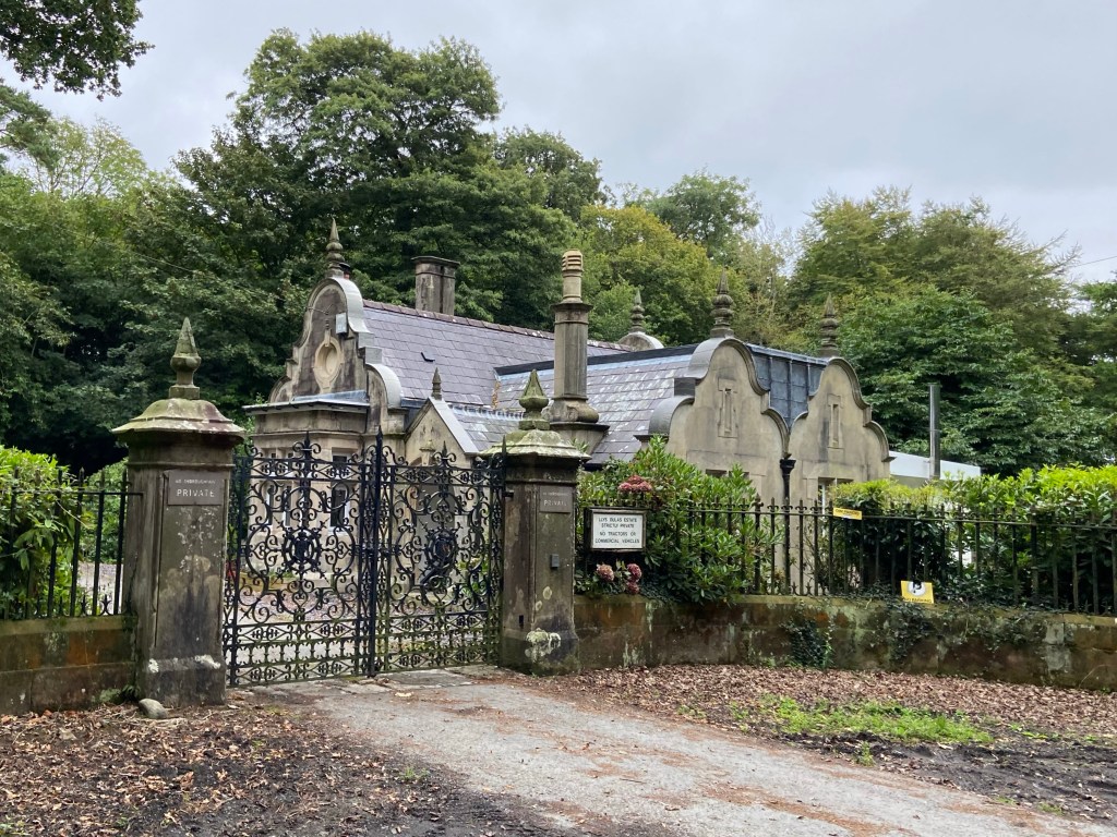
I had a very early start today, just after 7.30. I was dropped off more or less where Frances and I had been picked up the day before, and my aim was to get to Red Wharf Bay by 1.30 to catch my lift back. Initially, it felt like a typical early Herefordshire morning with little lanes, deep hedges, occasional farmsteads, and the ubiquitous harsh squawking of pheasants. Cattle crashed away from me in the woods beside the road. The coastal path here was detouring inland round a private estate, marked with ornate lodge houses.
It felt so familiarly landlocked that the sight of Dulas beach at the bottom of the lane as the coastal path once more joined the edge of the land took me somewhat by surprise.
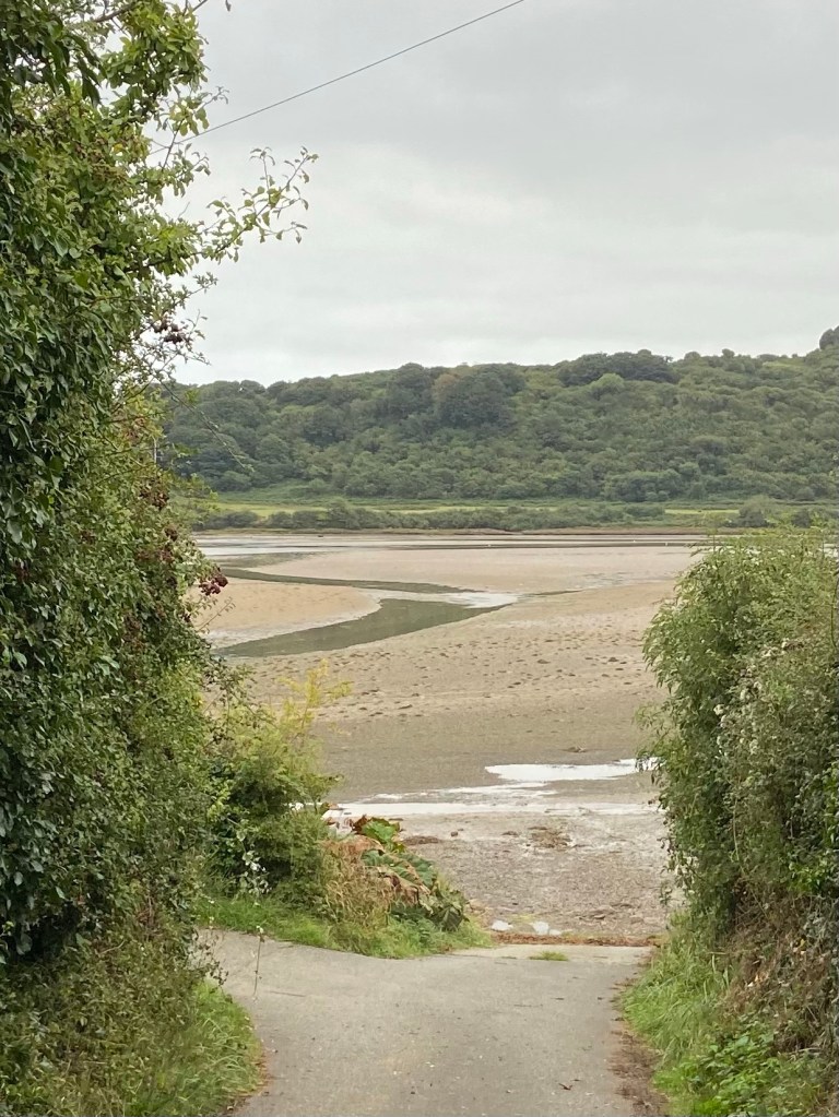
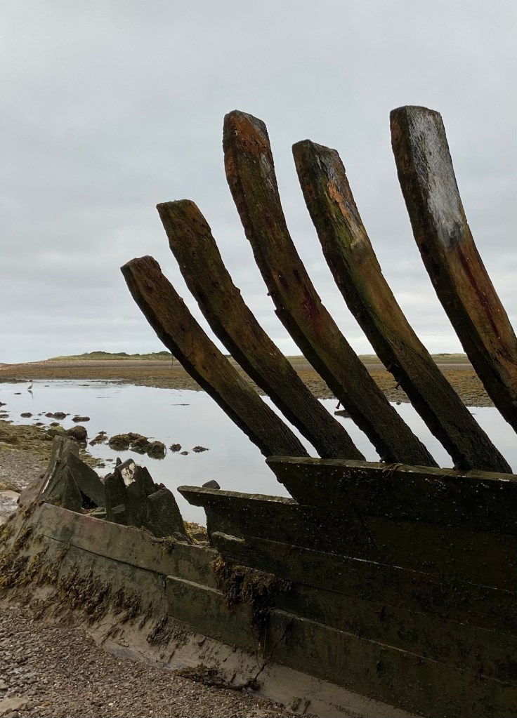
The tide was far out and once again I walked a long way round an estuary. But the difference here was that the path runs over the foreshore itself and my boots crunched deep into the mud and sand as I turned towards the coast to investigate the carcass of an old wooden boat,
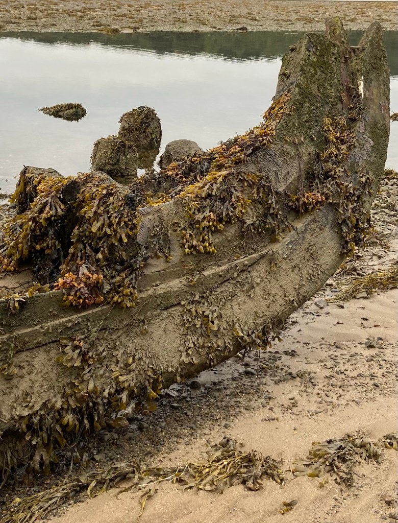
ribs sticking up starkly against the channel of slack water.
Willow trees hung with seaweed lined the shore, everywhere were weeds draped in sea lettuce.

I trod carefully over slippery heaps of bladderwrack on the path, and slimy sodden mats of a tough kind of halophytic grass which can survive tidal inundations.

Glasswort grew closest to the water, and expanses of sea purslane a little further up the estuary.

The soundscape was unfamiliar: subterranean tricklings in the creeks where the water drained off the land, strange sucking of mud, the laborious flap of a heron’s wings.
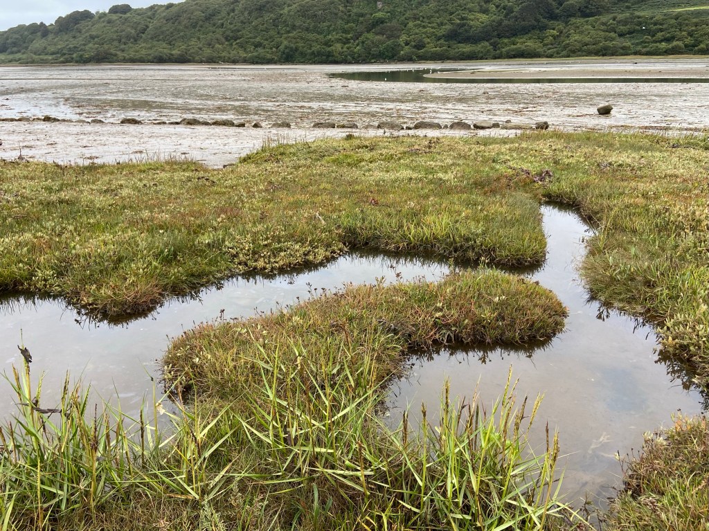
My boots made waterlogged squelches on the sodden mats of grass, reeds and seaweeds as I picked my way upriver, accompanied by the occasional peeping cries of oyster catchers curlews mournfully calling to each other. These weren’t alarm calls – I was too insignificant in this wide landscape to be a cause for fear.
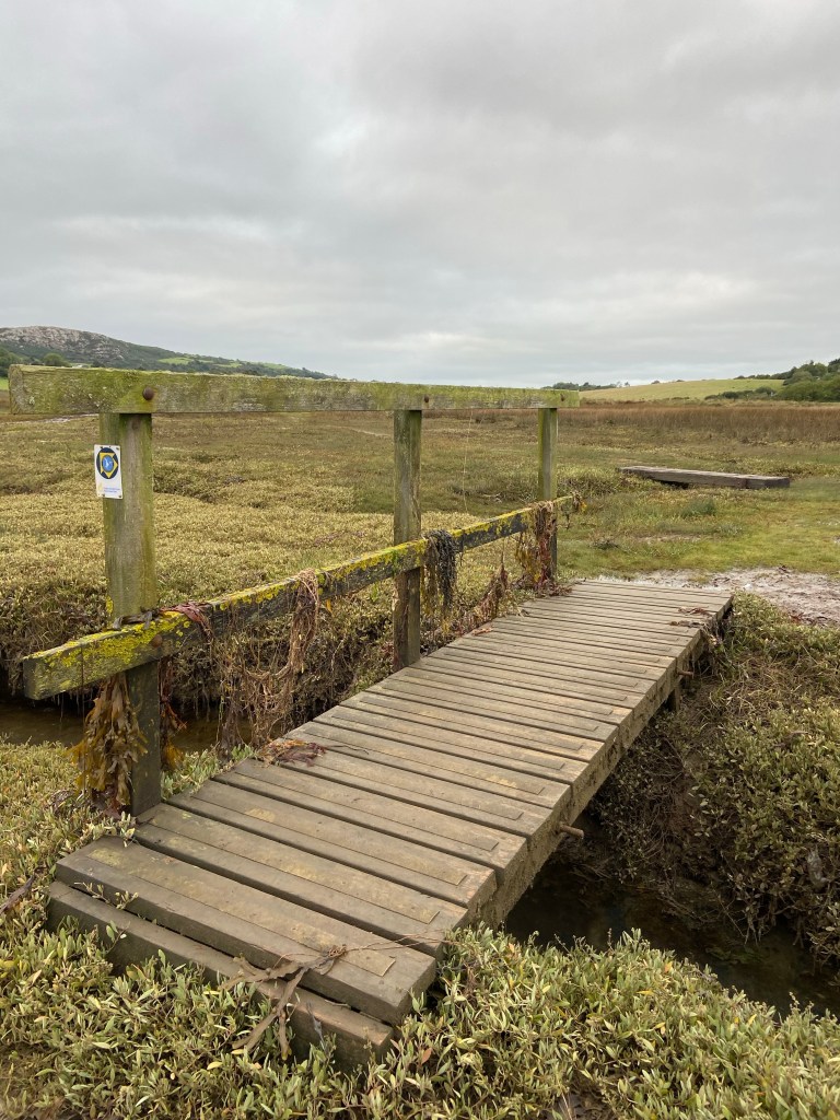
At the top of the estuary’s reach, the path moves onto firm field grazing and I could move a little faster. The passage through the marshes and estuary and tidal flat had been slow both because I had to watch my steps, and also because I was stopping to take so many photographs of this extraordinary, otherworldly landscape. Because of the early morning stillness, and the fact that the path was taking me right down into that watery, rhythmically inundated world, this estuary felt completely unlike my experience of the other tidal flats on Anglesey. I must return and see this place at high tide.

In my mind the Dulas estuary is the last of the wild places, and from here on in I will be walking through a part of the coast far more populous and shaped by people.
Climbing up the field on the other side of the bridge over the river, I looked back to see a line of sea right at the bottom of the estuary. I had almost forgotten that it must be there. It was flat and still, the water at the estuary outflow a band of greenish yellow, darkening to a steely-gray line further out, where the sea met the sky.

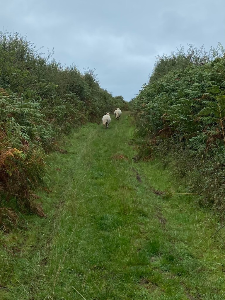
In a green lane between hedges of blackthorn, bracken and blackberries (now too wet and soggy to eat after the rain of the last couple of days) I found myself driving three sheep. They had somehow wandered out of their field and onto the coastal path. There was nothing I could really do about this, lacking a well-trained border collie. Luckily they eventually made their way through a small wrought-iron gate near the end of the climb.
The farmland round here is simply bustling with pheasants. Every fifteen minutes or so I was startled by a large flock of the birds taking off, protesting mightily. A hare bounded away from me through the thistles to the edges of a field its enormous hindquarters so distinctly different to those of a rabbit, and those tell-tale black tips to its ears.
The path reaches the sea at beautiful Traeth yr Ora – a pristine sandy cove at this time of the morning. On the final section of the path down to the sea I had bevies of female pheasants running busily in front of me like outriders of squawking old women. In the distance five gigantic container ships on the horizon moved so slowly they had barely changed position by the time I had finished my day’s walk, hours later.

The path curves inland through the dunes around the back of another favourite beach, Traeth Lligwy, and by the river bridge I found Geoff, metal detecting.

He told me that his last major find, four years ago, was a 24 carat white-gold ring and that he’d met a man who had lost a similar ring twenty years previously and described it to him pretty accurately. It wasn’t clear whether he’d reunited the ring with its possible owner – or whether it was finder’s keepers.
Lligwy is a beautiful beach for dog walking and as I walked around the edge, unable to resist picking up a few very small pebbles, I watched the dogs racing hell for leather along the sand to fetch balls or chase each other. Their tiny bodies and those of their owners have a sense of the scale of the place.

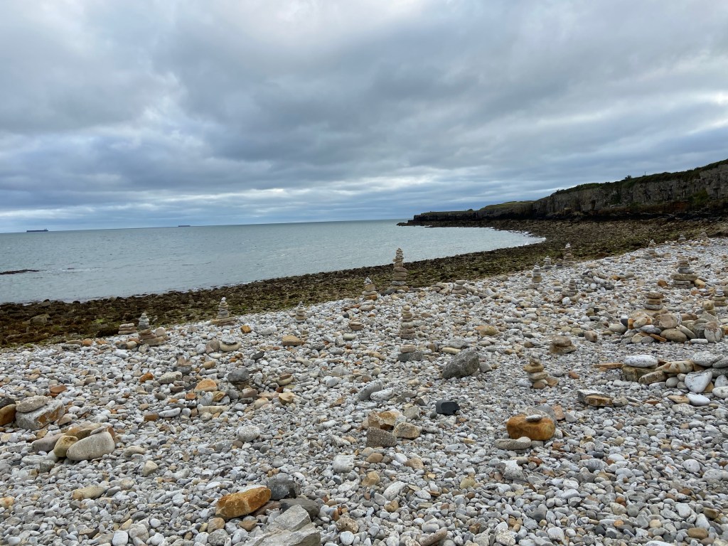
Lligwy is just around the corner from Moelfre and the coast between the two is where Stephen and I had done our trial Proof of Concept walklet eleven days ago. It tugged at my heart more than a little to see the cobbled beach empty where I had photographed Stephen last week

and now covered with grotesque towers of stones.
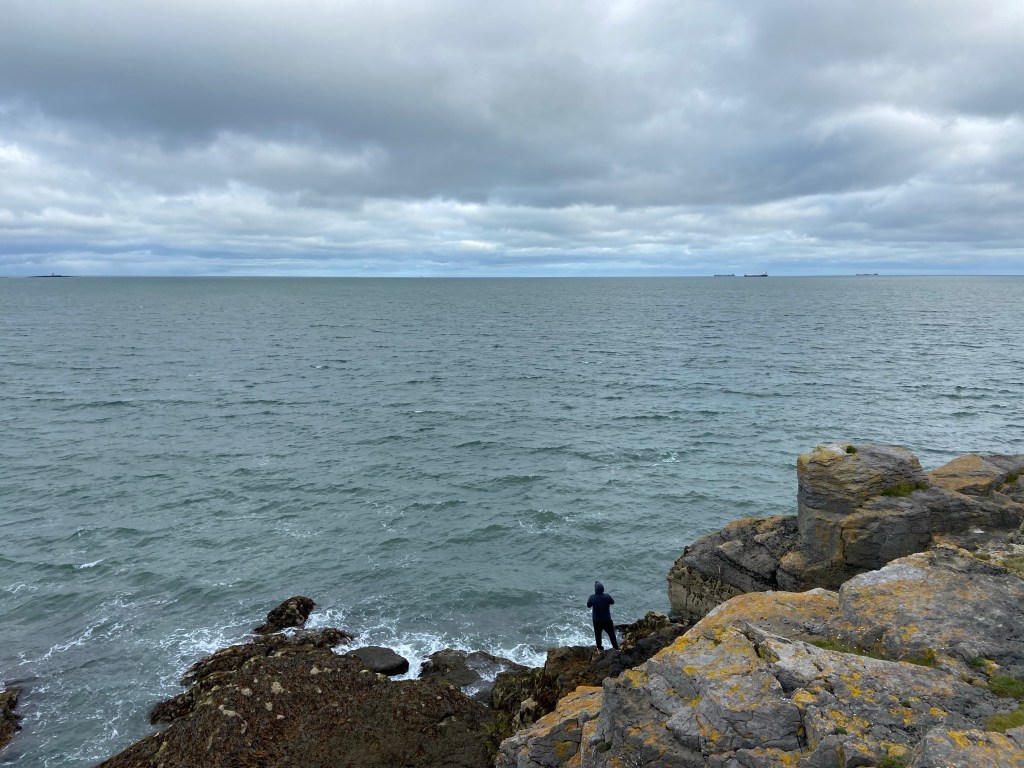
There was no fisherman on the limestone pavement slabs today, although further down the coast there was a man under the rocks with a line out trying for bass.
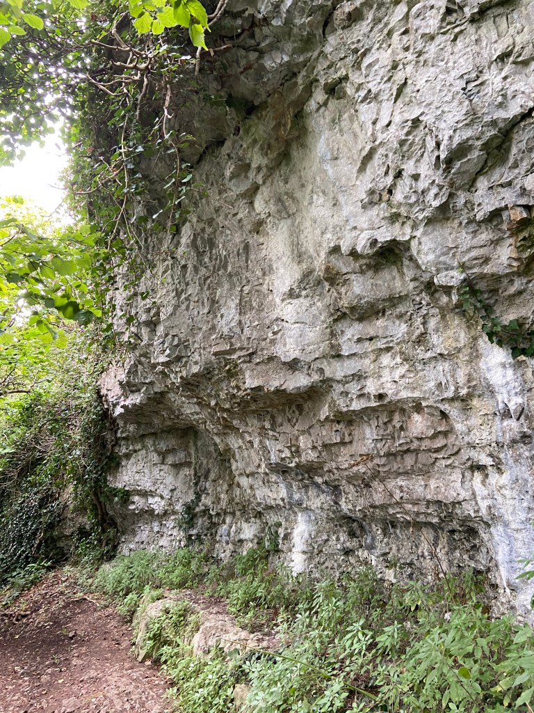
The geology of this part of the coast is characteristically limestone – and bedding planes of sandstone too, in great striped features and sweeping curves, in slabs of pavement, in smoothed cobbles, in slippery polished steps and in the rock faces at the side of the path.


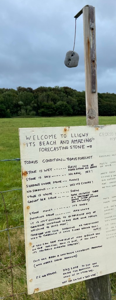
Even in a weather ‘forecasting stone’, hung up with home-made tongue-in-cheek instructions for reading it.
As I approached Moelfre I was reminded of the wreck of the Royal Charter by the memorial up on the rocks next to where it foundered. In Trearddur Bay last Thursday an enormous map of all the shipwrecks all around Anglesey had hung next to my table in the café. So many of them.

Moelfre is home to the second largest lifeboat of the fleet, RNLB Kiwi. It was largely funded by a £2.2 million bequest from New Zealander Reginald James Clark, a merchant seaman who had been rescued by an RNLI lifeboat in 1944 after his ship was torpedoed. The Tamar class boat is so large it wouldn’t fit in the station, so they had to build a new one of those as well, and the building’s wooden barrel vault is a thing of beauty in itself. The Kiwi looks brand new although it’s nine years old, and it’s last callout was just over a week ago. The callouts are slowing down now with the end of the summer season.

Standing by the statue of Moelfre‘s Dic Evans (one of the RNLI’s most decorated coxswains) were a group of four retired Royal Signallers, erstwhile members of the white helmet motorcycle display team.
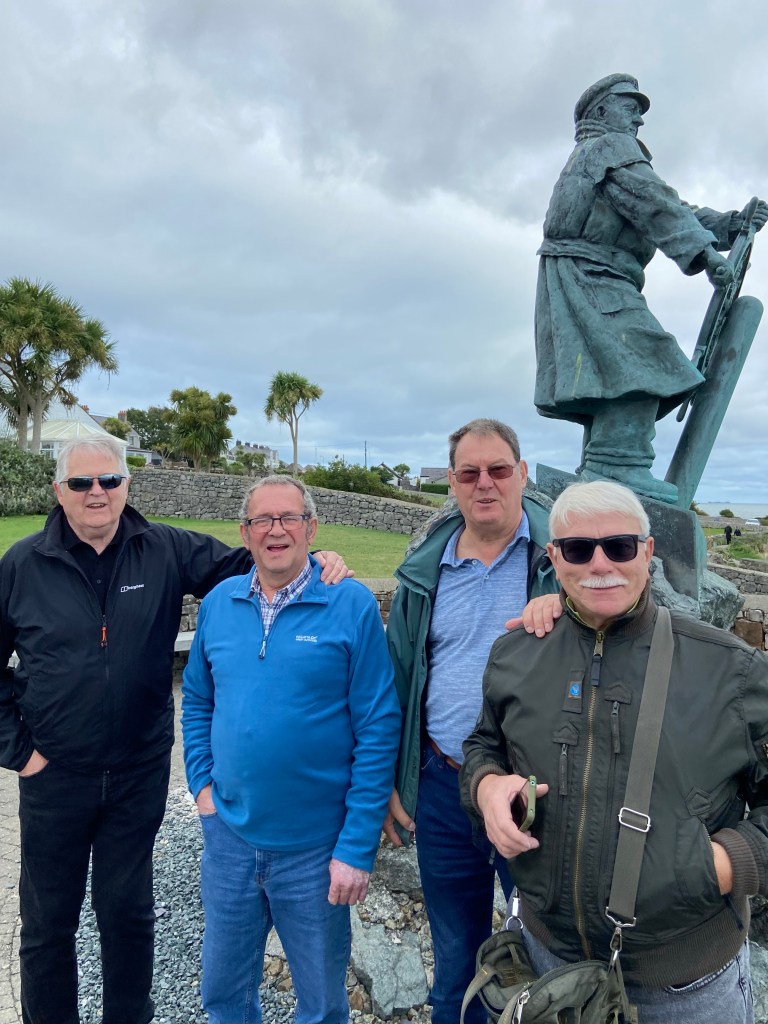
The daredevil stunt riders were disbanded in 2017 but friendships die hard and they regularly visit each other. We chatted Evel Knievel and long-distance walking routes in between posing for photographs and visiting the lifeboat centre and museum.

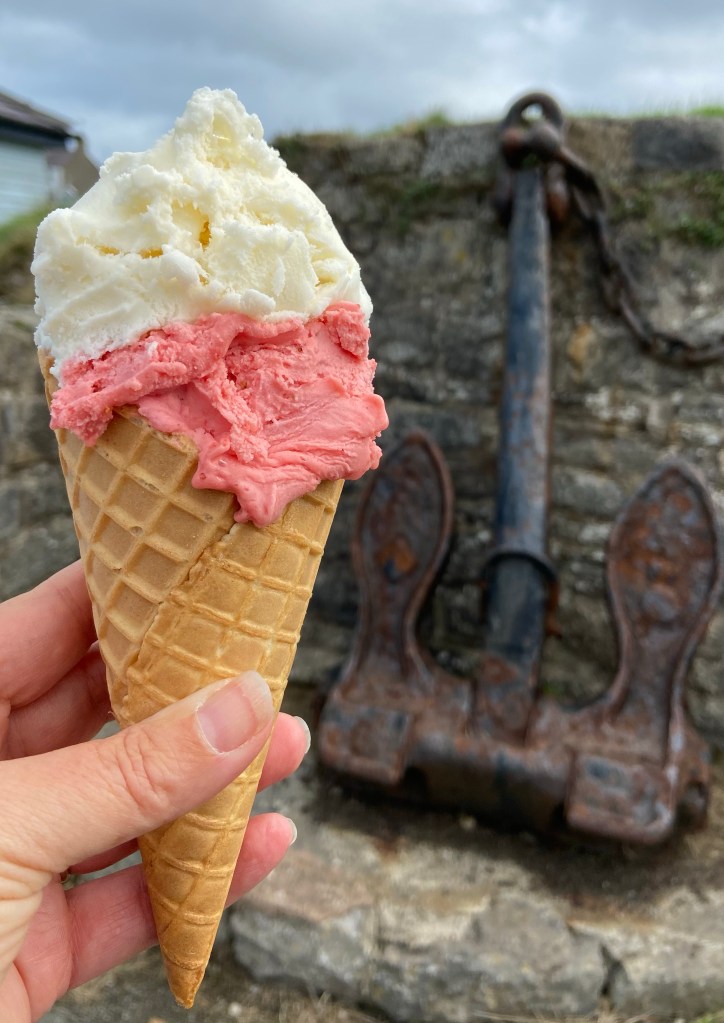
As well as being home to the lifeboat, Moelfre is also home to a fine ice-cream parlour and I treated myself to a ginormous cone. Because why not.
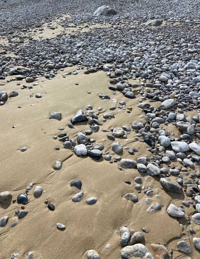
South from Moelfre are a set of mainly indifferent beaches, on a stretch of the coast lined with gloomy sycamores and static caravans. One of the beaches was pleasant in itself, full of limestone pavement and cobbles and thousands of worm casts

but I am not sure really what the particular draw is of this part of the coast because the beaches are inaccessible except by precipitous steps, and the paths are overgrown and/or dark and forbidding. And they go on for miles.

Benllech is a larger and less chi-chi town than Moelfre but its rocky path round into the cove

and satisfying waves as well as its sandy beach do it proud.

and it’s the last stop before vast Red Wharf Bay. The weather has closed in somewhat with annoying mizzle that couldn’t decide whether it was or was not going seriously to rain. It was on and off with the waterproofs like a jack in the box along uninspiring paths, going as fast as I could to make my lift. I missed a turn-off through a very upmarket caravan park (the homes had names like ‘Bordeaux’ and ‘Chamonix’) and my chance today to get down to the beach proper and so the last kilometre or so of today’s walk was simply a connecting road to get to the rendezvous… but tomorrow I shall walk on the sand – and I shall have company again.
Video of Today’s Route

Such a relief to see that you’re eating ice cream!! What flavour, though?
LikeLiked by 1 person
Banana on top and strawberry and cream all the way down the the bottom of the waffle cone. Heavenly 😋
LikeLike