From scenes like these old Scotia’s grandeur springs. – Robert Burns
No trains woke us overnight, but we did wake to drizzle, a drenched platform, still air, and the first cloud of midges of the journey. Not a milestone I greeted with any enthusiasm at all, except that it gave me the opportunity to put on my full upper-body midge jacket. Greeted, unfairly I feel, with derision by the general assembly in the mixed bunkhouse. They would be laughing on the other side of their faces when they were scratching away and I was not.
Luckily a breeze picked up and I was able to divest myself of the embarrassing costume and we were collected by Morris to take us to the Inveroran Hotel where we had finished last night. We passed the osprey’s nest in its tree, constructed securely out of large twigs with only a beak, and we passed several shoddily erected tents on flat ground, constructed very insecurely with two pairs of supposedly dexterous hands with opposing thumbs.
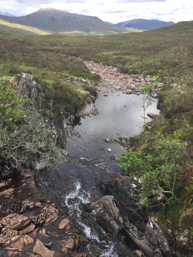
The cloudscapes were wild and dramatic, creating constantly-changing light effects across Loch Tulla, straight out of the Romantic imagination, light driving down through veils of misty rain and picking out the simplified outlines of trees and hills, whilst emphasising depth.
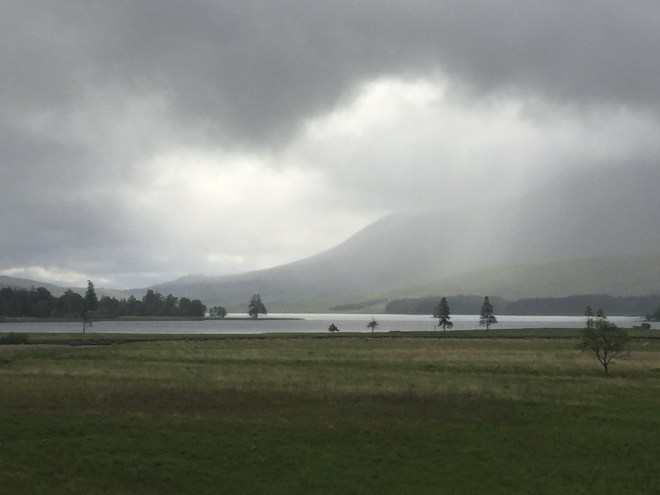
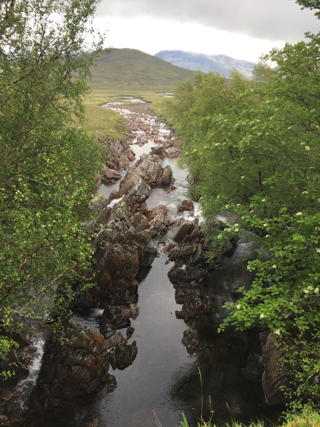
Shafts of sun lit patches of hillside through the clouds of suspended water droplets, creating a low rainbow on the far side of the Allt Tolaghan as it fed into the loch.
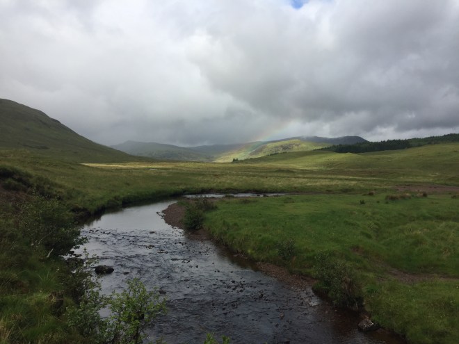
There was plenty of water in the air but also signs that showers were going to be broken up by clearer weather and good views.
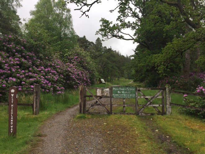
A gate at Forest Lodge took the track out through invasive rhododendrons out onto the parliamentary drove road to Glencoe, designed by Thomas Telford in 1803 when he was commissioned to survey the military roads. He engineered the new roads intentionally to take a gentler gradient, and with up to 15 inches of gravel to protect the hooves of the sheep and cattle being driven south.
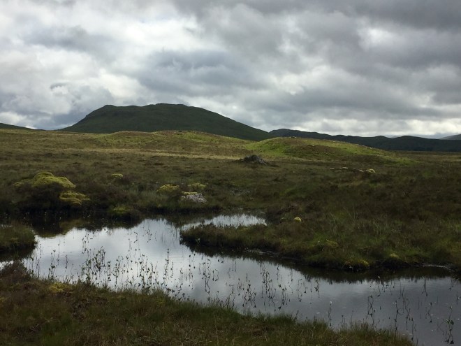
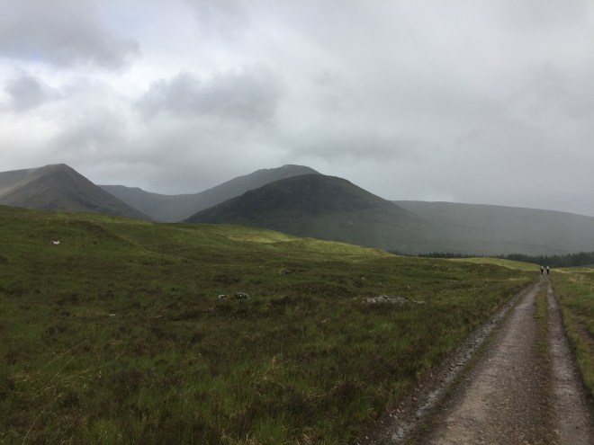
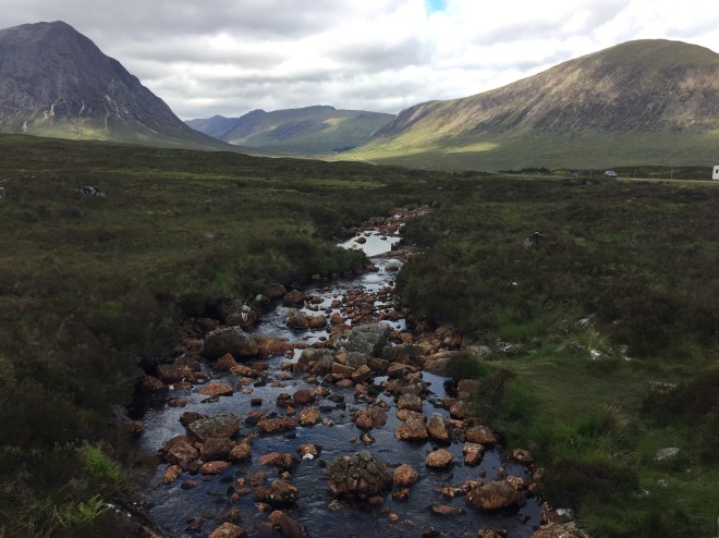
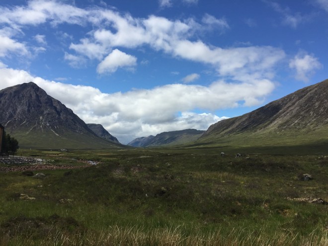
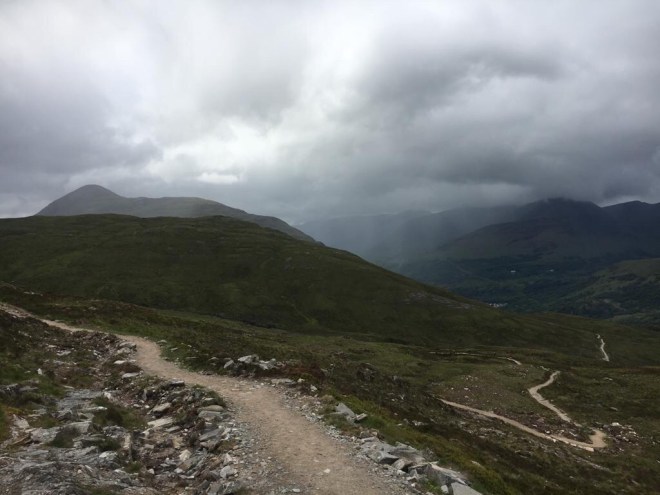
The track climbed steadily – now with unforgiving and uneven cobbles rather than the gentler bed of gravel, sadly. To our left were a suite of imposing hills made of a complex mix of ancient igneous rocks, quartz, marble, and other hard, slow-to-weather matrices. To our right the land swept down, and away to Rannoch Moor with its myriad little lochans.
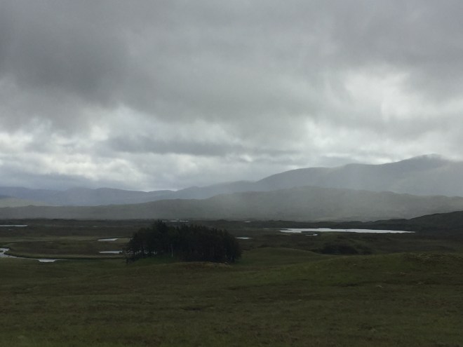
We were walking on the westernmost edge of the moor, so did not need to carve a route over the most complex patchwork of land and water. In the lochans we did walk close to, the bog bean was starting to come into leaf, ready to flower later in the summer.
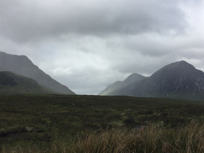
Showers scudded in and out with magisterial rapidity. It soon became apparent that if we saw a shower coming up from behind we would not necessarily get wet: the clouds were remarkably localised, and dropped the greater part of their burden of water on the summits and the high ground, and missed out the valley altogether.
Thus we might hurry to put on our jackets when we looked behind us and saw this approaching:
But twenty minutes earlier or later the same hill looked like this:

or even this:

It never stayed wet for long and as long as we had our rucksacks covered we didn’t bother to put on our waterproof trousers. The wind was brisk enough to dry our t-shirts and trousers in minutes.
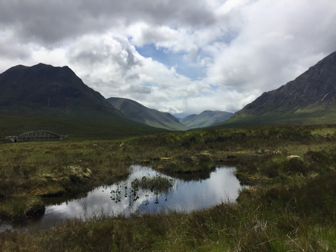
The track followed the course of the whole long valley northwards, crossing the Bà bridge at about the half-way point.
We made rapid progress on this flat path, and the start of the contour west around the shoulder of the north-south range came upon us sooner than we had expected.
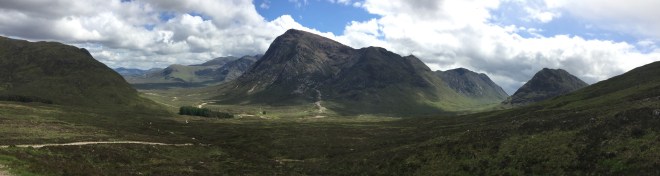
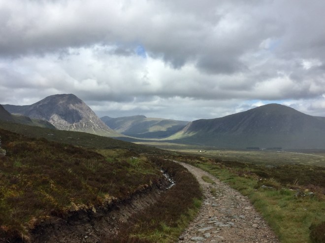
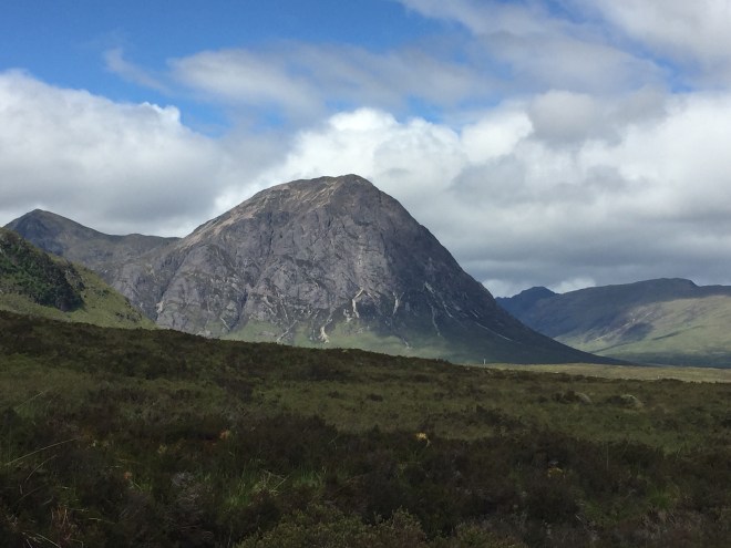
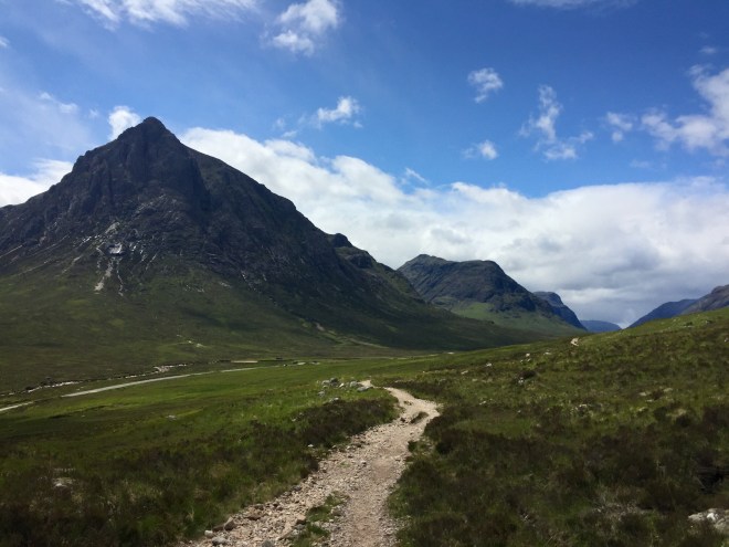
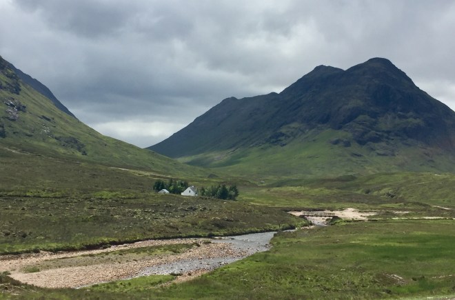
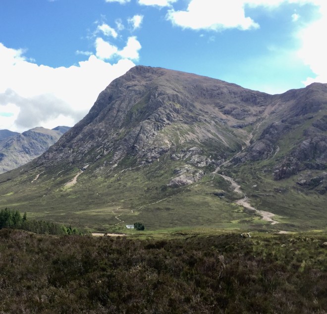
Now the eastern edge of Glencoe lay before us, the severely bare slopes of the Bucaille Etive Mòr, the Great Herdsman of Etive, standing like the portal guard to the colossal glen. Towering ranges of hills flanked the glacial curve of its mouth on either side as it seemed to rise straight up from the watery flatland of Rannoch. In the far distance the Kingshouse Hotel and tiny specks of cars on the A82 provided scale, if scale we needed, to respond to the impact of the sight.
Two walkers joined us as we stood looking and recorded this moment for us. Another significant milestone.
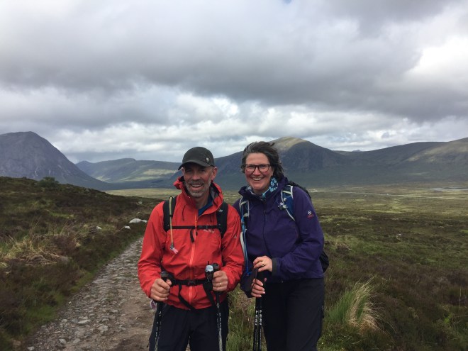
We walked with Sam and Andy down to the hotel, stopping it seemed every two minutes to photograph the Bucaille as we grew closer and closer, and as each new set of clouds combined to amplify the effect of its powerful presence.
Turning the other way to look east, we had a clear view of Schiehallion touching the bank of clouds on the skyline, way across Rannoch Moor.

A few last showers blew through Glen Etive,
the dramatic contrast between hulking grey mass and sharp sunlit definition within the space of minutes serving to exhilarate us.

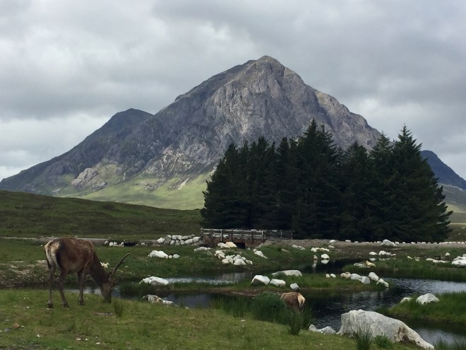
By lunchtime we had reached the revamped Kingshouse Hotel, landscaped to create photo opportunities complete with a semi-domesticated one-antlered stag; I thought he was quite photogenic, although I couldn’t bring myself to include in the picture the hotel employee in full Highland dress. And of course I had to wait for a gap in the A82 traffic for the full Insta-effect.
The Kingshouse is in some ways an impressive setup, with glorious views through the picture windows. The food is fabulous, but in other ways it is a shame that the character of the old building has been lost. We had a most convivial lunch with Sam, also walking End-to-End (tracing an interesting route which for the first half of the walk was mostly along the UK watershed), and Andy, who was meeting friends for a long weekend climbing.

During the time it took us to eat smoked salmon sandwiches and drink a hot chocolate, the skies cleared markedly. We walked on with Sam in brilliant sunshine down the mouth of the glen towards the infamous Devil’s Staircase.
We were barely aware of walking. The scale of our surroundings and the impact on us was colossal.
The military road which we joined some way back runs parallel but at a distance from the A-road, and even though we were relatively close to the traffic it was effortlessly swallowed up by the landscape as the first of Glencoe’s three sisters came into view.
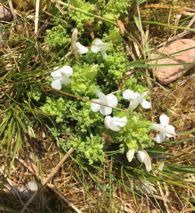
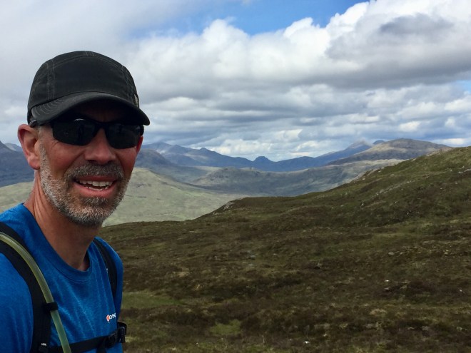
On the minute scale, while Stephen and Sam walked on, deep in discussion, I noticed our third kind of lousewort: a white variety.
About an hour’s walk down the glen the lone homestead of Altnafeadh emphasises the insignificance of the human scale to the incomprehensibly vast geological masses amongst which the building lies.
Wade’s military road starts to climb here, a zig-zag path known as the Devil’s Staircase, up to the col between Stob Mhic Mhartuin and Beinn Bheag. At 548m it is the highest point on the West Highland Way. Andy Robinson does note that by the fifth day of walking from Milngarvie, those hiking the WHW to Fort William will still find the climb quite a challenging pull but that once you have done the South West Coast stage from Boscastle to Bude, nothing on the West Highland Way presents a comparable obstacle. All three of us certainly found that we had more than enough puff to enjoy the spectacular views back into Glencoe.
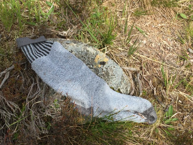
Some, though, appear to have fallen by the wayside
Height gained on this side of the valley allowed views into the Lairig Gartain, too high to be seen from the road far below

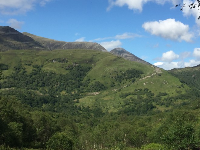
Where I had been overwhelmed by my first view of the mouth of Glen Coe, Stephen was profoundly moved by the panorama of hills to the north as we came up over the edge of the col: Ben Nevis (the top shrouded in cloud),

and the Mamore Forest.
Once we had recovered our breath and our composure, we took the long, snaking path north-west towards Ben Nevis, into the depths of this astounding perspective. Powerful showers were still blowing in, but they missed us entirely.
Our long descent into the valley in the bottom of which Kinlochleven lies was not only dry, but gloriously sunny,
and once we had dropped below the tree line, impressively, generously green.
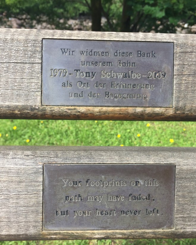
The spirit of the place was summed up by the inscription in German and English on a memorial bench, as a place of remembrance and inspiration.
We were hosted like royalty in Kinlochleven by Alan, relation of our Malvern friend Susan Wall. Over a glass of wine he showed us photos of the village before and after the building of the aluminium processing plant which established the village at the beginning of the 20th century, now recast as a mountain-biking and ice-climbing centre. There were also two recent photographs of a pine marten sniffing round the bird table in the garden, and as Alan took us into the village for supper a stag was right outside the gate on the road.
Alan has fished the rivers in the area and further afield for a lifetime, and provided not only very generous hospitality and a comfortable night’s rest but also good advice about the tracks north of Fort William, and a suggestion for a cunning shortcut on tomorrow’s route. And we always take local advice.