A map is not the territory it represents, but, if correct, it has a similar structure to the territory, which accounts for its usefulness— Alfred Korzybski, Science and Sanity

In planning our upcoming journey, we have spent many weeks on mapping it. The mapping seems doable, and thus, by some beatific process of equivalence in my mind, it seems that the walk will also be doable. Alfred Korzybski, however, suggests it might be otherwise. Korzybski was the founding father of the theory of General Semantics – which sounds too fiendishly ungraspable a concept to be able to achieve its object of making us feel better about living with each other in the world. He coined the phrase ‘the Map is not the Territory’ to draw focus on the crucial difference between ‘the object and a representation of that object’, or ‘the geographical territory and the map of it’. It would be ridiculous to attempts a walk of this length without some pretty detailed mapping, but although our maps give us information even down to the scale of field boundaries, they do not equate to the reality of the thing. They don’t tell us where the bogs are, let alone where we will get sunburned, where a footbridge has collapsed into a stream. Our maps suggest a plot, but can’t tell the story of our walk – which would be, in the words of economist Joan Robinson, “a model which took account of all the variation of reality”. Our maps are simplifications, abstractions of reality, stripping away all the variation which would describe our walk exactly. But if they could, they ‘would be of no more use than a map at the scale of one to one.”
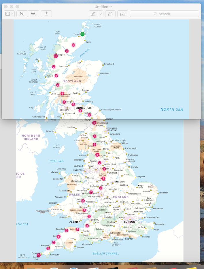
On our spreadsheet (there has to be a spreadsheet, otherwise what kind of economist would Stephen be?) there are 1,900km to be travelled on foot. We have carved them up into 65 walking days, and 6 planned rest days, including the day after we reach John O’Groats. The mathematically-minded will do a rapid calculation and realise that this averages out as 29.23km each day, sometimes a few fewer, which means that there are days when we’ll be… doing more. Our shortest day is 19.9km, and our longest is 37.77km, which is the very last day of all, from Watton, northwest of Wick, along the coast to John O’Groats. One can look at that day’s route with the breezy attitude that if we’re not fit enough to walk 10 hrs 20 mins by then, we never will be. Or one could be appropriately horrified at the prospect. At any rate, I have 64 days for the anticipation to mount.
Looking at those statistics written down it seems sinkingly clear to us that 5 scattered days lying flat on our backs is really not enough. I think we’re mentally prepared for the collapse of our careful scheduling – but can’t actually plan for rescheduling until it’s needed. It occurs to me that in this we take a similar attitude to that of our neighbourhood policeman, who was quoted in the local rag as saying that he took ‘a proactive approach, dealing with crimes as and when they occur’.
One of the problems with measuring our route is that models, as discussed above, are simplifications, and therefore inaccuracy is built into their very nature. How far are we walking? From the bird’s-eye perspective of the OS map 1:250,000, at which scale I can fit a day’s route comfortably on a laptop screen, 1,900km doesn’t look very far at all. But as you increase the magnification down through 1:50,000 to the 1:25,000 maps at which scale we have planned each day’s path, the red thread of our route stretches longer and longer. If I could drill down further it would spool onwards and onwards, at 1:1 scale being 1,900,000m long. If I went further in to measure the route at ground level, over every bump in the ground, our route would measure a lot more than 1,900km. On into even greater magnification, down through the atomic scale, the route would consist mostly of empty space, and then even the idea of ‘plans’ starts to seem perfectly pointless. I am setting off without knowing how far I will be going.
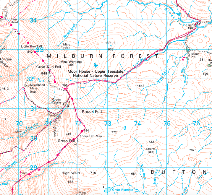
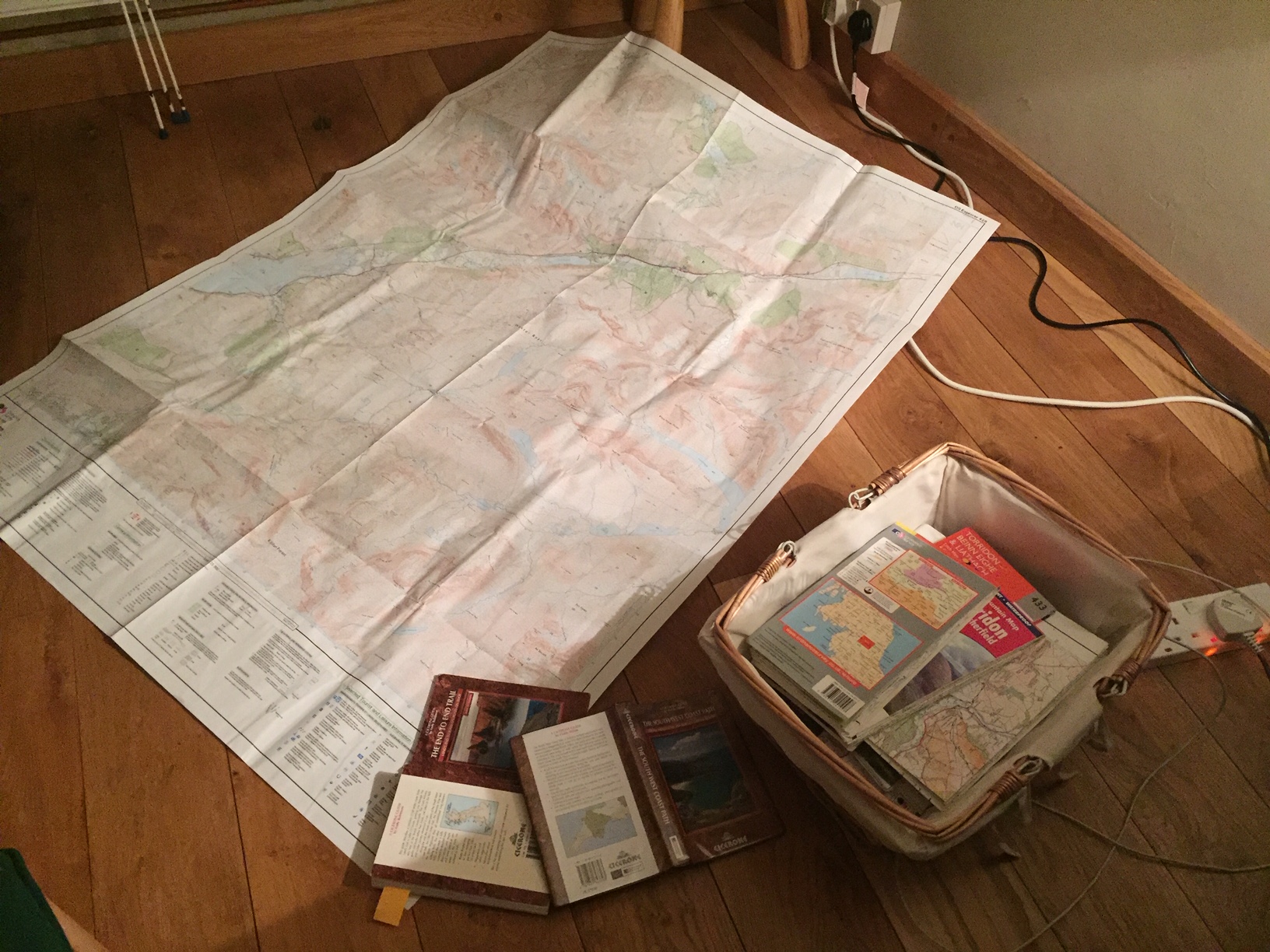
We will be taking a variety of maps with us, useful for different purposes. Some of Stephen’s large collection of OS maps are being cannibalised, unnecessary sections being cut away to minimise weight. Then for the stretches which follow national trails we have helpful booklets of OS strips, rather like a much more accurate version of those beautiful 18thc strip maps, straight roads pictured as looped ribbons marked only with bridges and clusters of tiny black squares by crossroads to denote settlements. This being the 21st and not the 18th century (when the military need to map the Highlands in the wake of the Jacobite Rebellion of 1745 was the origin of what was eventually to become the British Government’s Ordnance Survey), we have the almost unimaginable convenience of all our routes digitally mapped, and accessible on our phones with the additional feature of GPS location. We have an app from the British Geological Survey which overlays the OS map with a transparent layer showing the geology of each area we traverse, down to 1:25,000 scale, with notes on the formations we walk over. We’ll know when we cross from the Land’s End igneous intrusions, on through striations of Devonian layers along the Cornish coast, and out onto the mud and silt of the Somerset levels which lie on top of Triassic bedrock.

At present all our maps are maps of an imagined reality lying in the future. I’m not very good at imagining a three-dimensional landscape from a two-dimensional representation. I’m enjoying the place-names, though. They seem talismanic somehow: as though they could conjure the landscape into being. Dr Syntax’s Head. Grains in the Water. Old Woman. The Thrang. We’re downloading Radio4 podcasts to listen to along the route; one from today’s ‘Word of Mouth’ series is about how places got their names. For people like me for whom words, and not maps, create mental images of physical reality, the OS digital route-mapping software helpfully provides a cross-section of the elevation of our route. I look dubiously at the jagged ups-and-downs and think of my 52-yr-old knees.