Several of you have asked to see a map of the route. We used the Ordnance Survey mapping software to plot the route (an annual subscription is amazingly good value), then we printed out a series of paper maps for each day. We can also download these route-maps on our phones and use them offline (mostly to be able to zoom in for micro-navigation, which you can’t do with the printed map), and we have found that in built-up areas it’s useful to use the location feature on our phones to pinpoint ourselves precisely.
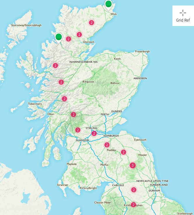
The whole route is shown in the first two maps below. Numbers in the red circles denote the number of days’ walks that section is split into.
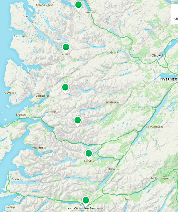
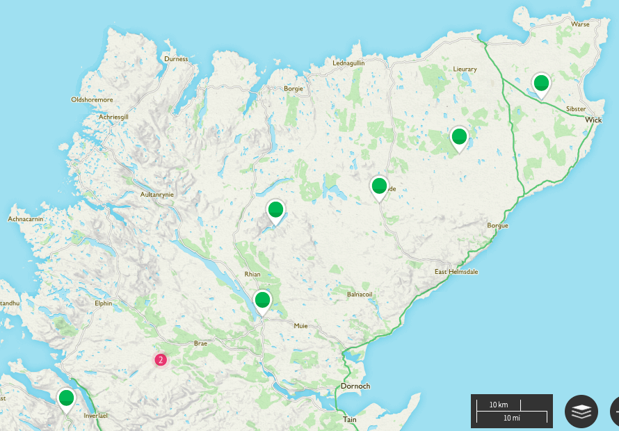
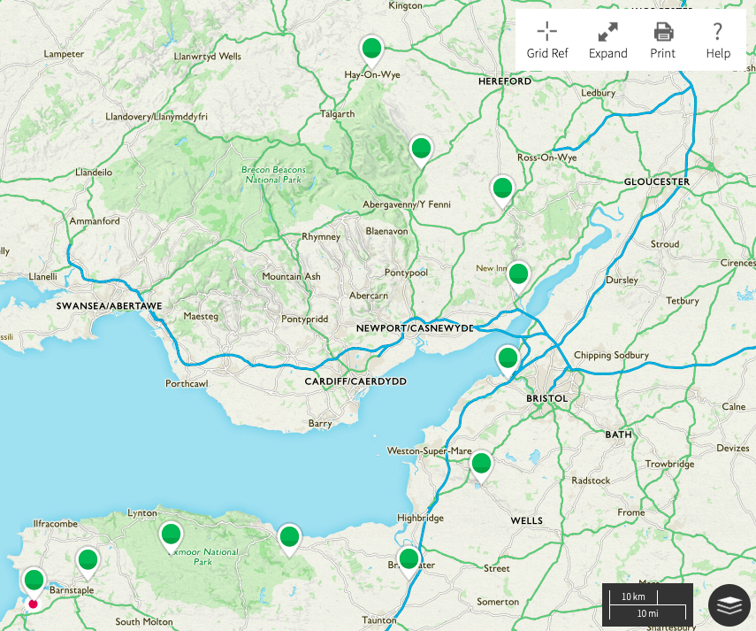
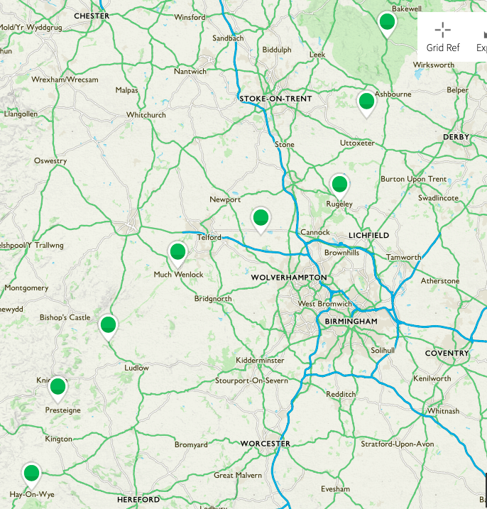
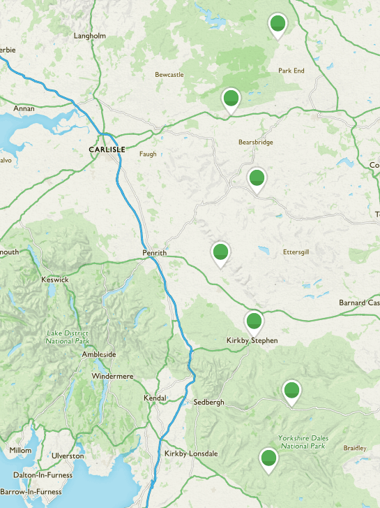
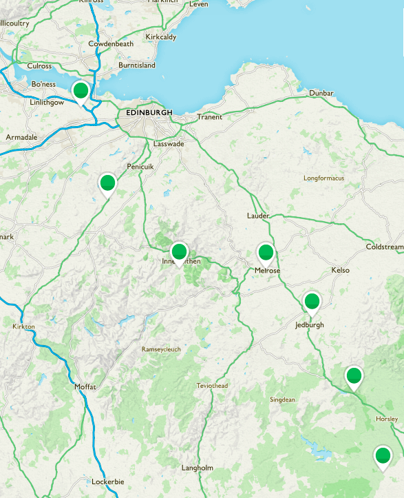
The route is then split into seven screenshots, with stopping points marked (colours of pins are irrelevant): sections under our belts, the section we’re walking, and the ones still to come.
And that’s it!
Complete Route

Sections Walked


Section Being Walked

Sections To Be Walked